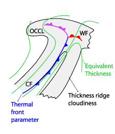
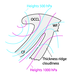
Thickness Ridge Cloudiness - Key Parameters
by ZAMG and DHMZ
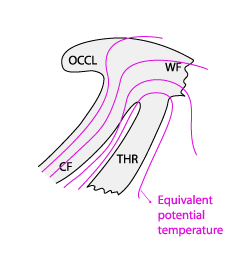
- Equivalent thickness and Thermal front parameter (TFP):
Within the ridge of the equivalent thickness (not accompanied by a TFP), the TFP zones are connected to the consecutive CF and the WF if existing. - Equivalent potential temperature at 850 hPa:
The thickness ridge cloud lies within a ridge or a maximum of the equivalent potential temperature at 850 hPa - Height Contours at 1000 hPa and 500 hPa:
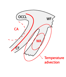
The Thickness Ridge Cloudiness is situated within the ridge of the 1000 hPa and the 500 hPa height, in front of a frontal system - Temperature advection (TA) at 700 hPa:
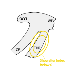
A distinct maximum of WA is superimposed upon the Thickness Ridge Cloudiness. - Showalter index:
There is usually a stable stratification associated with Thickness Ridge Cloudiness, but during the summer season the area within the thickness ridge is often unstable.
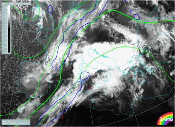
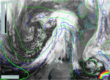
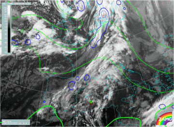
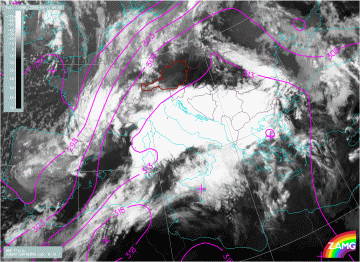
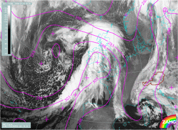
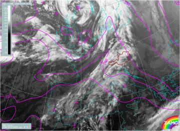
Equivalent thickness and Thermal front parameter (TFP)
|
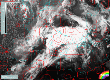
11 April 2008/06.00 UTC - Meteosat 9 IR10.8 image; blue: thermal front parameter (TFP), green: equivalent thickness 500/850 hPa
|
|
|
|
|
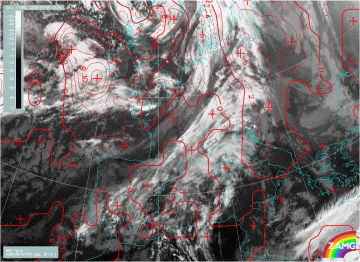
13 January 2008/00.00 UTC - Meteosat 9 IR10.8 image; blue: thermal front parameter (TFP), green: equivalent thickness 500/850 hPa
|
|
|
|
09 January 2008/12.00 UTC - Meteosat 9 IR10.8 image; blue: thermal front parameter (TFP), green: equivalent thickness 500/850 hPa
|
|
|
Equivalent potential temperature at 850 hPa
|
11 April 2008/06.00 UTC - Meteosat 9 IR10.8 image; magenta: equivalent potential temperature 850 hPa
|
|
|
|
|
13 January 2008/00.00 UTC - Meteosat 9 IR10.8 image; magenta: equivalent potential temperature 850 hPa
|
|
|
|
09 January 2008/12.00 UTC - Meteosat 9 IR10.8 image; magenta: equivalent potential temperature 850 hPa
|
|
|
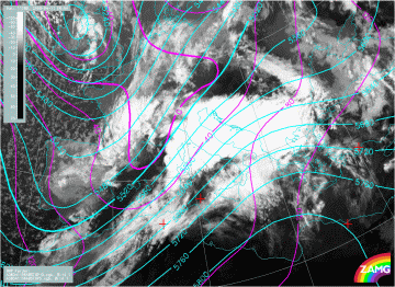
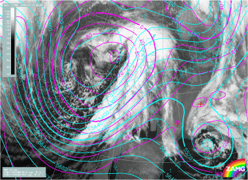
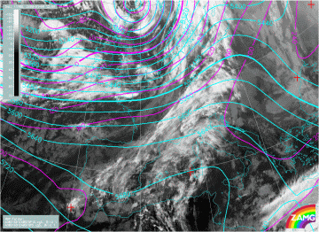
Height Contours at 1000 hPa and 500 hPa
|
11 April 2008/06.00 UTC - Meteosat 9 IR10.8 image; magenta: height contours 1000 hPa, cyan: height contours 500 hPa
|
|
|
|
|
13 January 2008/00.00 UTC - Meteosat 9 IR10.8 image; magenta: height contours 1000 hPa, cyan: height contours 500 hPa
|
|
|
|
09 January 2008/12.00 UTC - Meteosat 9 IR10.8 image; magenta: height contours 1000 hPa, cyan: height contours 500 hPa
|
|
|
Temperature advection (TA) at 700 hPa
|
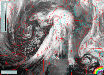
11 April 2008/06.00 UTC - Meteosat 9 IR10.8 image; red dashed: temperature advection - CA 700 hPa, red solid: temperature advection - WA 700 hPa
|
|
|
|
|
13 January 2008/00.00 UTC - Meteosat 9 IR10.8 image; red dashed: temperature advection - CA 700 hPa, red solid: temperature advection - WA 700 hPa
|
|
|
|
09 January 2008/12.00 UTC - Meteosat 9 IR10.8 image; red dashed: temperature advection - CA 700 hPa, red solid: temperature advection - WA 700 hPa
|
|
|
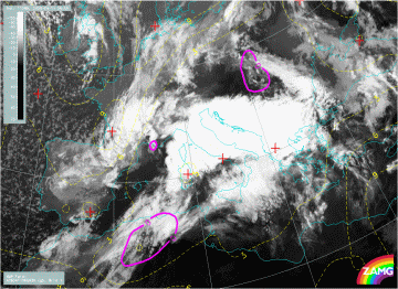
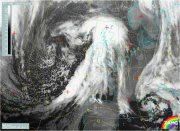
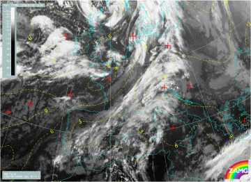
Showalter index
|
11 April 2008/06.00 UTC - Meteosat 9 IR10.8 image; yellow: Showalter index 500/850 hPa
|
|
|
|
|
13 January 2008/00.00 UTC - Meteosat 9 IR10.8 image; yellow: Showalter index 500/850 hPa
|
|
|
|
09 January 2008/12.00 UTC - Meteosat 9 IR10.8 image; yellow: Showalter index 500/850 hPa
|
|
|


