Thickness Ridge Cloudiness - Meteorological Physical Background
by ZAMG and DHMZ
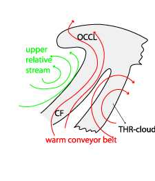
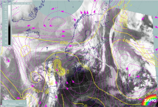
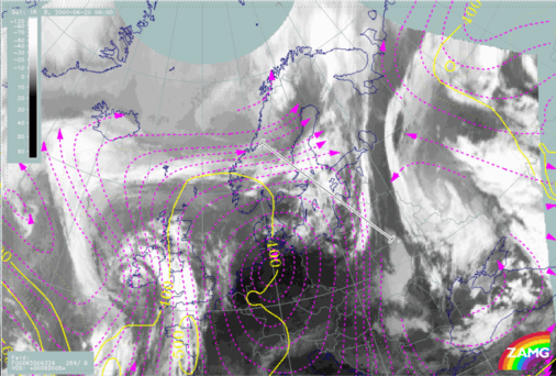
Relative streams provide a good explanation of the physical processes of Thickness Ridge Cloudiness formation:
- A rising warm conveyor belt is associated with the Thickness Ridge Cloudiness;
- An upper relative stream/dry intrusion can be seen to the rear of the frontal cloud band;
- The warm conveyor belt dominates the Thickness Ridge Cloudiness over a thick layer and sometimes influences a part of the frontal cloud band (Drier upper relative streams are far behind the Thickness Ridge Cloudiness and usually not involved in the physics of the cloud itself).
|
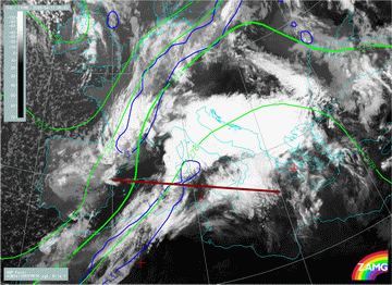
20 June 2000/06.00 UTC - Meteosat IR image, blue: thermal front parameter 500/850 hPa, green: equivalent thickness
500/850 hPa, position of vertical cross section indicated
|
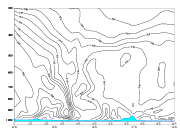
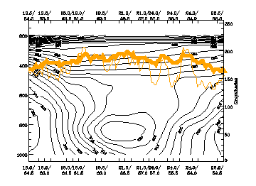
20 June 2000/06.00 UTC - Vertical cross section; black: isentropes (ThetaE), orange thin: IR pixel values, orange thick: WV pixel
values
|
|
|
|
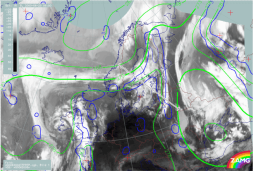
20 June 2000/06.00 UTC - Meteosat IR image; magenta: relative streams 318K - system velocity: 284° 8 m/s, yellow: isobars 318K,
position of vertical cross section indicated
|
20 June 2000/06.00 UTC - Meteosat IR image; magenta: relative streams 324K - system velocity: 284° 8 m/s, yellow: isobars 324K,
position of vertical cross section indicated
|
|
|
The tongue of warm air transported in the warm conveyor belt is also indicated by distinct warm temperature advection and a maximum in the ridge of
equivalent potential temperature.
The rising warm conveyor belt stream causes condensation.
The embedded convective cloudiness is a bit of a contradiction.
The Thickness Ridge Cloudiness is mostly consisting of fibrous cloudiness and is seldom associated with precipitation.
During the summer season there can be strong convective activity within the thickness ridge (compare
Convective cloud features in typical synoptic environments - The warm sector
). Furthermore, because of the thermal energy and the high relative humidity within the thickness ridge this convective activity can be very strong.


