Thickness Ridge Cloudiness - Cloud Structure In Satellite Images
by ZAMG and DHMZ
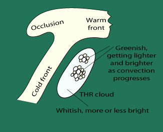
Thickness Ridge Cloudiness is a system with the appearance of a band of cloud which can be found in the thickness ridge ahead of a frontal cloud band.
It often contains convective clouds in the summer season. The cloudiness in the thickness ridge may be associated with the frontal system in its
northern parts or may be separate. No characteristic life cycle can be observed in the cloud features of a Thickness Ridge Cloudiness.
Appearance in satellite images:
- IR imagery:
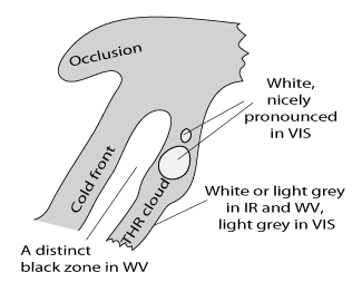
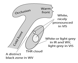
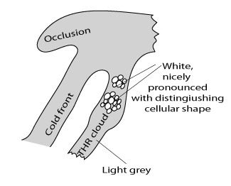
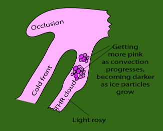
- Mostly fibrous and/or dense cloudiness, white or light grey;
- cellular features within the cloud band indicating embedded convection;
- WV imagery:
- The cloud features in the IR image can be seen as white features in an extended grey area;
- for some cases a distinct black zone appears between the frontal cloud band and the Thickness Ridge cloud band.
- VIS imagery:
- The VIS image generally shows light grey shades, representing middle to high translucent clouds, with white spots
indicating embedded convection cells.
|
THR cloud - connected type
|
THR cloud - disconnected type
|
|
|
|
|
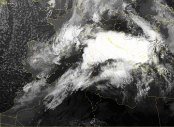
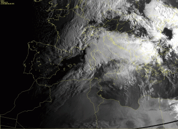
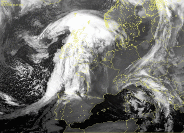
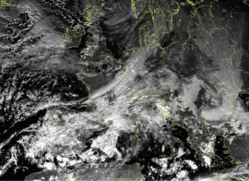
11 April 2008/06.00 UTC - Meteosat 9 IR10.8 image
|
11 April 2008/06.00 UTC - Meteosat 9 HRVIS image
|
|
|
|
|
|
|
|
11 April 2008/06.00 UTC - Meteosat 9 WV6.2 image
|
|
The above three images show a case with the Thickness Ridge Cloudiness situated ahead of the frontal cloud band over the Mediterranean Sea. The THR is
mostly separated from the frontal cloud band. Nevertheless, a closer look into the IR and HRVIS images can reveal that in its northern part the THR
cloudiness is connected to the front with high fibrous clouds. Due to the fact that it is very thick and reaches higher levels, cloudiness of the Warm
Front Shield is much more pronounced then the surrounding cloudiness, especially in the WV image.
|
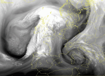
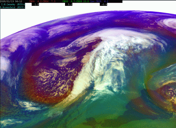
13 January 2008/06.00 UTC - Meteosat 9 IR10.8 image
|
13 January 2008/06.00 UTC - Meteosat 9 WV6.2 image
|
|
|
|
The example shows pronounced THR cloudiness situated in the warm sector in south-westerly upper-level flow ahead of the Cold Front cloud band. Although
in winter cases, such as this one, there is no convective development within the THR and hardly any precipitation, in this case some drizzle over England
and North Sea was observed (see
Weather Events).
|
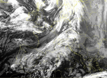
09 January 2008/12.00 UTC - Meteosat 9 IR10.8 image
|
09 January 2008/12.00 UTC - Meteosat 9 WV6.2 image
|
|
|
|
The example of the 9th of January shows THR cloudiness situated over the Mediterranean Sea. It consists mostly of high clouds with no weather activity.
Also Cold Front part of the frontal cloud band behind the THR is quite weak (this can be seen in the Vertical cross section).
Appearance in Meteosat RGB composite imagery
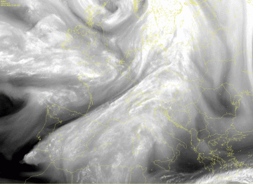
High resolution of Meteosat HRVIS images makes smaller fine-scale cloud structures more distinct. In case of THR cloudiness, it is especially valuable
for the recognition of the embedded cellular cloudiness, hence, possibly convective areas.
|
THR cloud - connected type
|
09 January 2008/12.00 UTC - Meteosat 9 HRVIS image
|
|
|
|
To take into account and combine different types of information retrieved from SEVIRI imagery, such as optical thickness of clouds, particle size and
phase, upper and mid level moisture and cloud top temperature, combinations of channels are constructed
|
|
09 January 2008/12.00 UTC - Meteosat 9 RGB image (VIS0.6, NIR1.6 and IR10.8i)
|
|
|
|
|
|
|
|
|
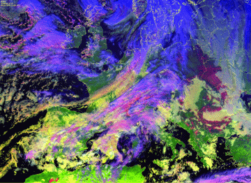
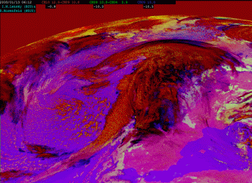
13 January 2008/06.00 UTC - Meteosat 9 Airmass RGB image (WV6.2-WV7.3, IR9.7-IR10.8, WV6.2i)
|
The Airmass RGB (WV6.2-WV7.3, IR9.7-IR10.8 and WV6.2i) can be used during both day- and night-time and for that reason it is very useful. It is often
used for the synoptic overview because one can recognize air-mass types in it (warm, cold as well as dry or humid upper level troposphere) at the first
glance. In the case of THR cloudiness it can be observed that it is situated within warm air-mass (greenish colours) and that it consists mostly of
thick high level clouds.
13 January 2008/06.00 UTC - Meteosat 9 Dust RGB image (IR12.0-IR10.8, IR10.8-IR8.7, IR10.8)
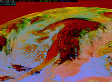
The Dust RGB is more suited for the detection of dust in the atmosphere but it can also be used for other purposes. In case of the frontal cloudiness as
well as THR cloudiness reddish colours are very prominent. The red colour reveals thick high level ice clouds and the dark blue colours superimposed
over the red usually reveal thin high level clouds.
13 January 2008/06.00 UTC - Meteosat 9 Night-microphysical RGB image (IR12.0-IR10.8, IR10.8-IR3.9, IR10.8)
Similar to the Dust RGB, the Nightmicrophysical RGB uses channel differences of IR channels and because of that it can be used during the day and the
night. One can detect high level clouds which, presented in reddish colours, and thin high level clouds, shown in transparent bluish colour. The THR
cloudiness in this case consists, in contrast to the Cold Front, of both high level thick and thin clouds.