Jet Fibres - Key Parameters
by DHMZ
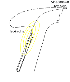
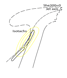
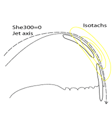
- Isotachs (at 300 hPa, 250 and 200 hPa can all be considered)
- Indications of jet intensity and the location of entrance and exit regions
- Jet Fibres form very near to the jet maximum
- Shear vorticity (zero-line of shear vorticity at 300 hPa)
- Indication of jet axis
- Zero-line of shear vorticity is parallel to both Jet Fibre and the WV Dark Stripe
When compared to jet axes, Fibres can in most cases be found along the zero-line of shear vorticity or slightly shifted to the anticyclonic side of the jet. Some exceptions occur in Warm Front cases (see Meteorological Physical Background ).
|
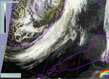
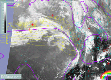
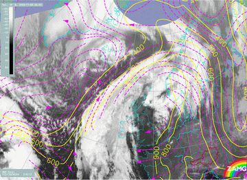
06 November 2003/ 06.00 UTC - Meteosat IR image, yellow: isotachs, violet: zero line of shear vorticity 300 hPa
|
|
|
|
|
|
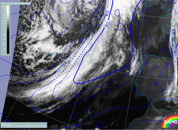
17 June 2003/12.00 UTC - Meteosat IR image; yellow: isotachs, violet: zero line of shear vorticity 300 hPa
|
|
|
|
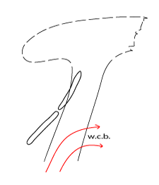
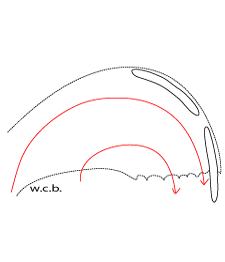
Supporting Parameters
- Relative humidity - necessary condition for the formation of clouds
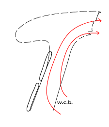
Distribution of humidity in the model fields is governed by the synoptic scale features with which Fibres are associated. - Warm conveyor belt - the Jet Fibre coincides with the limiting streamline.
|
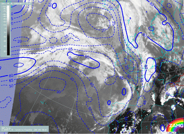
06 November 2003/06.00 UTC - Meteosat IR image, blue: relative humidity
|
17 June 2003/12.00 UTC - Meteosat IR image, blue: relative humidity
|
|
|
|
|
|
|
|
05 November 2003/06.00 UTC - Meteosat IR image; magenta: relative streams 304K - system velocity 216° 12 m/s; yellow: isobars 304K
|
|


