Orographic Effects on Frontal Cloud - Cloud Structure In Satellite Images
by ZAMG and DHMZ
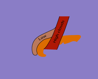
Front Delay
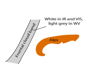
Front Delay is a modification of a Cold Front cloud band. For general information of a Cold Front see Cold Front - Cloud structure in satellite images .Two kinds of front delays are discussed:
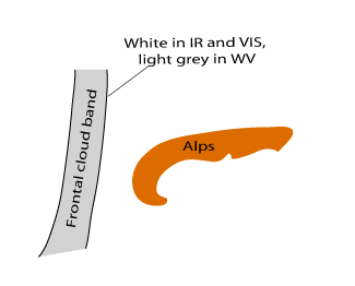
- A front moving north of the Alps, with the cloud band becoming deformed (hooked)
- A front moving across the Alps, one part clearly staying behind (grey in IR and WV, white in VIS) the rest of the frontal cloud band band (white in IR and VIS, light grey in WV)
|
|
|
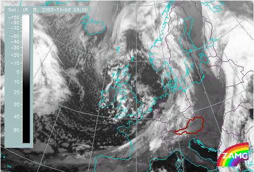
03 November 2003/03.00 UTC - Meteosat IR image
|
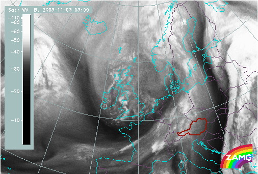
03 November 2003/03.00 UTC - Meteosat WV image
|
|
|
|
|
|
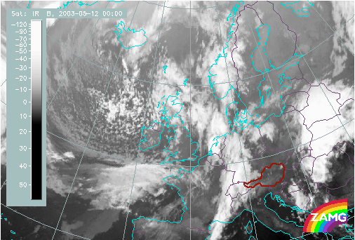
05 May 2003/00.00 UTC - Meteosat IR image
|
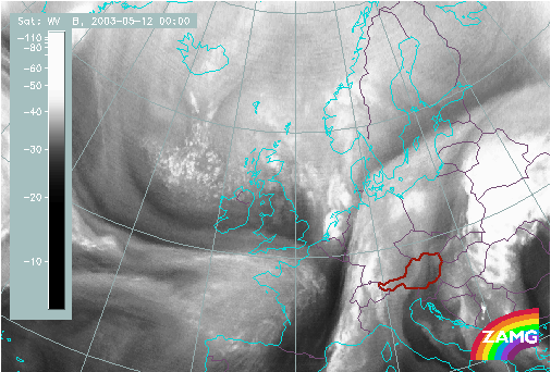
05 May 2003/00.00 UTC - Meteosat WV image
|
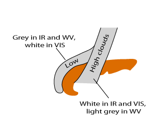
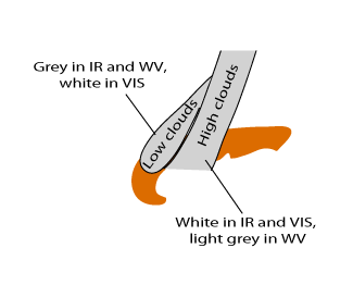
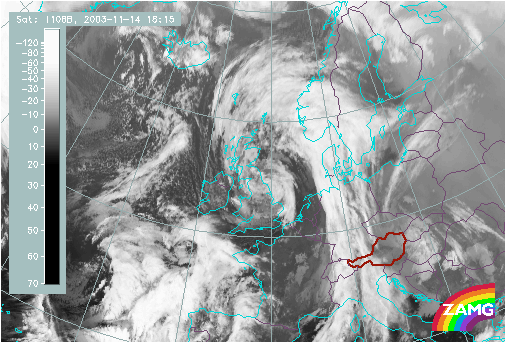
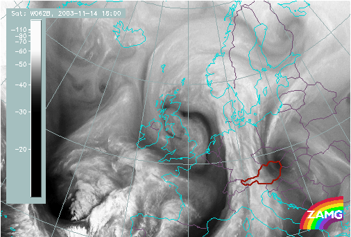
Decoupling of clouds at different heights
When frontal clouds approach mountain chain decoupling of clouds can be noticed. The upper part passes the mountain, but the surface front is retarded and low level clouds stay behind.- Frontal cloud band moving over the Alps: bright in IR, VIS and WV
- Frontal cloudiness being decoupled: low level cloudiness, grey in IR and dark grey in WV, bright in VIS
|
|
|
14 November 2003/15.00 UTC - Meteosat IR image
|
14 November 2003/15.00 UTC - Meteosat WV image
|
|
|
Appearance in the RGB composite image
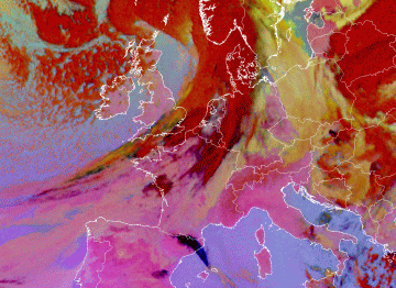
As it is mentioned before, it is not always easy to detect and distinguish front delay or decoupling of clouds at different heights. Combinations and differences of satellite channels enable a deeper insight into the structure of cloudiness and could help us to follow the process.The 24 hours Microphysics RGB is an RGB composite based upon the data from infrared channels and differences as follows: IR12.0 - IR10.8 on red colour, IR10.8 - IR8.7 on green and IR10.8 on blue. As the name declares, it can be used day and night. It is designed and tuned to monitor the evolution of fog and low stratus on one hand, and dust and volcanic ash on the other. Secondary applications of this RGB are the detection of fires and low-level moisture boundaries. However, this RGB makes thick high level ice clouds distinctive in its dark red colour, fog or low stratus in ochre and cloud free areas in pinkish (bluish) colour (worth for Mediterranean region and differs quite a lot depending on the time of the year as can be noticed in the two images below).
|
Front Delay as it appears in Microphysics RGB Image
|
17 July 2009/12.00 UTC - Meteosat 9 Microphysics RGB image
|
|
|
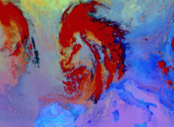
The following 1 hourly loop shows decoupling of clouds at different heights when the front passes the Alps. The first, high cirrus clouds cross the mountain chain (dark blue, almost black colour) and after that, a part of frontal cloudiness (red or dark red colour) moves over the Alps and low level cloudiness (orange to ochre colour) stay behind.
|
Front Decoupling as it appears in Microphysics RGB Image
|
08 March 2009/03.00 UTC - Meteosat 9 Microphysics RGB image
|

|
|

