NON-OROGRAPHIC CONVERGENCE LINES - METEOROLOGICAL PHYSICAL BACKGROUND
by ZAMG
Likewise, for the orographically driven convective Convergence Lines (see Orographically Induced Convergence Lines ) cloudiness is produced by upward motion due to low level convergence which is the result of different processes described below. These Convergence Lines also show a life cycle during the day time dependant on solar radiation with a maximum of convection in the early afternoon.
The pre-frontal Convergence Lines
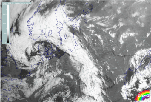
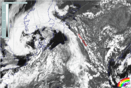
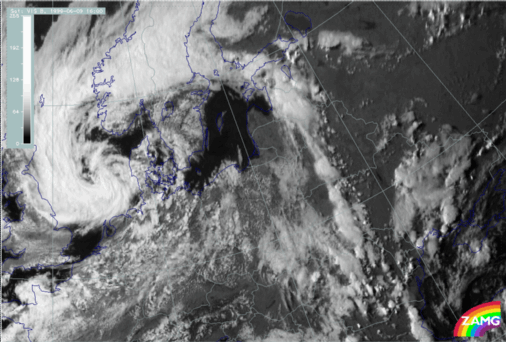
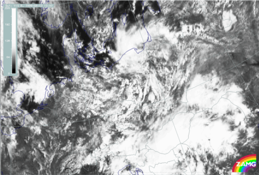
Pre-frontal convective lines are influenced by an approaching frontal system as well as the diurnal variation of solar radiation. Consequently, the synoptic situation is changing during day.|
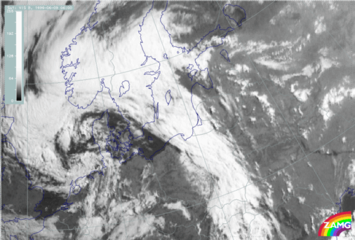
09 June 1999/06.00 UTC - Meteosat VIS image
|
09 June 1999/12.00 UTC - Meteosat VIS image
|
|
|
|
|
|
09 June 1999/16.00 UTC - Meteosat VIS image
|
- The development related to the solar radiation and heating of the land
- The approach of the upper level cloudiness (better seen in the IR images) which might be indicative of the cold air at upper levels; at the same time low level clouds (better seen in the VIS image) remain to the rear of the Convergence Line and slowly dissolve.
|
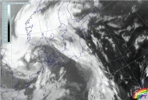
09 June 1999/06.00 UTC - Meteosat IR image
|
09 June 1999/06.00 UTC - Meteosat VIS image
|
|
|
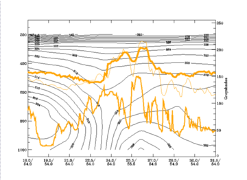
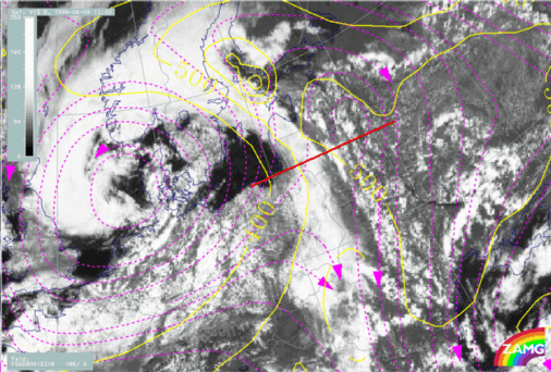
The vertical cross section shows two peaks in the pixel values. One at 54N/23E is the frontal cloud band. The other at 54N/26E belongs to the convective Convergence Line. The isentropic surface of 318K lies above both the frontal and the unstable layer.
|
09 June 1999/12.00 UTC - Meteosat VIS image; magenta: relative streams 318K, yellow: isobars 318K; position of
vertical cross section indicated
|
|
|
|
But this is only an insight into the situation at the synoptic scale. The results cannot explain the band form of the pre-frontal Convergence Line. For this LAM models (e.g. Aladin) have to be studied. Small scale wind fields clearly show a confluence zone in front of the main frontal cloud band which results in a small scale convergence zone.
|
09 June 1999/12.00 UTC - Meteosat VIS image; green: wind vectors 925 hPa
|
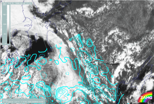
09 June 1999/12.00 UTC - Meteosat VIS image; cyan solid: convergence 925 hPa, cyan dashed: divergence 925 hPa
|
|
|
Post-frontal convergence bands
According to literature, convergence bands in the cold air are caused by instability and solar radiation and there is a life cycle during the day. However, the sequence shown below shows a decrease of convective cloudiness already in the early afternoon.One might conclude that there are no additional factors that increase the convergence such as the flow of drier and cooler air at higher levels, typical for pre-frontal Convergence Lines. The post-frontal cloud bands already lie within dry and cold air which restricts the vertical extent of the convective lines.
|
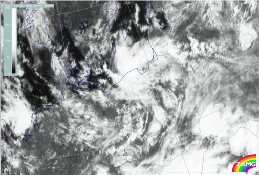
13 August 1999/09.00 UTC - Meteosat VIS image
|
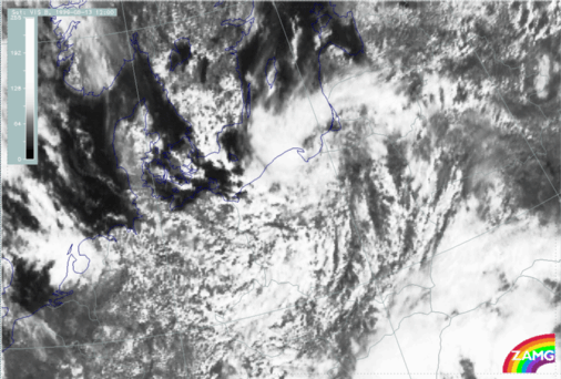
13 August 1999/12.00 UTC - Meteosat VIS image
|
|
|
|
|
|
13 August 1999/15.00 UTC - Meteosat VIS image
|
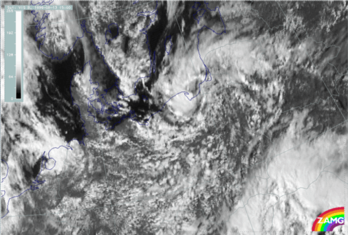
13 August 1999/10.00 UTC - Meteosat VIS image
|


