NON-OROGRAPHIC CONVERGENCE LINES - KEY PARAMETERS
by ZAMG
Typical synoptic environment
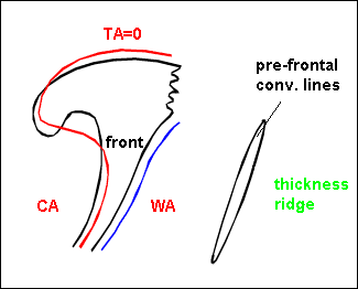
Convective lines in advance of frontal cloud bands
- Convective lines in advance of frontal cloud bands are situated within or at the rear edge of the equivalent thickness ridge.
- Since they are in the neighbourhood of fronts there can be some Thermal Front Parameter (TFP) further behind indicating the frontal cloud band.
- Although Temperature Advection (TA) is not very pronounced, there is some warm advection in front of the frontal system.
|
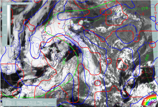
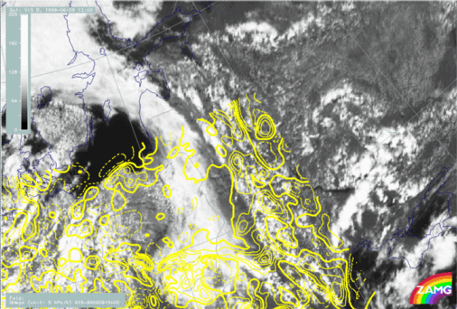
09 June 1999/12.00 UTC - Meteosat VIS image; blue: thermal front parameter 700 hPa, red: temperature advection 700
hPa, green: equivalent thickness 700 hPa
|
|
|
|
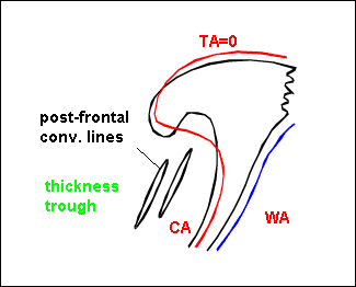
Convective lines in cold air behind Cold Fronts
- Convective lines in the cold air behind Cold Front cloud bands are situated within an equivalent thickness trough.
- Since they are in the neighbourhood of fronts there can be some TFP in advance of the convective line indicating the frontal cloud band.
- There is cold advection behind the frontal cloud band.
|
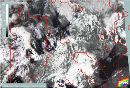
08 August 1999/12.00 UTC - Meteosat VIS image; red: temperature advection 700 hPa
|
|
|
|
- Both types occur with Showalter indices typical for instability (around 0)
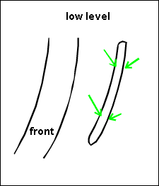
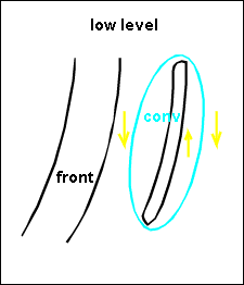
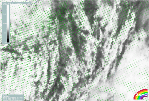
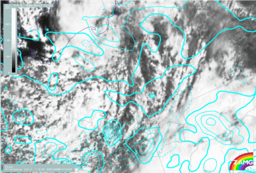
Pre-frontal Convergence Line
Typical distribution of wind field, divergence and upward motion
- Wind vectors: The wind field shows confluence up to a height of 850 hPa; above there is a uniform wind regime. Often there are easterly winds to the east and southerly winds to the West of the convective Convergence Line resulting in a discontinuity in the low level wind field.
- Convergence is found in the lower levels, sometimes only at 925 hPa, sometimes up to 800 hPa.
- Upward motion can be observed to a slightly higher level.
|
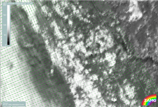
09 June 1999/12.00 UTC - Meteosat VIS image; green: wind vectors 925 hPa
|
|
|
|
|
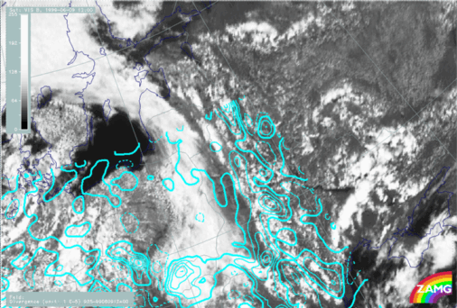
09 June 1999/12.00 UTC - Meteosat VIS image; cyan solid: convergence 925 hPa, cyan dashed: divergence 925 hPa
|
|

|
|
|
09 June 1999/12.00 UTC - Meteosat VIS image; yellow solid: upward motion 925 hPa, yellow dashed: downward motion 925 hPa
|
|
|
|
Post-frontal Convergence Line
13 August 1999/12.00 UTC - Meteosat VIS image; green: wind vectors 925 hPa
13 August 1999/12.00 UTC - Meteosat VIS image; cyan solid: convergence 925 hPa, cyan dashed: divergence 925 hPa
13 August 1999/12.00 UTC - Meteosat VIS image; yellow solid: vertical motion - upward motion 925 hPa, yellow dashed:
vertical motion - downward motion 925 hPa
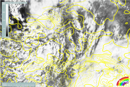
The post frontal Convergence Lines are not as well marked as pre frontal lines. They also show less convective activity.


