NON-OROGRAPHIC CONVERGENCE LINES - CLOUD STRUCTURE IN SATELLITE IMAGES
by ZAMG
- in advance of a frontal cloud band
- within cold air behind frontal systems.
Regions where these phenomena can be frequently observed during summer time include Germany, Poland, Czech Republic and the Baltic States.
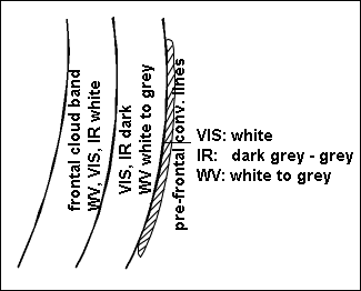
Convective lines with very strong convective activity are indicated by high brightness in VIS, IR and WV channels.
Less active convective lines appear white in the VIS, grey in the IR image and mostly do not show up in the WV image. Sometimes they are even situated in a dry (black) zone in WV images.
|
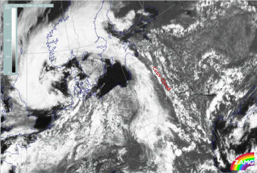
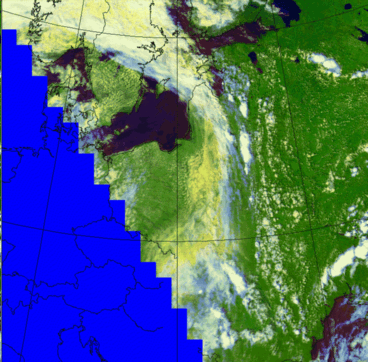
09 June 1999/12.00 UTC - Meteosat VIS image
|
|
|
|
|
|
|
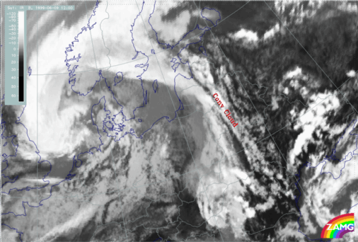
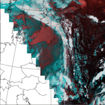
09 June 1999/12.00 UTC - Meteosat IR image
|
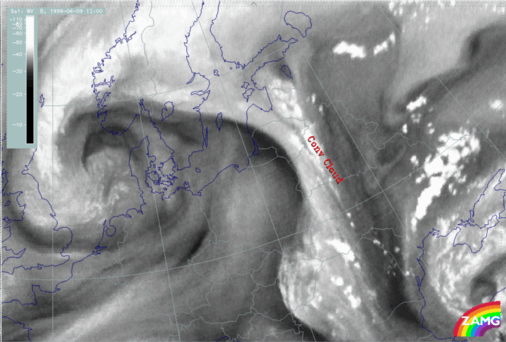
09 June 1999/12.00 UTC - Meteosat WV image
|
The AVHRR channels show a more detailed structure. Some cellular substructures within the lines can be detected which are not visible in Meteosat images.
Some slight difference can be found between the VIS1 and VIS2 channels: VIS2 shows the line being more distinct and continuous. The combination channel 124 shows the Convergence Lines as a white to light blue cloud band. A discrimination between thick cloudiness and the thin cirrus clouds at the edge can be done. Use of combination channel 345 shows a more a white to bluish appearance.
|
01 July 1999/11:53 UTC - AVHHR image
|
01 July 1999/11:53 UTC - AVHHR image
|
|
|

