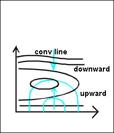
Orographically Induced Convergence Lines - Typical Appearance In Vertical Cross Sections
by ZAMG and DHMZ
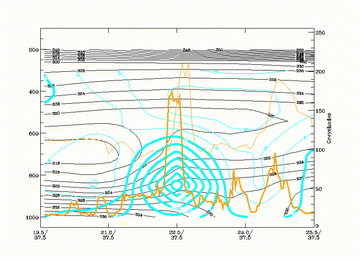
Vertical cross-sections from the ECMWF model
When ECMWF cross-sections are analyzed, it can be noted that some features can be recognised even with the coarse grid of this large area model. The typical parameters are equivalent potential temperature, divergence and upward motion. The ECMWF cross section is laid over a Greek Convergence Line.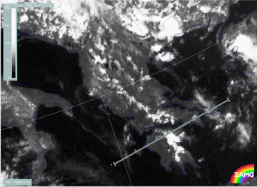
|
13 June 1999/12.00 UTC - Vertical cross section; black: isentropes (ThetaE), orange thin: IR pixel values, orange thick: VIS pixel
values
|
|
|
|
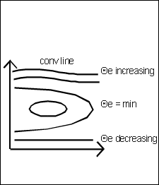
- There is convergence in low layers and divergence above.
|
13 June 1999/12.00 UTC - Vertical cross section; black: isentropes (ThetaE), magenta thin: divergence, magenta thick: divergence,
orange thin: IR pixel values, orange thick: VIS pixel values
|
|
|

|
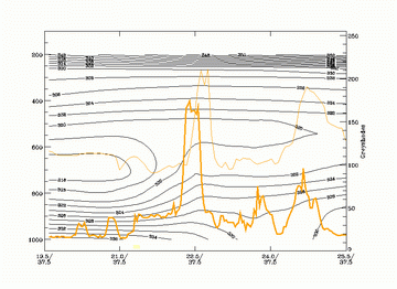
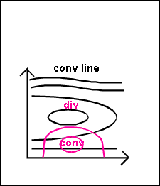
- Upward motion is situated in the convergence lines on top of the convergence zone.
|
13 June 1999/12.00 UTC - Vertical cross section; black: isentropes (ThetaE), cyan thick: vertical motion (omega) - upward motion,
cyan thin: vertical motion (omega) - downward motion, orange thin: IR pixel values, orange thick: VIS pixel values
|
|
|
|
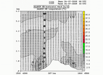
Vertical cross-sections from the meso-scale model Aladin
The example cross-section is laid across the Dinaric Alps as shown in the image below.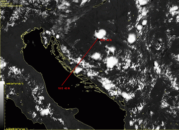
- Highest values of relative humidity are found above the mountain chain, representing the clouds forming there.
- The isentropes show an unstable air mass up to 2.5 km height in the region above the mountains
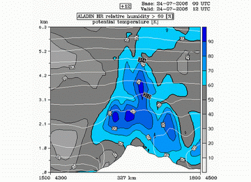
- Upward motion occurs above the slopes of the mountains.
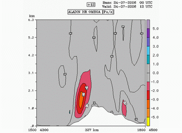
- Convergence of the wind in the lower layers above the mountain chain
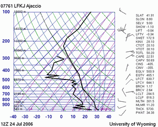
Radio Sonde data
Another way to investigate the vertical structure of the atmosphere in the region of the convergence induced by orographic influence is the analysis of the radiosonde measurement, presented by Skew T diagram.A Skew T diagram is a plot of temperature with height as denoted by pressure. The pressure lines are plotted horizontally and are on an inverse log scale. The concept of Skew T means that the temperature is not plotted vertically but angles off to the right at a 45 degree angle. The green curved lines are called dry adiabats. The blue curved lines are saturation adiabats. The sounding is plotted as two black lines. The right line is the temperature profile and the left line is the dewpoint profile. The thin black line (behind the temperature line) is the parcel temperature. The winds are plotted as wind barbs with height on the right edge of the plot.
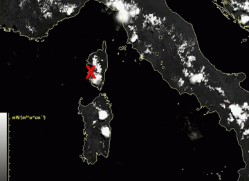
The example shown here is from the radiosonde station in Ajaccio.
|
24 July 2006/11.45 UTC - Meteosat 8 HRVIS image; position of Ajaccio station indicated
|
24 July 2006/12.00 UTC - Skew T diagram of the radio sonde measurement in Ajaccio
|
|
|


