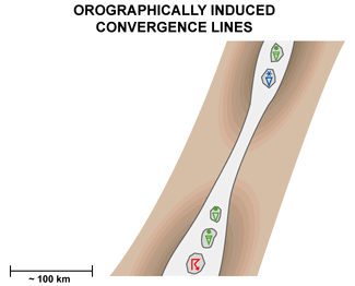
Orographically Induced Convergence Lines - Weather Events
by ZAMG and DHMZ
This conceptual model can be used to detect "small" showers, which do not result in large areas of heavy precipitation, but can result in localised heavy precipitation in the mountains. Thunderstorms can also appear in cases with more developed single cells.
| Parameter | Description |
| Precipitation |
|
| Temperature |
|
| Wind (incl. gusts) |
|
| Other relevant information |
|
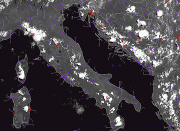
24 July 2006/12.00 UTC - Meteosat 8 HRVIS image; actual weather from synop measurements
|
|
|
|
|
|
|
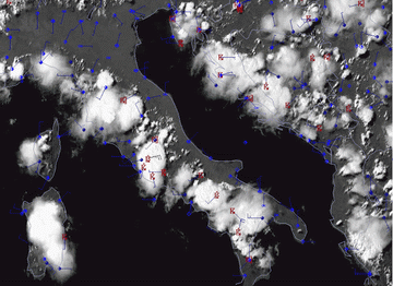
24 July 2006/15.00 UTC - Meteosat 8 HRVIS image; actual weather from synop measurements
|


