Cumulonimbus Cluster - Meteorological Physical Background
by KNMI and DHMZ
The synoptic environment shows great resemblance with that of an MCS (see Cumulonimbus (Cb) and Mesoscale Convective System (MCS) - Meteorological Physical Background ). In fact, Cb Cluster is often a preliminary stage in the life cycle of an MCS.
|
Mature Stage of a Cb Cluster
|
MCS
|
|
|
Life cycle of a Cb Cluster in Warm Air
|
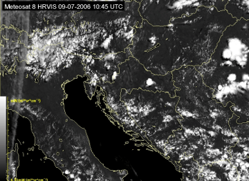
09 July 2006/10.45 UTC - Meteosat 8 HRVIS image
|
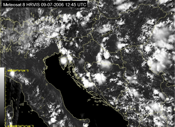
09 July 2006/12.45 UTC - Meteosat 8 HRVIS image
|
|
|
|
|
|
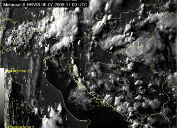
09 July 2006/17.00 UTC - Meteosat 8 HRVIS image
|
|
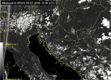
09 July 2006/10.00 UTC - Meteosat 8 HRVIS image
|
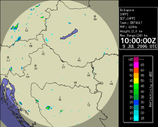
09 July 2006/10.00 UTC - Radar image
|
|
|
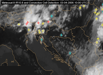
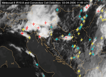
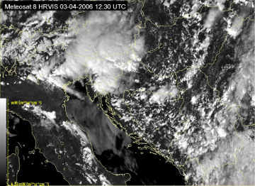
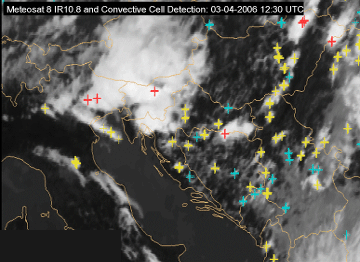
A Cb Cluster developing into an MCS
|
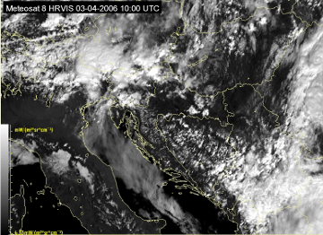
03 April 2006/10.00 UTC - Meteosat 8 HRVIS image
|
03 April 2006/10.00 UTC - Meteosat 8 IR10.8 image with nowcasting product Convective Cell Detection
|
|
|

|
|
|
03 April 2006/11:45 UTC - Meteosat 8 HRVIS image
|
03 April 2006/11:45 UTC - Meteosat 8 IR10.8 image with nowcasting product Convective Cell Detection
|
|
03 April 2006/12:30 UTC - Meteosat 8 HRVIS image
|
03 April 2006/12:30 UTC - Meteosat 8 IR10.8 image with nowcasting product Convective Cell Detection
|
|
|
The environment favorable for the development of Cb Clusters
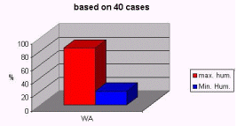
The favourable area for the development of Cb clusters is characterized by an unstable humid air mass.|
Average of the min and max values of relative humidity
|
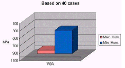
The average height of the min and max of relative humidity
|
|
|
The average height of the potentially unstable layer is characterized by the more or less pronounced inversion of the potential temperature. In the investigated cases a common height of this inversion was 700 hPa.
|
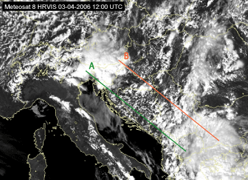
03 April 2006/12.00 UTC - Meteosat 8 HRVIS image; position of vertical cross sections indicated
|
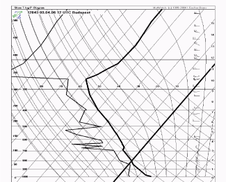
03 April 2006/12.00 UTC Radio Sounding Budapest
|
|
|
|
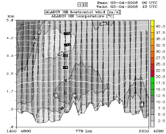
03 April 2006/12.00 UTC - ALADIN model vertical cross section A; grey shaded: wind speed, wind barbs: wind direction
|
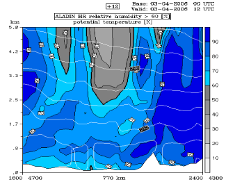
03 April 2006/12.00 UTC - ALADIN model vertical cross section B; white: isentropes, blue and grey shaded: relative humidity
|
|
|
|
|
|
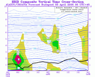
03-04 April 2006 - ALADIN model time vertical cross section for Budapest; black-dotted: LCL, blue: temperature and shaded: relative humidity
|
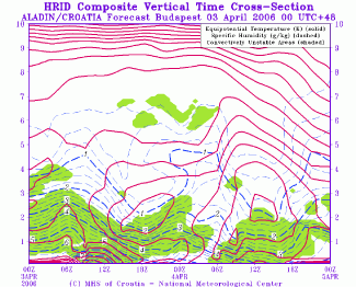
03-04 April 2006 - ALADIN model time vertical cross section for Budapest; magenta: equipotential temperature, blue dashed: specific humidity and
green shaded: convectively unstable area
|
The area with high humidity is present in ALADIN model spatial cross section B and even more pronounced in the vertical time cross sections for Budapest. Furthermore, potential instability can be seen in the vertical distribution of isentropes. In time cross section, it can be clearly recognized as the area of backward inclined isentropes with values decreasing with height, sometimes even a closed isoline indicating the minimum in the level between 3 and 4 kilometers. Also, vertical wind shear in speed and direction, shown in spatial Vertical Cross Section A, is necessary for the development of thunderstorms (see Cumulonimbus (Cb) and Mesoscale Convective System (MCS) - Meteorological Physical Background , the Role of vertical wind shear).
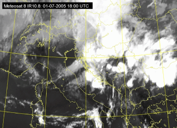
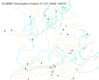
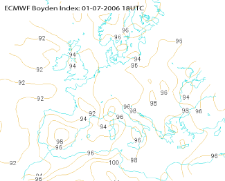
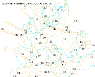
Instability of the atmosphere is often described by different instability indices. In the description of this conceptual model the most common ones, Showalter Index, K Index and Boyden Index are used. Indices themselves may be misleading, and using them one must be aware that they give only an indication of the possibility for convective activity.
|
01 July 2005/18.00 UTC - Meteosat 8 IR10.8 image
|
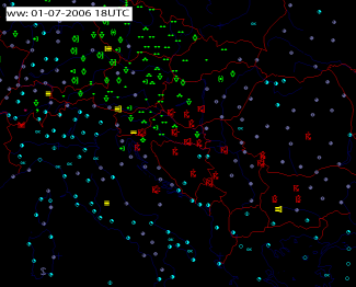
01 July 2005/18.00 UTC - synop observations in the area of interest
|
|
|
|
01 July 2005/18.00 UTC - ECMWF model analysis field, Showalter index
|
01 July 2005/18.00 UTC - ECMWF model analysis field, Boyden index
|
|
|
|
|
|
01 July 2005/18.00 UTC - ECMWF model analysis field, K index
|
|
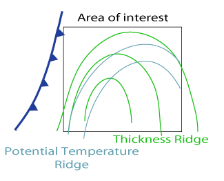
Environment favourable for development of convection, potential temperature and thickness field
|
01 July 2005/18.00 UTC - ECMWF model analysis field, equivalent potential temperature 850 hPa
|
|

|
|
|
|
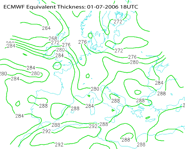
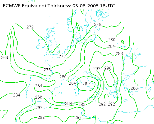
01 July 2005/18.00 UTC - ECMWF model analysis field, equivalent thickness
|
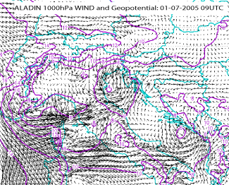
Orographic effects in mountainous terrain also play an important role in this convergence mechanism.
|
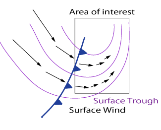
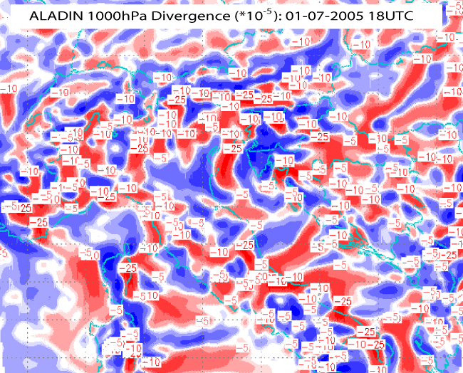
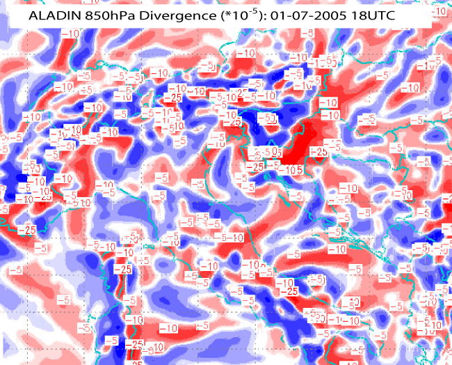
Environment favourable for development of convection, surface trough and convergence zone
|
01 July 2005/09.00 UTC - ALADIN model forecast field, wind and geopotential 1000 hPa
|
|
|
|
|
|
01 July 2005/18.00 UTC - ALADIN model forecast field, divergence 1000hPa
|
01 July 2005/18.00 UTC - ALADIN model forecast field, divergence 850hPa
|
|
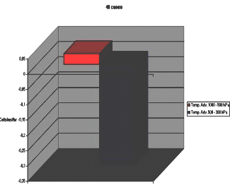
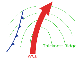
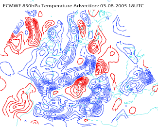
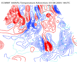
Average values of temperature advection
|
Diagram showing Warm Advection in lower layers by Warm Conveyor Belt (WCB)
|
|
|
|
|
|
|
|
|
|
|
|


