AVALANCHE CATASTROPHE 05 - 25 FEBRUARY 1999 - THICKNESS TROUGH
by ZAMG
- The Alpine mountain region lies within the area of a thickness trough
- No frontal conditions
- CA dominates in the Alpine region but WA approaches from NW to the rear of the upper level trough
- PVA might play an additional role
- The wind direction is NWly throughout a deep layer of the troposphere
- Main cloud features: Stau features and, to some extend, Lee features
One typical example is the 08 February/00.00 UTC ("First case"), a second one the 23 February/06.00 UTC ("Second case"). Both cases show intensive Stau Cloud which extends northward into Germany. But there are also differences in the various model fields between these two cases concerning, in particular, the orientation of flow in relation to the Alpine mountain chain. The interesting point is that despite the regional discrepancies, very similar cloud configurations are produced which can, therefore, be regarded as typical of a thickness trough situation.
|
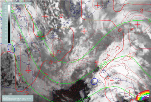
08 February 1999/00.00 UTC - Meteosat IR image; green: equivalent thickness 500/1000 hPa, red solid: temperature advection - WA 700 hPa, red
dashed: temperature advection - CA 700 hPa, blue: Thermal Front Parameter (TFP)
|
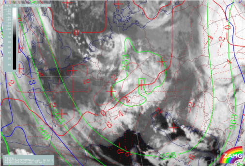
13 February 1999/06.00 UTC - Meteosat IR image; green: equivalent thickness 500/1000 hPa, red solid: temperature advection - WA 700 hPa, red
dashed: temperature advection - CA 700 hPa, blue: Thermal Front Parameter (TFP)
|
|
|
|
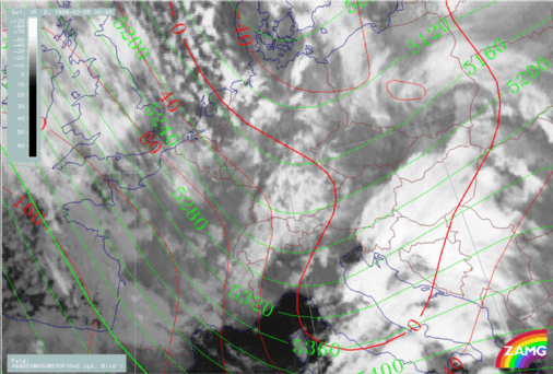
08 February 1999/00.00 UTC - Meteosat IR image; red: height contours 1000 hPa, green: height contours 500 hPa
|
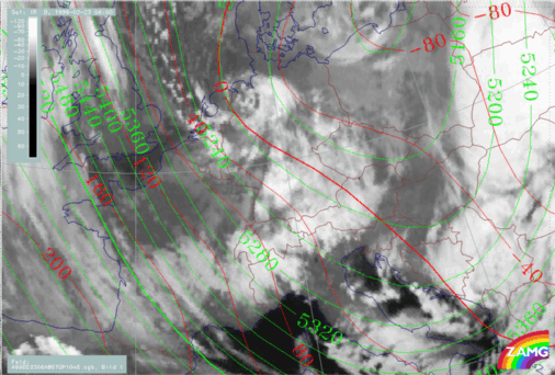
13 February 1999/06.00 UTC - Meteosat IR image; red: height contours 1000 hPa, green: height contours 500 hPa
|
|
|
|
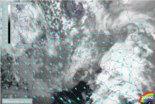
08 February 1999/00.00 UTC - Meteosat IR image; cyan: wind vectors 850 hPa
|
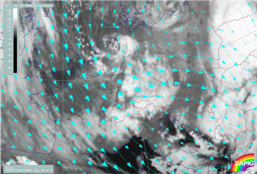
13 February 1999/06.00 UTC - Meteosat IR image; cyan: wind vectors 850 hPa
|
|
|
|
|
|
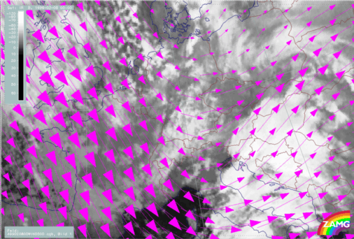
08 February 1999/00.00 UTC - Meteosat IR image; magenta: wind vectors 500 hPa
|
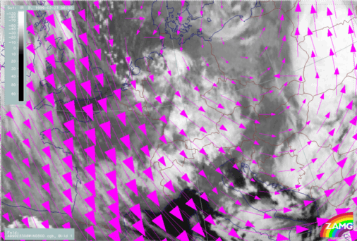
13 February 1999/06.00 UTC - Meteosat IR image; magenta: wind vectors 500 hPa
|
For the complete sequence of satellite images during this phase see Overview - Phase 3 .
|
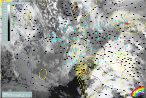
13 February 1999/06.00 UTC - Meteosat IR image; yellow: positive vorticity advection (PVA) 500 hPa; weather events (green: rain and showers,
blue: drizzle, cyan: snow, red: thunderstorm with precipitation, purple: freezing rain, orange: hail, black: no actual precipitation or
thunderstorm with precipitation)
|
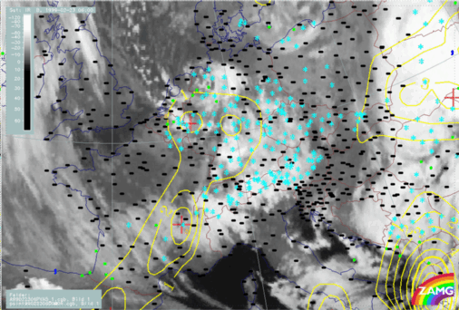
13 February 1999/12.00 UTC - Meteosat IR image; yellow: positive vorticity advection (PVA) 500 hPa; weather events (green: rain and showers,
blue: drizzle, cyan: snow, red: thunderstorm with precipitation, purple: freezing rain, orange: hail, black: no actual precipitation or
thunderstorm with precipitation)
|
|
|
|
|
|
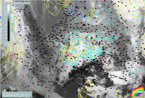
13 February 1999/18.00 UTC - Meteosat IR image; yellow: positive vorticity advection (PVA) 500 hPa; weather events (green: rain and showers,
blue: drizzle, cyan: snow, red: thunderstorm with precipitation, purple: freezing rain, orange: hail, black: no actual precipitation or
thunderstorm with precipitation)
|
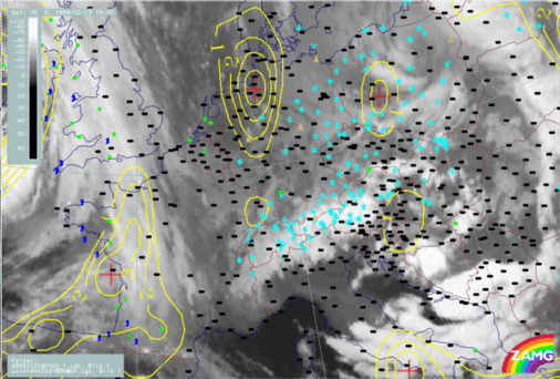
For the complete sequence of satellite images during this phase see
Overview - Phase 10
. The most interesting image in this regard is from 23/15.00 UTC, where the eastern part of the Comma tail extends southward, with a fibrous structure, from the Czech Republic across the Stau Cloud over E. Austria, whilst the Comma head appears over South Germany. A cloud free stripe has developed between the Comma
head and the northern boundary of the Stau Cloud. The satellite loop reveals that the Stau Cloud has intensified under the influence of the southern part of the Comma cloud.
Close to this time the catastrophic avalanche of Galtuer in Tyrol occurred.


