FLOOD CATASTROPHE 10 - 13 AUGUST 2002 - FLOODPHASE
by ZAMG
Sequence of weather: Rain, and rain amounts
|
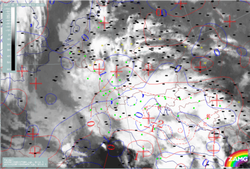
11 August 2002/00.00 UTC - Meteosat IR image; weather events (green: rain and showers, blue: drizzle, cyan: snow, red: thunderstorm with
precipitation, purple: freezing rain, orange: hail, black: no actual precipitation or thunderstorm with precipitation)
|
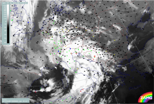
12 August 2002/00.00 UTC - Meteosat IR image; weather events (green: rain and showers, blue: drizzle, cyan: snow, red: thunderstorm with
precipitation, purple: freezing rain, orange: hail, black: no actual precipitation or thunderstorm with precipitation)
|
|
|
|
|
|
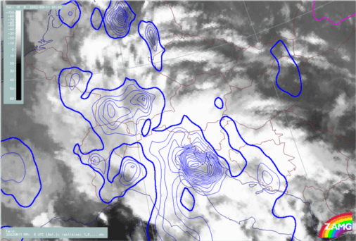
11 August 2002/00.00 UTC - Meteosat IR image; blue: 6-hourly precipitation amounts (thick line: 1mm, isoline distance: 4mm), magenta: areas with
insufficient data coverage
|
In a second phase (11 August/12.00 - 18.00 UTC) the precipitation spreads over the whole Austria and is clearly associated with the 2nd Occlusion cloud band. From there, the precipitation extends to Slovakia and the Czech Republic with high amounts caused by Stau effects. A separate maximum of precipitation, over Hungary in this phase, is associated with the 2nd low within the Occlusion cloud band developing from a 3rd Wave (Croatia).
In the time frame from 12 August/00.00 - 06.00 UTC, in addition to the already mentioned countries, pronounced precipitation starts and remains over East Germany, while the neighbouring countries of Hungary, Slovenia and Slovakia now have lower amounts of precipitation.
In the time phase 12 - 13 August, precipitation amounts remain high over East Germany, W. Czech Republic and very high over N. Austria (Salzburg, Upper and Lower Austria).
Relationships between precipitation and relevant parameters
Wind fields at 850 and 500 hPa
|
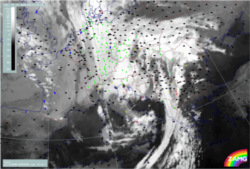
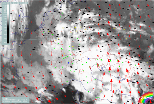
11 August 2002/00.00 UTC - Meteosat IR image; weather events (green: rain and showers, blue: drizzle, cyan: snow, red: thunderstorm with
precipitation, purple: freezing rain, orange: hail, black: no actual precipitation or thunderstorm with precipitation; red: wind vectors at 850 hPa
|
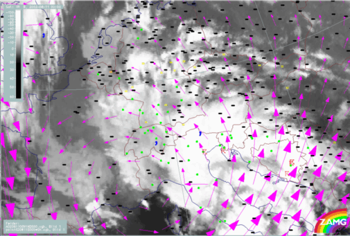
11 August 2002/00.00 UTC - Meteosat IR image; weather events (green: rain and showers, blue: drizzle, cyan: snow, red: thunderstorm with
precipitation, purple: freezing rain, orange: hail, black: no actual precipitation or thunderstorm with precipitation; magenta: wind vectors at 500
hPa
|
|
|
The distinct Stau effects at the Alps first start in the western part but very soon move to the eastern parts where they remain for the duration of this case.
Fields of divergence at 850 and 700 hPa