15 - 16 MARCH 1998 - 06.00 UTC - KEY PARAMETERS ON ISOBARIC SURFACES
by ZAMG
|
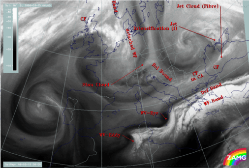
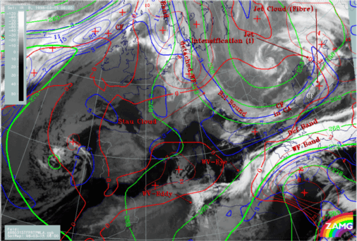
15 March 1998/06.00 UTC - Meteosat IR image; red: height contours 1000 hPa, green: height contours 500 hPa, SatRep overlay: names of conceptual
models
|
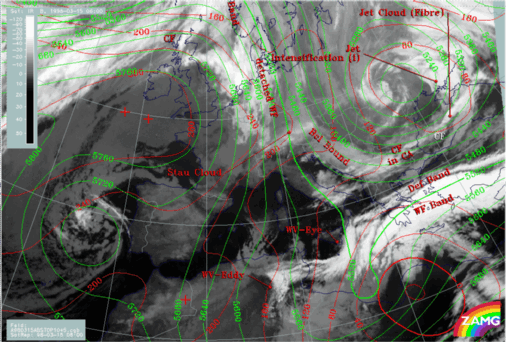
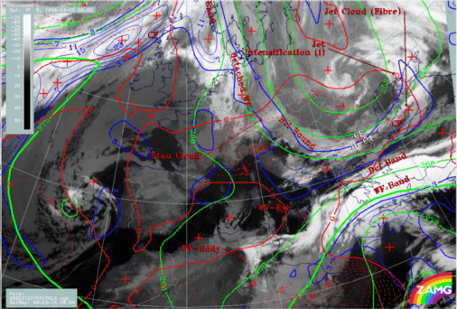
15 March 1998/06.00 UTC - Meteosat IR image; magenta: wind vectors 500 hPa, SatRep overlay: names
of conceptual models
|
|
|
|
|
|
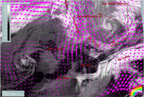
15 March 1998/06.00 UTC - Meteosat WV image; green: wind vectors 850 hPa
|
The second area with an intensive cyclone is Romania and the Ukraine with a low centre developed throughout the whole troposphere and with a nearly vertical axis.
|
15 March 1998/06.00 UTC - Meteosat IR image; blue: thermal front parameter (TFP) 500/850 hPa, green: equivalent thickness 500/850 hPa, red:
temperature advection - WA 1000 hPa, SatRep overlay: names of conceptual models
|
15 March 1998/06.00 UTC - Meteosat IR image; blue: thermal front parameter (TFP) 500/850 hPa, green: equivalent thickness 500/850 hPa, red:
temperature advection - CA 1000 hPa, SatRep overlay: names of conceptual models
|
|
|
The latter fact concerning the WA is rather untypical for Warm Fronts and confirms that this Mediterranean system is rather difficult to diagnose. This is especially true for a Cold Front diagnosis over the Mediterranean and north Africa. From the numerical parameters (compare also height levels) a Cold Front can be diagnosed over Africa crossing for instance 30N/22E with intensive WA at the leading side. But there is no reflection of such a frontal situation in the satellite imagery; on the contrary, this is a cloud-free area with very dry air in upper levels as can be seen in the WV image (image below). The cloud fields extending from the east of Crete south-eastward are situated on the warm boundary of the thickness ridge and do not represent a Cold Front there.