29 - 30 JANUARY 1998 - ADDITIONAL INVESTIGATION: COMPARISON OF HIRLAM FIELDS VS. ECMWF FIELDS OF ISOTACHS AND PVA AT 300 HPA
by FMI
Fields of 300 hPa isotachs and PVA were used for the comparison. Six hour forecasts for five consecutive HIRLAM runs were selected, the first time step being for 29 January 06.00 UTC and the last for 30 January 06 UTC. The analysis fields apparently contained more details and substructures, which were not so strikingly present in six hour forecast fields.
|
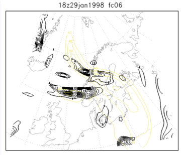
29 January 1998/06.00 UTC - Six-hourly HIRLAM forecast; yellow: isotachs 300 hPa, black: positive vorticity advection (PVA) 300 hPa
|
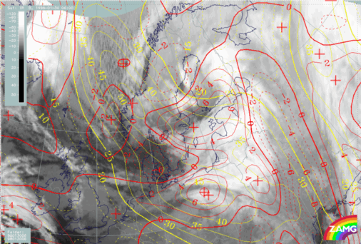
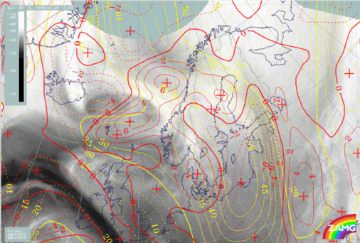
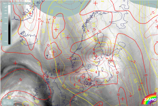
29 January 1998/06.00 UTC - Meteosat WV image; yellow: isotachs 300 hPa, red: vorticity advection 300 hPa
|
|
|
|
|
|
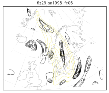
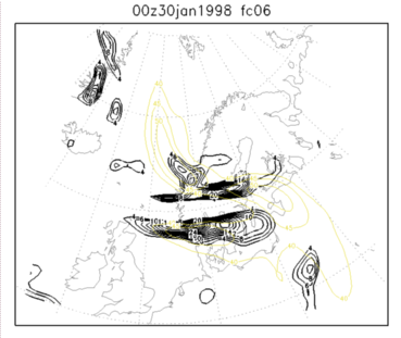
29 January 1998/12.00 UTC - Six-hourly HIRLAM forecast; yellow: isotachs 300 hPa, black: positive vorticity advection (PVA) 300 hPa
|
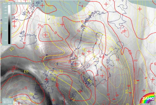
29 January 1998/12.00 UTC - Meteosat WV image; yellow: isotachs 300 hPa, red: vorticity advection 300 hPa
|
|
29 January 1998/18.00 UTC - Six-hourly HIRLAM forecast; yellow: isotachs 300 hPa, black: positive vorticity advection (PVA) 300 hPa
|
29 January 1998/18.00 UTC - Meteosat WV image; yellow: isotachs 300 hPa, red: vorticity advection 300 hPa
|
|
|
|
|
|
30 January 1998/00.00 UTC - Six-hourly HIRLAM forecast; yellow: isotachs 300 hPa, black: positive vorticity advection (PVA) 300 hPa
|
30 January 1998/00.00 UTC - Meteosat WV image; yellow: isotachs 300 hPa, red: vorticity advection 300 hPa
|
|
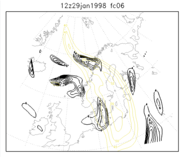
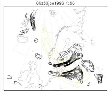
30 January 1998/06.00 UTC - Six-hourly HIRLAM forecast; yellow: isotachs 300 hPa, black: positive vorticity advection (PVA) 300 hPa
|
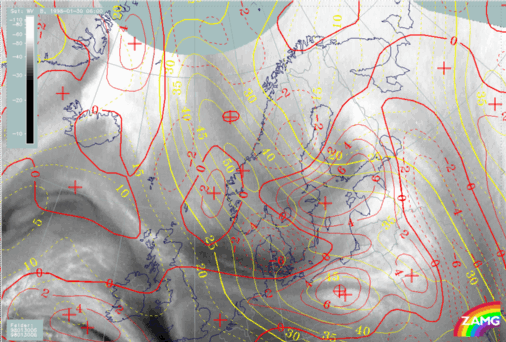
30 January 1998/06.00 UTC - Meteosat WV image; yellow: isotachs 300 hPa, red: vorticity advection 300 hPa
|
|
|
- The HIRLAM model shows much more clearly the initial double structure of the jet streak. This can be seen, for example, in the images for 29 January at 12.00 UTC, where the HIRLAM model is in very good accordance with the observations as well as WV images.
- The PVA maxima are generally about twice as intensive in HIRLAM as in ECMWF. This applies to the maxima associated with the upper level trough coming from the north as well as to the initial Icelandic Upper level Low. The gradient in PVA is also generally much more pronounced in HIRLAM, which - at least in this case - makes the separate maxima quite prominent.
- The development of PVA for the respective systems is roughly the same in both models, but at certain periods notable differences can be seen. For example, the location of the PVA maximum associated with the upper level trough on 29 January at 06.00 UTC is in HIRLAM more to the north than in ECMWF.
- Apparently there are some PVA maxima which are not really relevant for the analysis. On the other hand, at least in this case, the HIRLAM model does not seem to miss any meteorologically important PVA maxima.
- The intensification of the upper level trough is nicely seen as rapidly increasing values in the HIRLAM model on 30 January 1998 at 06.00 UTC, when the closed Upper Level Low has formed south of Finland.
- The HIRLAM PVA fields fit nicely to the observed cloud systems. This can be seen most clearly by comparing PVA on 30 January 1998 at 06.00 UTC to IR images for the same time.
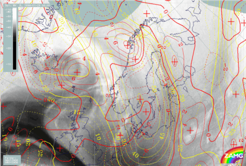
30 January 1998/06.00 UTC - Meteosat IR image; yellow: isotachs 300 hPa, red: vorticity advection 300 hPa