12 - 13 NOVEMBER 1997 - THE PERIOD 12 NOVEMBER 11.00 - 12.00 UTC
by ZAMG
Observational part
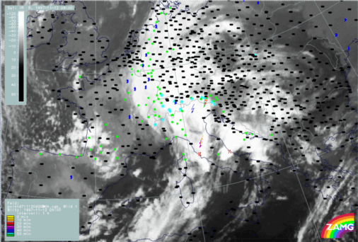
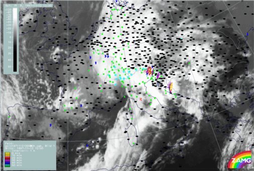
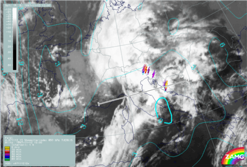
12 November 1997/09.00 UTC - Meteosat IR image; weather reports (green: rain and showers, blue: drizzle, cyan: snow, purple: freezing rain,
red: thunderstorm with precipitation, orange: hail, black: no actual precipitation or thunderstorm with precipitation)
|
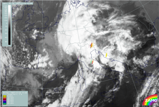
12 November 1997/11.00 UTC - Meteosat IR image; lightning reports
|
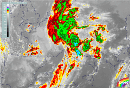
12 November 1997/11.00 UTC - Meteosat IR enhanced image
|
|
|
|
|
|
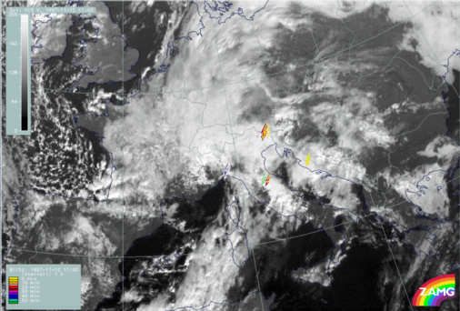
12 November 1997/11.00 UTC - Meteosat VIS image; lightning reports
|
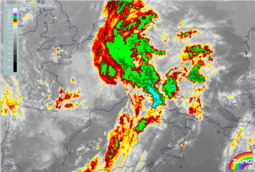
12 November 1997/09.00 UTC - Meteosat IR image; red: mean values of grey shades of cloud development and decay, cyan: cloud development greater
than 30 units, magenta: cloud decay greater than 20 units
|
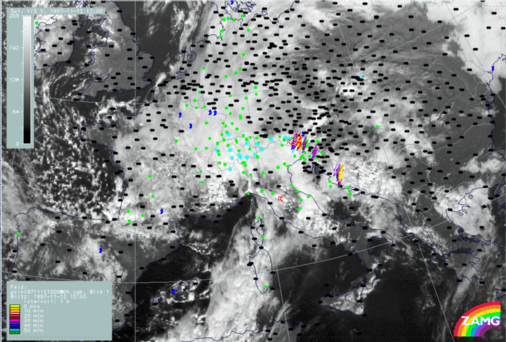
12 November 1997/12.00 UTC - Meteosat IR image; weather reports (green: rain and showers, blue: drizzle, cyan: snow, purple: freezing rain,
red: thunderstorm with precipitation, orange: hail, black: no actual precipitation or thunderstorm with precipitation)
|
12 November 1997/12.00 UTC - Meteosat IR enhanced image
|
|
|
|
|
|
12 November 1997/12.00 UTC - Meteosat VIS image; weather reports (green: rain and showers, blue: drizzle, cyan: snow, purple: freezing rain,
red: thunderstorm with precipitation, orange: hail, black: no actual precipitation or thunderstorm with precipitation)
|
12 November 1997/12.00 UTC - Meteosat IR image; red: mean values of grey shades of cloud development and decay, cyan: cloud development greater
than 30 units, magenta: cloud decay greater than 20 units
Synoptic environment part
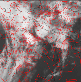
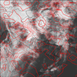
12 November 1997/12.00 UTC - Meteosat IR image; yellow: Showalter index 500/850 hPa, lightning reports; position of vertical cross section indicated
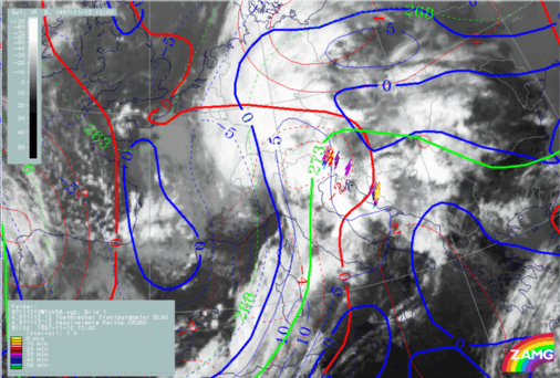
12 November 1997/12.00 UTC - Meteosat IR image; blue: thermal front parameter (TFP) 500/850 hPa, green: equivalent thickness 500/850 hPa, red:
temperature advection 1000 hPa, yellow: positive vorticity advection (PVA) 500 hPa, lightning reports
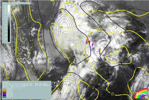
12 November 1997/12.00 UTC - Meteosat IR image; yellow: positive vorticity advection (PVA) 500 hPa, black: positive vorticity advection (PVA) 300 hPa,
lightning reports
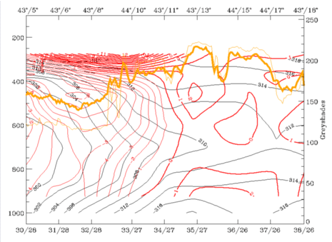
12 November 1997/12.00 UTC - Vertical cross section; black: isentropes (ThetaE), orange thin: IR pixel values, orange thick: WV pixel values

|
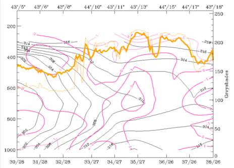
12 November 1997/12.00 UTC - Vertical cross section; black: isentropes (ThetaE), red thin: temperature advection - CA, red thick: temperature
advection - WA, orange thin: IR pixel values, orange thick: WV pixel values
|
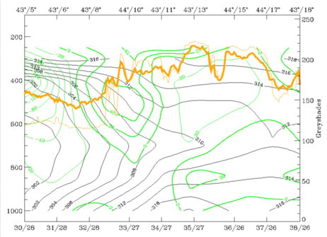
12 November 1997/12.00 UTC - Vertical cross section; black: isentropes (ThetaE), magenta thin: divergence, magenta thick: convergence, orange
thin: IR pixel values, orange thick: WV pixel values
|
|
|
|
|
|
12 November 1997/12.00 UTC - Vertical cross section; black: isentropes (ThetaE), green thick: vorticity advection - PVA, green thin: vorticity
advection - NVA, orange thin: IR pixel values, orange thick: WV pixel values
|
- A thick superadiabatic layer for both MCSs;
- WA in low layers (left image top) but CA above in the middle troposphere which is a classical condition for an instability for both MCSs;
- Notable convergence (right image top) in a thick layer which takes place in front of the frontal zone;
- No PVA increase with height in connection with the two MCSs (left image bottom).
12 November 1997/12.00 UTC - Vertical cross section; black: isentropes (ThetaE), orange thin: IR pixel values, orange thick: WV pixel values
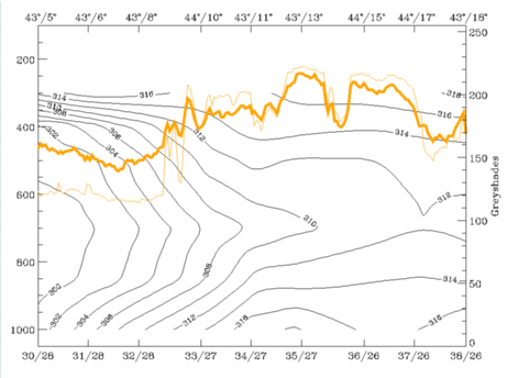
- 310K which is on top of the frontal surface and can be followed from 300 hPa downward to about 700 hPa for the developing MCS Th3 over the Adriatic Sea;
- 312K, a surface which is downward inclined between 300 and 600 hPa and is relevant for both MCSs Th2 and Th3.
|
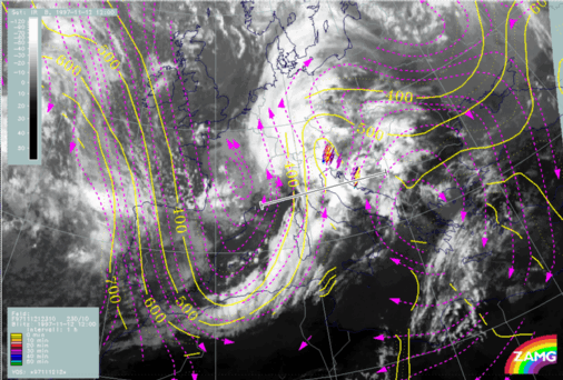
12 November 1997/12.00 UTC - Meteosat IR image; magenta: relative streams 310K - system velocity 230° 10 m/s, yellow: isobars, lighting
reports; position of vertical cross section indicated
|
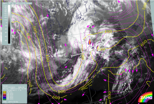
12 November 1997/12.00 UTC - Meteosat IR image; magenta: relative streams 312K - system velocity 230° 10 m/s, yellow: isobars, lighting
reports; position of vertical cross section indicated
|
|
|
On the 312K surface (right image) the relative stream clearly originates from the rear of the Cold Front and represents the upper relative stream there.


