29 JULY 1997 - UPPER LEVEL FEATURES
by ZAMG
29 July 1997/18.00 UTC - Meteosat IR image; red: vorticity advection 300 hPa
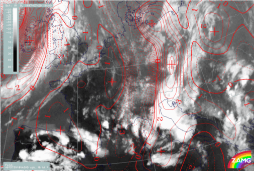
Another reason for the strong thunderstorm development can be found in a zone of strong PVA at 300 hPa accompanying the cloud system. Although the maximum of PVA has moved more to the north there are still high cyclonic values in the area south of the Alps.
29 July 1997/18.00 UTC - Meteosat IR image; red: vorticity advection 300 hPa, blue: shear vorticity 300 hPa, yellow: isotachs 300 hPa
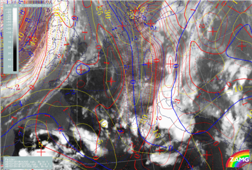
The image above shows that there is still a jet streak existing which contributes intensified shear vorticity to the PVA maximum. The influence of jet and shear is more dominant in the northern part, which might be the reason for the increased values more to the north. In the southern area, where there is convective cloudiness, the trough with its curvature has more influence.


