29 JULY 1997 - FRONTAL DIAGNOSIS
by ZAMG
- Equivalent thickness 500/850 hPa
- Temperature advection (TA) especially warm advection (WA) 500/1000 hPa
- Thermal front parameter (TFP) 500/850 hPa
While these parameters support the frontal character of the cloud band on the western boundary of the image, the two cloud bands in the centre with a north-south orientation are not at all frontal cloud bands. A rather weak thickness gradient crosses the cloud band perpendicularly, WA and CA are rather weak and without any distinct relation to either of the two cloud systems, and the TFP extends in a more west-east direction from the Pyrenees across north Italy to Slovenia and south Austria.
This is a typical situation where the TFP characterises an air mass boundary immediately south of the Alpine mountain ranges separating the warm air mass in the Mediterranean from the colder one north of the Alps. The two north-south oriented cloud bands are to a large extent on the northern side of the air mass boundary and have a different physical background.
|
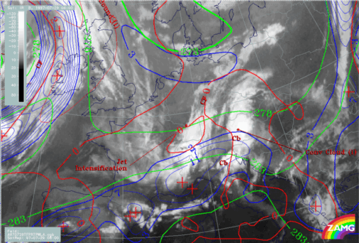
29 July 1997/06.00 UTC - Meteosat IR image; red: height contours 1000 hPa, green: height contours 500 hPa; SatRep overlay: names of conceptual
models
|
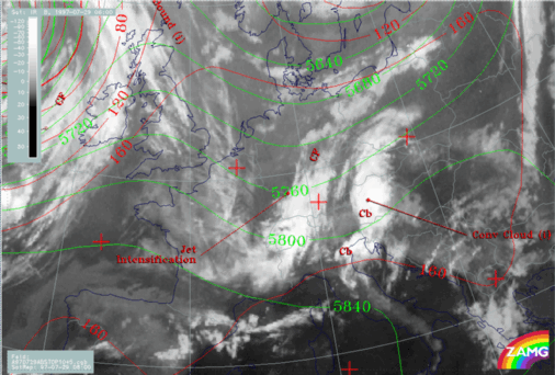
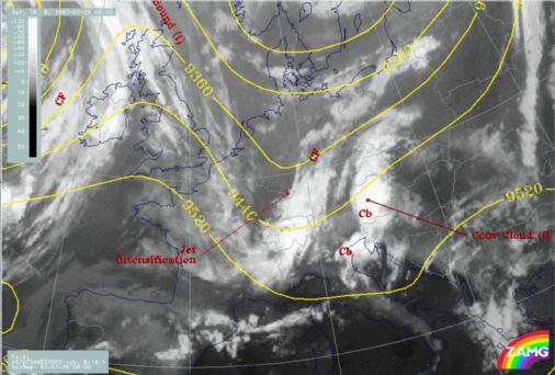
29 July 1997/06.00 UTC - Meteosat IR image; yellow: height contours 300 hPa; SatRep overlay: names of conceptual models
|
|
|
This relationship indicates also that what occurs in the upper levels has an important influence on cloud systems.


