19 FEBRUARY 1997 - VERY SHORT RANGE FORECAST FOR THE RAPID CYCLOGENESIS AND THE COMMA FEATURE

by ZAMG


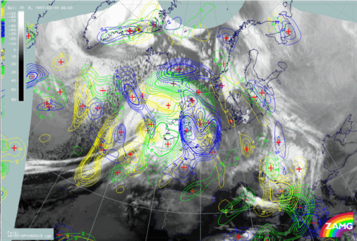
19 February 1997/06.00 UTC - Meteosat IR image; yellow: height contours 1000 hPa 06.00 UTC, green: height contours 1000 hPa 12.00 UTC, blue: height contours 1000 hPa 18.00 UTC
The main parameter for predicting the path of the Rapid Cyclogenesis is the surface (or 1000 hPa) field. Two phenomena are of interest: the surface minimum in connection with the Rapid Cyclogenesis and the surface trough at the rear side of the Cold Front in connection with the Comma.

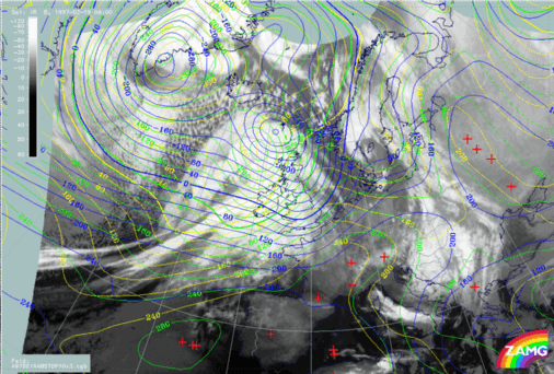
The surface minimum, which is already well developed at 06.00 UTC (yellow in the image), shows a distinct north-eastward displacement as well as a further deepening during the next 12 hours, which is another sign for the intensity of the ongoing Rapid Cyclogenesis.

The surface trough also propagates quickly eastward and reaches England at 18.00 UTC. This is also in accordance with the displacement of the TFP and gives some indication for the Comma feature.

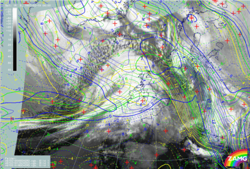
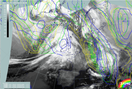
19 February 1997/06.00 UTC - Meteosat IR image; yellow: shear vorticity 300 hPa 06.00 UTC, green: shear vorticity 300 hPa 12.00 UTC, blue: shear vorticity 300 hPa 18.00 UTC
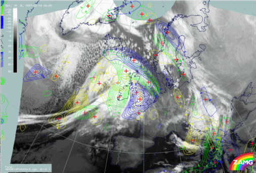
19 February 1997/06.00 UTC - Meteosat IR image; yellow: positive vorticity advection (PVA) 300 hPa 06.00 UTC, green: positive vorticity advection (PVA) 300 hPa 12.00 UTC, blue: positive vorticity advection (PVA) 300 hPa 18.00 UTC
During the process of diagnosis of both features the separation of curvature and shear vorticity played an important role in the identification of the conceptual models. Therefore the same parameters have to be looked at in the VSRF. The images above contain the relevant fields of shear vorticity (left image) and PVA at 300 hPa (right image). With the knowledge of the diagnosis the relevant maxima can be sorted out and traced forward. The PVA maximum passes Ireland to the north-east and reaches a location north of Scotland at 18.00 UTC (blue lines) with intensification.
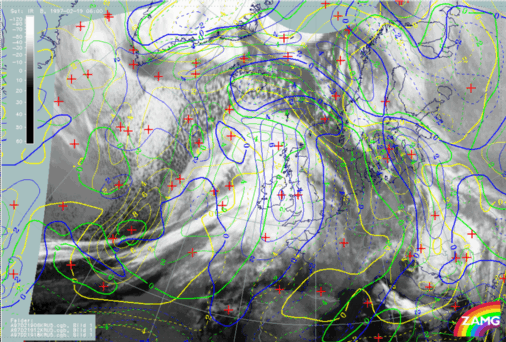
19 February 1997/06.00 UTC - Meteosat IR image; yellow: curvature vorticity 300 hPa 06.00 UTC, green: curvature vorticity 300 hPa 12.00 UTC, blue: curvature vorticity 300 hPa 18.00 UTC
19 February 1997/06.00 UTC - Meteosat IR image; yellow: positive vorticity advection (PVA) 500 hPa 06.00 UTC, green: positive vorticity advection (PVA) 500 hPa 12.00 UTC, blue: positive vorticity advection (PVA) 500 hPa 18.00 UTC
19 February 1997/06.00 UTC - Meteosat IR image; yellow: height of PV = 2 units 06.00 UTC, green: height of PV = 2 units 12.00 UTC, blue: height of PV = 2 units 18.00 UTC
For the Comma - like feature curvature vorticity and PVA at 500 hPa are the relevant parameters which are shown in the top left and right images. The curvature maximum (left image) shows a quick displacement to a location over Ireland and west England at 18.00 UTC. The configuration of the isolines of the curvature vorticity maximum becomes double structured which is best visible at 12.00 UTC (green lines). The isolines of the related PVA maximum become double structured, too, and reach south Ireland at 12.00 UTC and west England at 18.00 UTC. Another informative parameter for this conceptual model is the height of potential vorticity PV = 2 units (left image bottom). Although there are different opinions in literature it is commonly held that this threshold separates tropospheric from stratospheric air; therefore this parameter can also be interpreted as the height to which dry stratospheric air has sunk. In this case dry stratospheric air has reached 440 hPa at the rear of the Comma at 06.00 UTC (yellow) and can be followed to north-west Ireland at 18 UTC.

So summarizing, the single conceptual models represented by typical cloud systems in the satellite images can be forecast with help of other key parameters (mostly numerical parameters) of these conceptual models quite well.


SUB-MENU OF 19 FEBRUARY 1997
VERY SHORT RANGE FORECAST FOR THE FRONTAL SYSTEM
VERIFICATION OF VERY SHORT RANGE FORECAST