19 FEBRUARY 1997 - OVERVIEW OF SATELLITE IMAGE FOR RAPID CYCLOGENESIS 00.00 UTC
by ZAMG
|
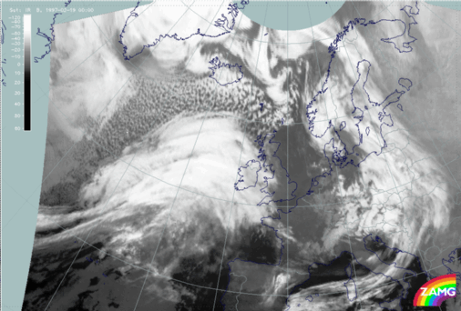
19 February 1997/00.00 UTC - Meteosat IR image
|
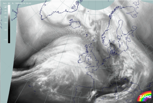
19 February 1997/00.00 UTC - Meteosat WV image
|
|
|
|
Already during the frontal diagnosis the cloud configurations to the north-north-west of the frontal cloud band (north-north-west of the line 44N/30W - 55N/15W) have been mentioned and called
cloud head. This expression indicates already the first guess about the existence of the conceptual model of a
Rapid Cyclogenesis (compare
Conceptual Models: Rapid Cyclogenesis
). However, cloudiness deviates in many instances from the typical configurations described for a Rapid Cyclogenesis. The images above show a cloud system which is
clearly separated from the frontal cloudiness and has over a wide area lower cloud tops; thus it can be interpreted as the typical cloud shield which protrudes from below the frontal cloudiness. But in this case the cloud head area is by far too extended and shows two separate cloud bulges. It is not clear from the imagery which of the two bulges (if any) belongs to a Rapid Cyclogenesis. This uncertainty is increased by an even more distinct double structure in the WV imagery (right image).