09 - 10 APRIL 1996 - RAPID CYCLOGENESIS: ANALYSIS FOR "SPECIAL INVESTIGATION": 09 APRIL 18.00 UTC TO 10 APRIL 00.00 UTC

by ZAMG


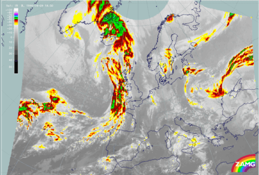
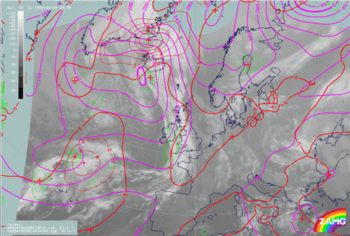
09 April 1996/18.00 UTC - Meteosat IR enhanced image
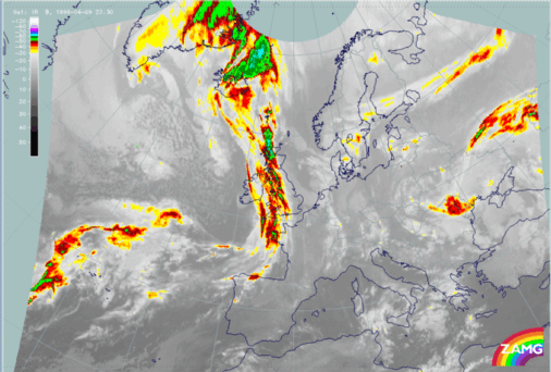
10 April 1996/00.00 UTC - Meteosat IR enhanced image
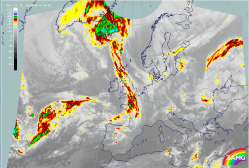
10 April 1996/06.00 UTC - Meteosat IR image
Compared with the image from 12.00 UTC, at 18.00 UTC (left image top) the area of the cloud head is characterized by a small area of cold (high) cloud tops at approximately 45N/30W. In the paragraphs below, we will see that this local intensification is due to the right entrance region of the northern jet streak. The rest of the cloud head shows no significant intensification. The entrance region of the southern jet streak is indicated by cold (high) cloud tops within the leading part of the frontal cloud band at approximately 43N/30W. Six hours later (right image top) the cloud tops of the cloud head are getting warmer (lower) even in the right entrance region, which at 00.00 UTC is less pronounced than at 18.00 UTC. Only in the right entrance region of the jet streak core, at approximately 48N/21W, can colder cloud tops (but also warmer than six hours before) be observed. At 06.00 UTC (left image bottom) nearly the whole cloud head has dissolved. The rest of the cloud head can be found at approximately 48N/26W.
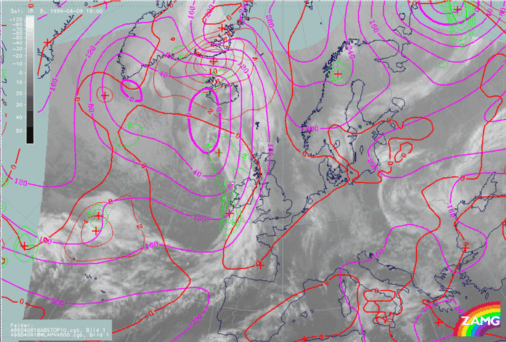
09 April 1996/18.00 UTC - Meteosat IR image; magenta: height contours 1000 hPa, green: positive vorticity advection (PVA) 500 hPa, red: temperature advection - WA 1000 hPa
10 April 1996/00.00 UTC - Meteosat IR image; magenta: height contours 1000 hPa, green: positive vorticity advection (PVA) 500 hPa, red: temperature advection - WA 1000 hPa
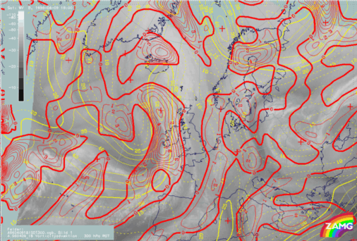
09 April 1996/19.00 UTC - Meteosat WV image; yellow: isotachs 300 hPa, red: positive vorticity advection (PVA) 300 hPa
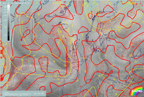
10 April 1996/00.00 UTC - Meteosat WV image; yellow: isotachs 300 hPa, red: positive vorticity advection (PVA) 300 hPa
The parameters in both images (left and right image top) represent a classical distribution. Therefore a low or a well-developed trough (left image top - this configuration of the isolines is typical for a weak low) at ground level can be found in both images situated at the rear of the frontal cloud band upstream of the cloud head. The field of temperature advection is characterized by pronounced warm advection. The maximum of warm advection again can be found very close to the merging zone between the frontal cloud band and the cloud head cloudiness. The third superimposed parameter, the field of PVA at 500 hPa, contains a maximum upstream of the merging zone. Within the area of the PVA the coldest cloud tops can be observed. As at 12.00 UTC both maxima are not situated within the left exit region of a superimposed jet streak at 300 hPa, but in the area of the right entrance region (left and right image bottom).

The model again shows a broad zone of high wind velocities (left and right image bottom) above the cloud head and does not separate between the northern and the southern oriented jet streak. The only indication by the model that two jet streaks exist can be found in the bulges of the isotachs within the area of the entrance region. The second superimposed parameter is the field of PVA at 300 hPa which shows two PVA maxima in the area of the right entrance region of both jet streaks (left image bottom). Compared with the coldest cloud tops, both maxima are shifted about two degrees too far to the west. At 00.00 UTC the jet streak and PVA within the right entrance region are less pronounced, which can also be seen by the lower (warmer) cloud tops.

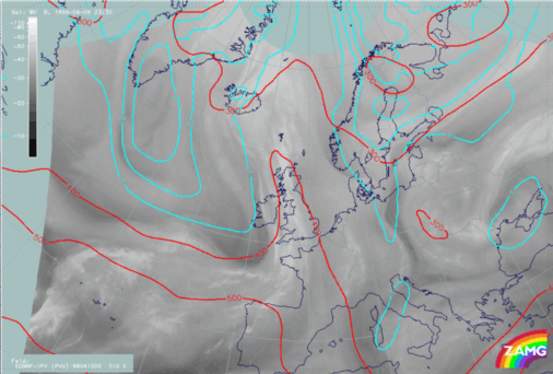
09 April 1996/18.00 UTC - Meteosat WV image; cyan: potential vorticity 310K, red: isobars
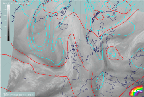
10 April 1996/00.00 UTC - Meteosat WV image; cyan: potential vorticity 310K, red: isobars
Both images above show the field of PV at the isentropic surface of 310K. In both images the IPV anomaly is situated too far northward of the Rapid Cyclogenesis. Therefore the PV has no effect on the development of the cloud head.

SUB-MENU OF 09 - 10 APRIL 1996
RAPID CYCLOGENESIS: DIAGNOSIS FOR 09 APRIL 12.00 UTC