09 - 10 APRIL 1996 - INTRODUCTION AND SHORT CASE DESCRIPTION
by ZAMG
|
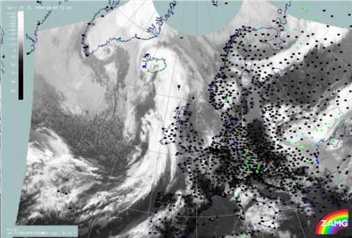
09 April 1996/12.00 UTC - Meteosat IR image; weather events (green: rain and showers, blue: drizzle, cyan: snow, purple: freezing rain, red:
thunderstorm with precipitation, orange: hail, black: no actual precipitation or thunderstorm with precipitation)
|
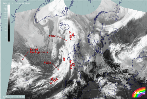
09 April 1996/12.00 UTC - Meteosat IR image; SatRep overlay: names of conceptual models
|
|
|
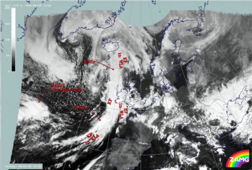
- A so-called classical Cold Front situated at the northern or downstream side of the Wave (see next paragraph);
- A Cold Front in Cold Advection (CA) at the southern or upstream side.
Both Cold Fronts are accompanied by a mesoscale substructure in the form of a Wave. In the case of the Cold Front in Warm Advection the wave can be found above the Atlantic north-west of Ireland at approximately 59N/13W. In the case of the classical Cold Front it is situated south-west of Ireland at about 52N/12W.
Above the Atlantic north-west of the Azores at approximately 44N/35W the satellite image shows the cloud head of a Rapid Cyclogenesis at approximately 44N/37W.
Further, a band of mostly deep cloudiness (compare IR and VIS images above) extends from south England across the coast of the Netherlands to the North Sea west of Denmark at approximately 56N/08E. This cloud band is not analyzed within SatRep and will be described in more detail in the third part of this case study - "Special Investigation": Diagnosis of a Mesoscale Cloud Band.
The next image contains the superimposed names of the conceptual models diagnosed within the first level of SatRep:
- KF: Cold Front
- KF IN WLA: Cold Front in Warm Advection
- KF IN KLA: Cold Front in Cold Advection
- WELLE: Wave
- RAPID CYCLOGENESIS: Rapid Cyclogenesis