02 - 03 JUNE 2000 - INTRODUCTION
by ZAMG
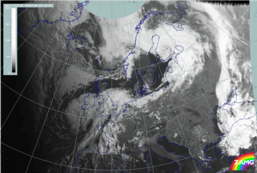
02 June 2000/18.00 UTC - Meteosat IR image; SatRep overlay: names of conceptual models
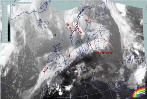
In the IR image above the Satellite Report (Sat Rep) is superimposed. The SatRep indicates a Wave in a developed stage SW of the British Isles, a CF over the North Sea and Denmark and an Upper Wave over the Baltic Sea. The Warm Front, which is marked as such over the Baltic States, is not accompanied by extensive cloudiness and can only be analysed with the help of model parameter fields (not shown here). The occlusion cloud band belonging to the system is situated over Finland and Central Scandinavia and a Back bent Occlusion has been identified at the northern end of the system.
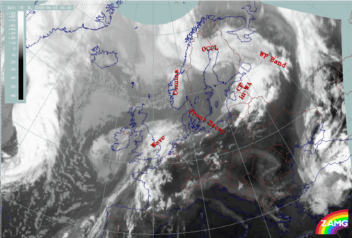
03 June 2000/06.00 UTC - Meteosat IR image; SatRep overlay: names of conceptual models
Diagnosis from satellite features
The area of dissipation of the frontal cloud band over Northern Europe can more easily be analysed with the help of loops of satellite imagery in IR, WV, and VIS:|
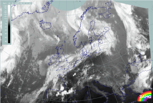
02 June 2000/22.00 UTC - Meteosat IR image
|
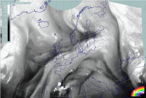
02 June 2000/22.00 UTC - Meteosat WV image
|
|
|
|
|
|
03 June 2000/06.00 UTC - Meteosat VIS image
|
- From 22.00 UTC, in the IR image a gap in the cloud starts extending over the North Sea to the rear of the Cold Front and within the frontal cloud band. In the WV image loop, the beginning of the decay can be observed from 22.00 UTC and over the following two hours.
- During the next 6 hours, the gap widens and the dissipation zone increases over the North Sea, except for a small band of low clouds remaining over Poland; this is seen in the loop of the VIS images at 05.00 UTC.
- In the WV imagery the growing dissipation zone over Northern Europe and the North Sea is indicated by a darker area within the WV cloud band.
- Also in the WV images, a thin Dark Stripe develops to the rear of the frontal zone, over the North Sea, at 22.00 UTC.
- The low clouds over Poland finally dissipate during the process, as observed in the VIS images between 06.00 UTC and 13.00 UTC
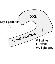
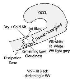
Such a process is very similar to the conceptual model "Front Decay" for which the main characteristics are described below:
- During the initial stage of the process, there is a multi layered frontal cloud band within a developed system consisting of Cold Front, Warm Front, and Occlusion which appear white in IR and VIS and light grey in WV images
- The dissipation of high clouds starts at the rear of the frontal cloud band and a resulting gap in the cloud grows within the front, however, low clouds remain
- At the mature stage of the process, the remaining low clouds will often dissappear
|
|

