29 MAY 2000 - SYNOPTIC SCALE ANALYSIS AT 06.00 UTC
by FMI
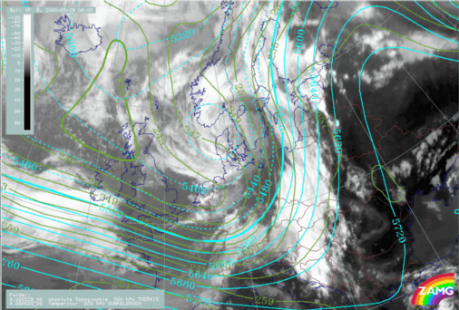
As the synoptic situation concerning this case does not change significantly during the day, it is convenient to begin by making a thorough analysis of the situation at 06.00 UTC. This is done by studying the ECMWF model analysis together with Meteosat satellite images. The geopotential height and the temperature at 500 hPa at 06.00 UTC show that there is distinct cold advection over eastern Germany and Poland. A corresponding wide area of warm advection extends from the Gulf of Finland to northern Norway. A 300 hPa jet is present in an east to southeast direction from the English Channel towards north of the Alps, and then turns north to Scandinavia. There is polar air mass in the area of the 500 hPa trough over the North Sea, the Atlantic and the British Isles. Furthermore, there is a tongue of mid-latitude (warmer) air extending from the Black Sea northwards in the area of the 500 hPa ridge.
|
29 May 2000/06.00 UTC - Meteosat IR image; green: temperature 500 hPa, cyan: height contours 500 hPa
|
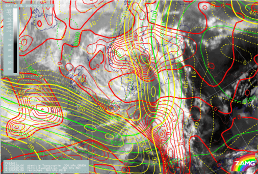
29 May 2000/06.00 UTC - Meteosat IR image; green: height contours 300 hPa, red: positive vorticity advection (PVA) 300 hPa, yellow: isotachs 300
hPa
|
|
|
|
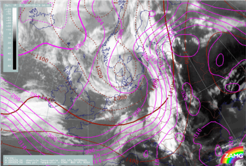
A very sharp gradient in equivalent potential temperature can be seen. This is characteristic of a distinct Cold Front and there is frontal cloudiness extending from the Baltic Sea in the north to Slovenia and Croatia in the south. Across the Gulf of Finland and southern Finland there is also a distinct temperature gradient, indicating a Warm Front. Moreover there is a thermal ridge with very warm air in the region to the east of the Cold Front; equivalent potential temperatures reach 322K.
29 May 2000/06.00 UTC - Meteosat IR image; magenta: equivalent potential temperature 850 hPa, brown: height contours 850 hPa
In the area of the Cold Front cloud bands there is pronounced positive vorticity advection at both 300 hPa and 500 hPa, especially over the southern part of the Cold Front, which is situated immediately ahead of the 500 hPa trough. However, ahead of the frontal cloud band, vorticity advection is small or even negative.
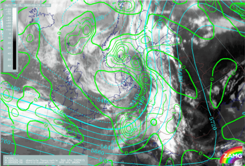
29 May 2000/06.00 UTC - Meteosat IR image; cyan: height contours 500 hPa, green: positive vorticity advection (PVA) 500 hPa
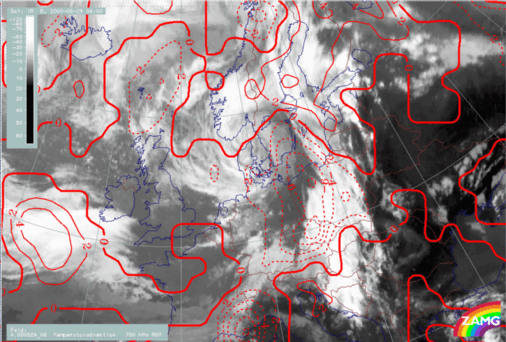
Temperature advection at 700 hPa shows pronounced cold advection over eastern Germany and Poland, underlining the fact that there is a Cold Front there, while the warm advection in the area of southern Finland is less pronounced. Immediately ahead of the frontal cloud band, there is some warm advection, indicating the existence of a Warm Conveyor Belt.
29 May 2000/06.00 UTC - Meteosat IR image; red: temperature advection 700 hPa
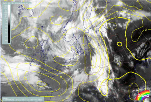
The Showalter index has values less than zero over a large part of the thermal ridge, east of the Cold Front. This means that severe thunderstorms are very likely in this region.
29 May 2000/06.00 UTC - Meteosat IR image; yellow: Showalter index
All in all, the most characteristic feature of the synoptic situation at 06.00 UTC is a pronounced Cold Front. Ahead of this front, there is a thickness ridge containing very warm air. To the rear (west) of the thickness ridge there is some warm advection. Thus the meteorological circumstances are very similar to those for pre-frontal convergence lines.