Thickness Ridge Cloudiness - Weather Events
by ZAMG and DHMZ
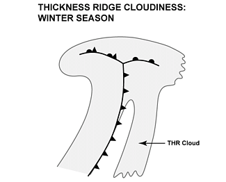
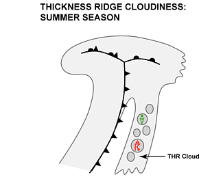
The Thickness Ridge cloudband is multi-layered and normally without significant precipitation except in cases with embedded convection.
| Parameter
|
Description
|
| Precipitation
|
- Usually no or very few surface reports of precipitation. Light drizzle or light rain can occur during the winter season.
- Rain, rain showers or even thunderstorms are possible during the summer season in connection with an unstable stratification during the daytime.
|
| Temperature
|
Rising temperatures in warm sector
|
| Wind
|
Mostly weak winds with a southerly component
|
| Other relevant information
|
Multi layered middle and high cloudiness
|
|
|
|
|
|
|
|
13 January 2008/06.00 UTC - Meteosat 9 IR image; weather events (green: rain and showers, blue: drizzle, cyan: snow,
red: thunderstorm, yellow: fog, black: no precipitation)
|
|
In the example of 13 January 2008, 06 UTC, light drizzle and light rain were reported over the UK. There is also light to moderate southerly and
south-westerly wind in the region of the Thickness Ridge Cloudiness. Synop measurements are shown for the region in red rectangulare.