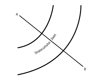
Stratocumulus Sheets - Typical Appearance In Vertical Cross Sections
by FMI and KNMI
|
|
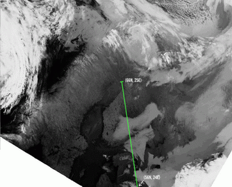
13 May 1998/02.40 UTC - Meteosat IR image; position of vertical cross section indicated
|
|
|
|
|
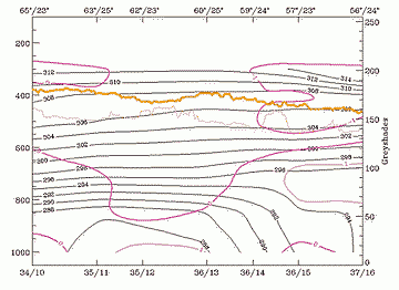
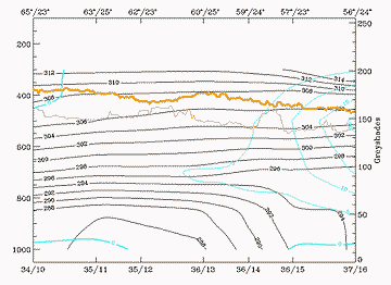
13 May 1998/00.00 UTC - Vertical cross section; black: isentropes (ThetaE), magenta thin: divergence, magenta thick: divergence, orange thin: IR
pixel values, orange thick: WV pixel values
|
|
|
|
|
13 May 1998/00.00 UTC - vertical cross section; black: isentropes (ThetaE), cyan thick: vertical motion (omega) - upward motion, cyan thin:
vertical motion (omega) - downward motion, orange thin: IR pixel values, orange thick: WV pixel values
|
|
|
|
|
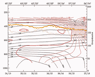
13 May 1998/00.00 UTC - Vertical cross section; black: isentropes (ThetaE), red thick: temperature advection - WA, red thin: temperature
advection - CA, orange thin: IR pixel values, orange thick: WV pixel values
|
|
|
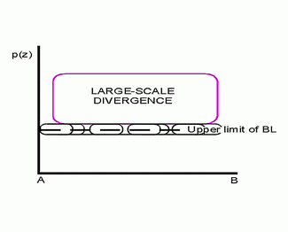
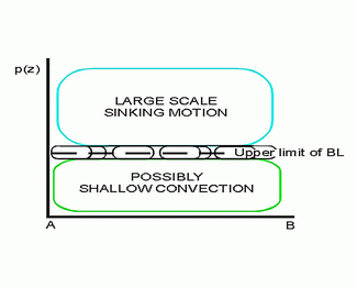
The divergence field gives very little information, divergence values over the area being negligible.
Almost the same applies to the omega field, even though there are weak positive values over the stratocumulus area, maybe indicating subsidence.
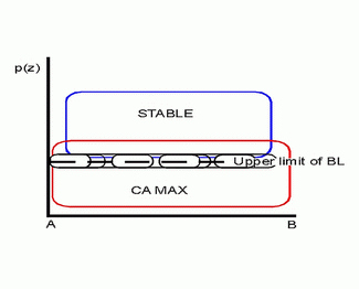
Temperature advection shows more clearly signs for cold advection in low layers (below 700 hPa) with maximum cold advection within the boundary layer. Shallow cold advection results in temperature sounding presented earlier (see Cloud structure in satellite image ).


