Jet Fibres - Weather Events

by DHMZ


Jet Fibres are high altitude cirrus clouds, therefore no weather phenomena on the ground are expected. However, they appear along the jet axis in the region of maximum wind, therefore jet related phenomena such as turbulence can be expected in that region.

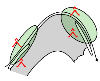
Turbulence generally appears in the zone of high horizontal and vertical wind shear, around the jet streak, but most frequently on the left-hand side below the level of the jet core, or on the right side above the level of the jet core. Furthermore, a sharply curving jet stream on the pole ward side of a Warm Front Shield, is associated with greater turbulence than a straight jet stream behind the Cold Front. Jet fibres are often considered a good indication for clear-air turbulence (CAT) which may affect flights at high levels and is a major cause of discomfort and disruption to passengers in flights.

Associated with the Subtropical Jet Stream (STJ), but separate from it, areas of tropical CAT are observed. These may be identified by their high-cloud signature, cirrus ribbons.

Parameter Description
Precipitation
  • No precipitation or thunder caused by Jet Fibres.
  • Observed weather events are connected to the nearby synoptic scale system
Temperature
  • No change
Wind (incl. gusts)
  • No change at the surface
  • Strong wind and shear in upper levels
Other relevant information
  • High-level cloudiness in the form of fibres
  • For aviation, Jet Fibres are often considered a good indication of (clear air) turbulence.

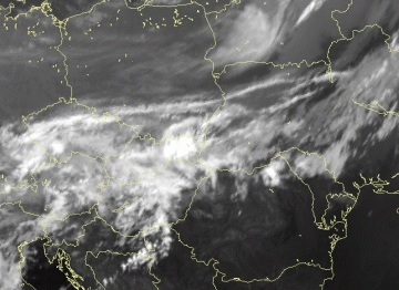
09 October 2009/06.00 UTC - Meteosat IR image
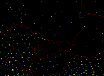
09 October 2009/06.00 UTC - clouds and precipitation observations from synop reports
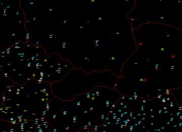
09 October 2009/06.00 UTC - cloud type observations from synop reports
Meteosat 8 IR image above shows an example of jet cloud fibres to the rear of a Cold Front, extended from Czech Republic over south Poland and Belarus. In the left image precipitation (green : rain and showers) and cloudiness (yellow: fog, light blue and gray: cloudiness in octas) can be noticed associated with a cold front. There is no significant weather events over south Poland and Belarus associated with jet cloud fibres. There are just different cloud types (right image) according to observations. Turbulence in the upper levels can be witness only through pilots reports.

Sub-Menu of Jet Fibres
Typical Appearance in Vertical Cross Sections
References