Instant Occlusion - Cloud Structure In Satellite Images
by ZAMG and FMI
The appearance of Instant Occlusion in different channels:
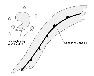
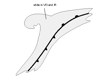
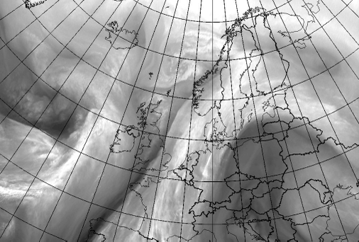
- VIS and IR: In the initial, separate Comma stage, the frontal cloud band is white and the Comma cloud and the surrounding convective cloudiness are white to light grey. In the final, merged stage, the whole cloud system is white.
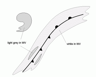
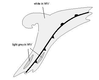
- WV: In the initial stage the Comma cloud is initially light grey to grey, and the frontal cloudiness is white with some light grey structure. In the final stage the whole cloud system is white with some light grey structure.
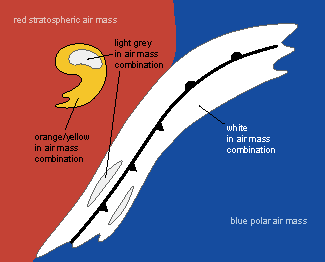
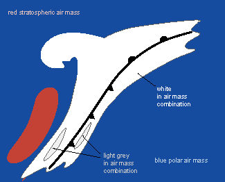
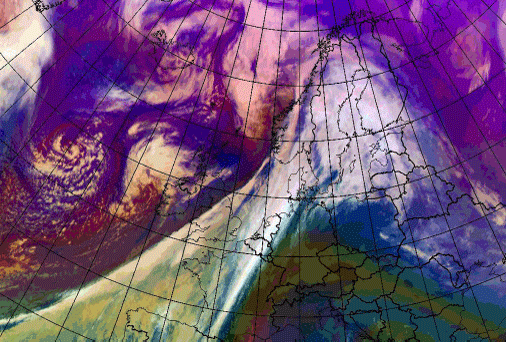
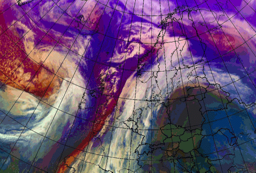
- Air mass combination WV6.2-WV7.3,IR9.7- IR10.8,WV6.2: In the initial stage the frontal cloudiness is white, while the Comma cloud appears light orange/yellow, being in the reddish very cold and dry air mass descending from the stratosphere behind the Cold Front. In the final stage the whole cloud system is white.
|
|
|
|
|
|
|
|
|
|
|
|
|
|
|
In the following images the initial and final stages are shown in different channels.
|
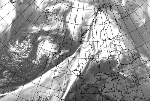
01 December 2006/12.00 UTC - Meteosat 8 IR10.8 image
|
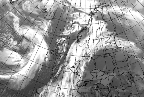
02 December 2006/12.00 UTC - Meteosat 8 IR10.8 image
|
|
|

|
|
|
01 December 2006/12.00 UTC - Meteosat 8 WV6.2 image
|
02 December 2006/12.00 UTC - Meteosat 8 WV6.2 image
|
|
01 December 2006/12.00 UTC - Meteosat 8 WV6.2-WV7.3,IR9.7- IR10.8,WV6.2
|
02 December 2006/12.00 UTC - Meteosat 8 WV6.2-WV7.3,IR9.7- IR10.8,WV6.2
|
|
|

