Instant Occlusion - Key Parameters
by ZAMG and FMI
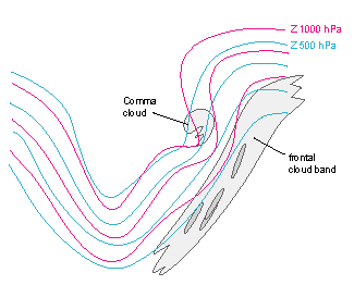
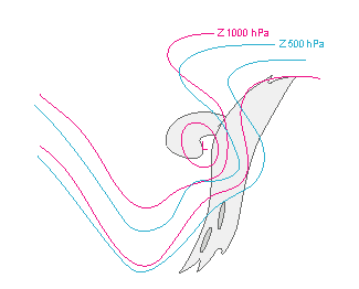
- Absolute topography at 500 and 1000 hPa:
- Initially a slowly moving large-scale and a faster moving small-scale trough within it.
- At final stage the small-scale trough coincides with a surface low.
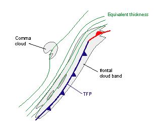
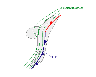
- Equivalent thickness and thermal front parameter (TFP):
- The frontal cloud band is associated with high gradient of thickness.
- Initially the Comma is within a weak thickness ridge.
- At final stage a there is a thickness gradient with a small nook in the location of the merging of Comma and frontal cloudiness.
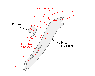
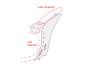
- Temperature advection at 700 hPa:
- There is CA behind the Cold Front, and WA ahead of the Warm front. Weaker temperature advections are related to Comma (WA in the leading edge, CA in the tail area).
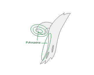
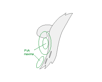
- Vorticity advection at 500 hPa:
- A small, but distinct PVA maximum is in the Comma area, mostly within the comma tail.
- PVA maxima can also be found near the rear edge of the Cold Front cloud band indicating the big upper trough and/or the approach of a jet streak (see Cold Front ).
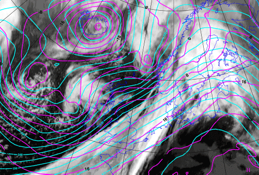
Height contours at 1000 and 500 hPa
| Initial Stage |
01 December 2006/12.00 UTC - Meteosat 8 IR 10.8 image; cyan: height 500 hPa; magenta: height 1000 hPa
|
|
|
|
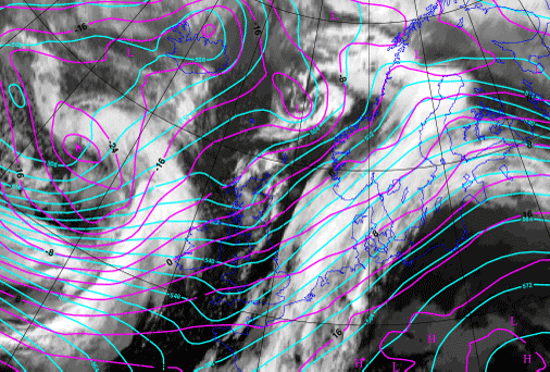
Final Stage
|
02 December 2006/12.00 UTC - Meteosat 8 IR 10.8 image; cyan: height 500 hPa; magenta: height 1000 hPa
|
|
|
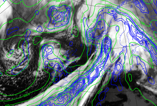
Equivalent thickness and TFP
| Initial Stage |
01 December 2006/12.00 UTC - Meteosat 8 IR 10.8 image; green: equivalent thickness 500/850 hPa, blue: thermal front parameter 500/850 hPa
|
|
|
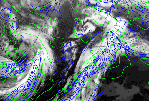
| Final Stage |
02 December 2006/12.00 UTC - Meteosat 8 IR 10.8 image; green: equivalent thickness 500/850 hPa, blue: thermal front parameter 500/850 hPa
|
|
|
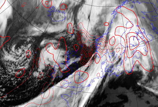
Temperature Advection at 700 hPa
| Initial Stage |
01 December 2006/12.00 UTC - Meteosat 8 IR 10.8 image; red solid: warm advection at 700 hPa, red dashed: cold advection 700 hPa
|
|
|
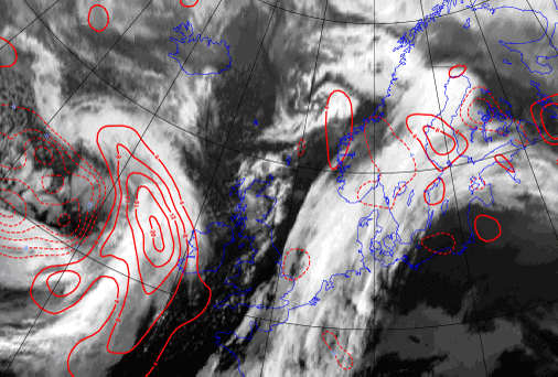
| Final Stage |
02 December 2006/12.00 UTC - Meteosat 8 IR 10.8 image; red solid: warm advection at 700 hPa, red dashed: cold advection 700 hPa
|
|
|
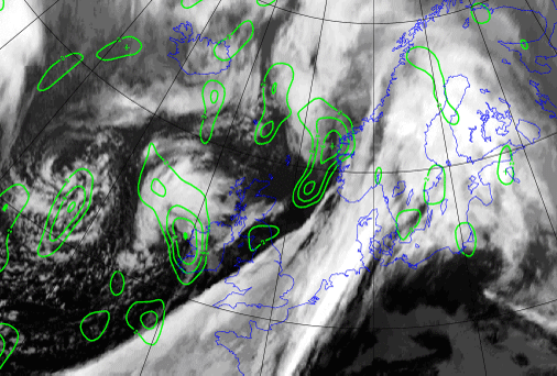
Vorticity advection at 500 hPa
| Initial Stage |
01 December 2006/12.00 UTC - Meteosat 8 IR 10.8 image; green: Positive Vorticity Advection 500 hPa
|
|
|
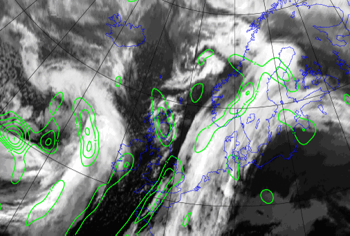
| Final Stage |
02 December 2006/12.00 UTC - Meteosat 8 IR 10.8 image; green: Positive Vorticity Advection 500 hPa
|
|
|


