Orographic Effects on Frontal Cloud - Key Parameters
by ZAMG and DHMZ
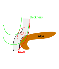
Front Delay
General frontal characteristics and the specifics for the frontal delay are given by the following key parameters:- TFP, Equivalent thickness and Temperature advection at 700 hPa, all of the parameters necessary to interpret Conceptual Model of a Cold Front (see Cold Front - Key Parameters ).
- Wind in lower troposphere, namely at 1000, 850 and 700 hPa
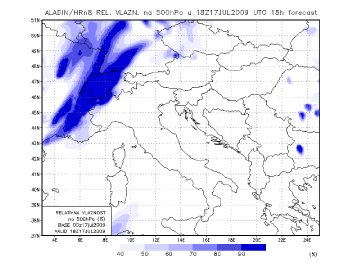
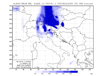
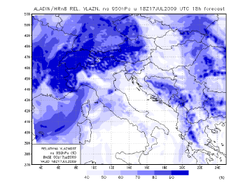
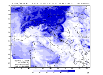
- (Relative) humidity in lower and upper troposphere
|
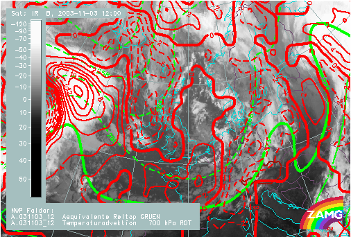
03 November 2003/12.00 UTC - Meteosat IR image; red dashed: temperature advection - CA 700 hPa, red solid:
temperature advection - WA 700 hPa, green: equivalent thickness
|
|
|
|
|
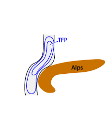
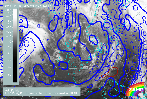
03 November 2003/12.00 UTC - Meteosat IR image; blue: TFP
|
|
|
|
|
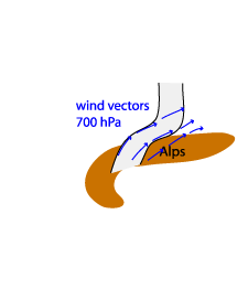
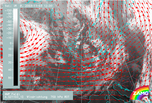
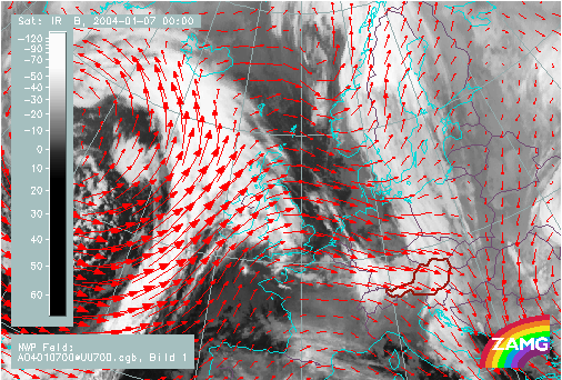
03 November 2003/12.00 UTC - Meteosat IR image; red: wind vectors 700 hPa
|
|
|
|
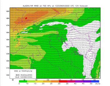
- Wind in higher troposphere is not influenced by the orography and shows the general flow which, in the case favourable for any kind of deformation of a frontal cloud, is westerly.
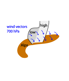
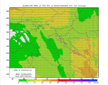
- At 700 hPa near to the orographic barrier, wind is backing to south-westerly direction. Also, a high horizontal gradient in the area of the delay is observed.
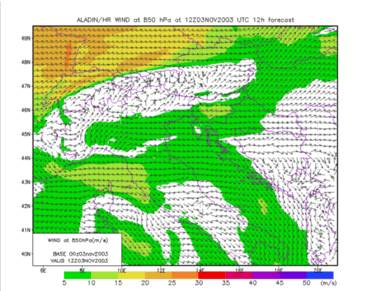
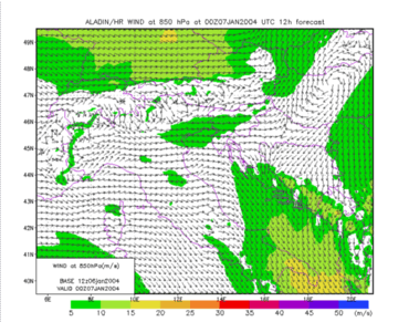
- At 850 hPa a significant disturbance by the mountain chain is evident. Generally, wind speeds are much reduced ahead of the frontal surface.
|
03 November 2003/12.00 UTC - LAM ALADIN; wind vectors 850 hPa
|
03 November 2003/12.00 UTC - LAM ALADIN; wind vectors 700 hPa
|
|
|
|
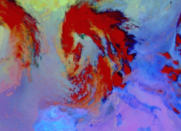
17 July 2009/15.00 UTC - Meteosat 9 Microphysics RGB image
|
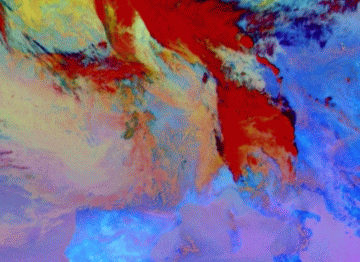
18 July 2009/12.00 UTC - Meteosat 9 Microphysics RGB image
|
|
|
|
|
|
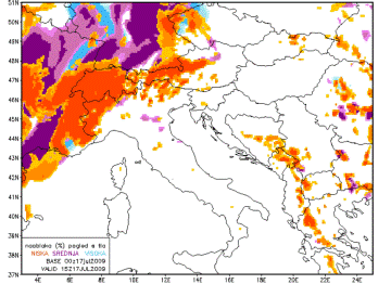
17 July 2009/15.00 UTC - LAM ALADIN; low (orange), middle (violet) and high (light blue) clouds as seen from the ground
|
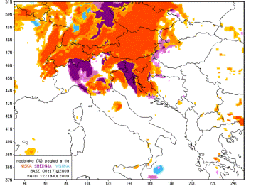
18 July 2009/12.00 UTC - LAM ALADIN: low (orange), middle (violet) and high (light blue) clouds as seen from the ground
|
|
17 July 2009/18.00 UTC - LAM ALADIN; relative humidity at 500 hPa
|
18 July 2009/15.00 UTC - LAM ALADIN; relative humidity at 500 hPa
|
|
|
|
|
|
17 July 2009/18.00 UTC - LAM ALADIN; relative humidity at 950 hPa
|
18 July 2009/15.00 UTC - LAM ALADIN; relative humidity at 950 hPa
|
Decoupling of clouds at different heights
Analogously to the case of the Front Delay general frontal characteristics are given by the following key parameters:- TFP, Equivalent thickness and Temperature advection at 700 hPa, all of the parameters necessary to interpret Conceptual Model of a Cold Front (see Cold Front - Key Parameters ).
- Wind in lower troposphere, namely at 1000, 850 and 700 hPa
- (Relative) humidity in lower and upper troposphere
|
07 January 2004/12.00 UTC - Meteosat IR image; red: wind vectors at 700 hPa
|
|
|
|
|
07 January 2004/12.00 UTC - LAM ALADIN; wind vectors 700 hPa
|
07 January 2004/12.00 UTC - LAM ALADIN; wind vectors 850 hPa
|
|
|
- Equivalently to the conditions of front delay, the wind in higher troposphere is not influenced by the orography and shows the general flow which, in the case favourable for any kind of deformation of a frontal cloud, is westerly.
- At 700 hPa near to the orographic barrier, wind is veering to north-westerly direction.
- Wind field clearly shows the location of the different parts of the front: decreasing at the boundary between high and low cloudiness.
- At the lower levels (850 hPa) wind speed is significantly reduced. Moreover, different velocities at different levels once again point out on decoupling of clouds.
|
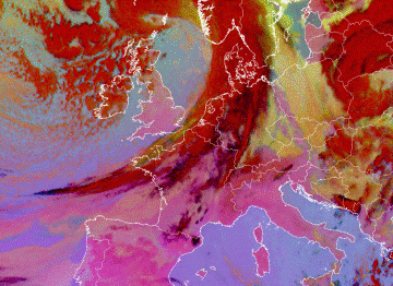
08 March 2009/06.00 UTC - Meteosat 9 Microphysics RGB image
|
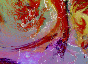
08 March 2009/15 00 UTC - Meteosat 9 Microphysics RGB image
|
|
|
|
|
|
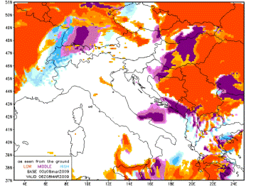
08 March 2009/06 00 UTC - LAM ALADIN; low (orange), middle (violet) and high clouds as seen from the ground
|
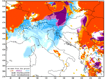
08 March 2009/15 00 UTC - LAM ALADIN: low (orange), middle (violet) and high (light blue) clouds as seen from the ground
|
|
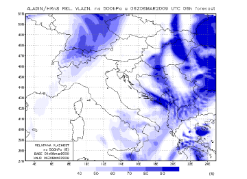
08 March 2009/06 00 UTC - LAM ALADIN; relative humidity at 500 hPa
|
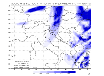
08 March 2009/15 00 UTC - LAM ALADIN; relative humidity at 500 hPa
|
|
|
|
|
|
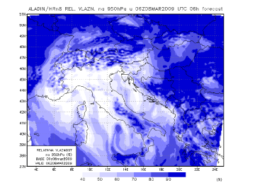
08 March 2009/06 00 UTC - LAM ALADIN; relative humidity at 950 hPa
|
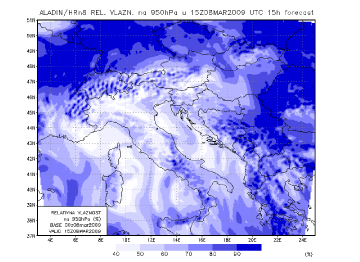
08 March 2009/15 00 UTC - LAM ALADIN; relative humidity at 950 hPa
|


