Enhanced Cumulus - Cloud Structure In Satellite Images
by KNMI, ZAMG and DHMZ
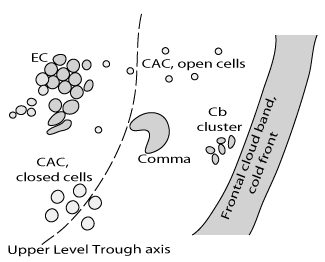
For EC (Enhanced Cumulus) areas the following satellite image features exist:
- The satellite images show a meso-scale area of cellular, sharp edged cloud clusters, with some variety in shape and size. Usually these cloud clusters are surrounded by cloud cells with warmer tops, i.e. typical cellular Cold Air Cloudiness.
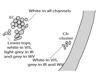
- The enhanced cells of EC are usually white in the IR, VIS and WV images indicating thick, multi-level convective clouds.
- There are types of ECs which are white in VIS but only light grey to white in IR and grey in WV indicating that the tops do not reach to high levels
- The more grey clusters are not normally surrounded by lower tops and the distance from the Cold Front is greater.
- In well-developed situations, the cirrus shields of single Cb cells merge, leading to a very cold smooth cloud shield in the IR but a transparent appearance in the VIS image.
- There are different developments associated with ECs:
- Under certain circumstances Cold Air Cloudiness (CAC) grows into EC
- EC can grow further into a Comma, and
- A Comma can grow into Cold Air Development (CAD).
The diagrams below show different kinds of convective cloud as well as the difference between Cb Clusters and ECs.
|
|
|
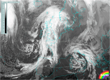
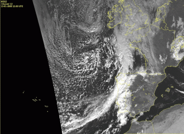
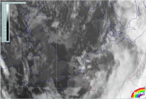
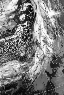
13 January 2008/12.00 UTC - Meteosat 9 IR10.8 image (zoom)
|
13 January 2008/12.00 UTC - Meteosat 9 IR10.8 image
|
|
|
|
|
|
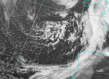
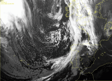
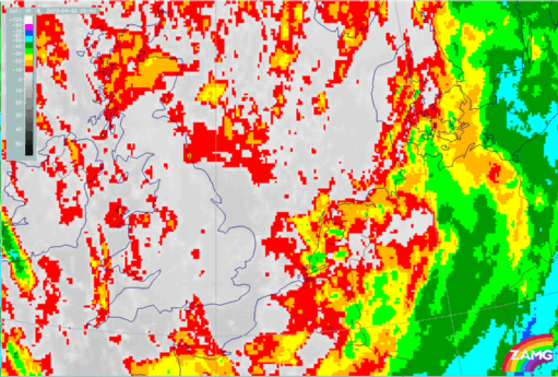
13 January 2008/12.00 UTC - Meteosat 9 HRVIS image (zoom)
|
13 January 2008/12.00 UTC - Meteosat 9 HRVIS image
|
|
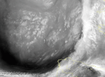
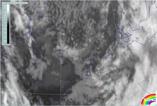
13 January 2008/12.00 UTC - Meteosat 9 WV 6.2 image (zoom)
|
13 January 2008/12.00 UTC - Meteosat 9 WV 6.2 image
|
|
|
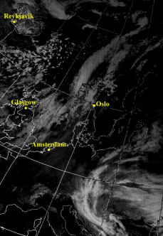
High spatial resolution of 1km in SSP (Sub-Satellite-Point), provided by Meteosat HRVIS images, makes small-scale cloud structures more distinct. In the above images the meso-scale area with cellular cloud clusters is nicely visible.
Typical Developments: From Cb Cluster to EC
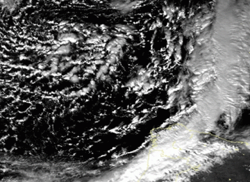
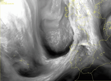
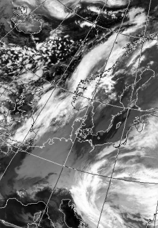
The case of 02 April 2003, below, shows a development over the North Sea immediately east of England over a period of 3 hours. At the beginning (left image, 02.00 UTC) there are only single cells while at 05.00 UTC a more compact area of cells has developed which has all the features of an EC.|
02 April 2003/02.00 UTC - Meteosat IR image
|
02 April 2003/05.00 UTC - Meteosat IR image
|
|
|
Typical Developments: From EC to Comma
The following 3-hourly loop shows the transition of an EC configuration to a Comma feature.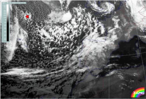
Appearance in Meteosat RGB composite imagery
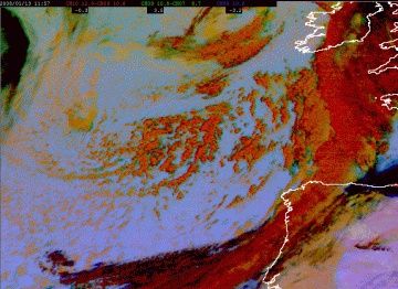
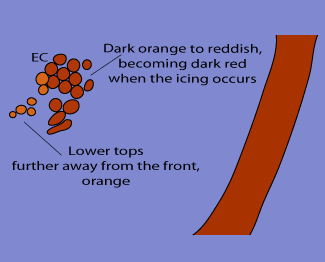
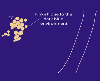
To take into account and combine different types of information retrieved from SEVIRI imagery, such as optical thickness of clouds, particle size and phase, upper and mid level moisture and cloud top temperature, combinations of channels are constructed.As the name itself says, the Dust RGB is more suited for the detection of dust in the atmosphere but it can also be used for convection monitoring. The icing in the clouds makes the cells appear red, so when the clouds change their colours from orange to the reddish ones we can conclude that there is vertical motion going on which is building up cumuli-like clouds.
|
13 January 2008/12.00 UTC -Meteosat 9 Dust RGB image (IR12.0-IR10.8, IR10.8-IR8.7, IR10.8) (zoom)
|
EC as it appears in Dust RGB
|
|
|
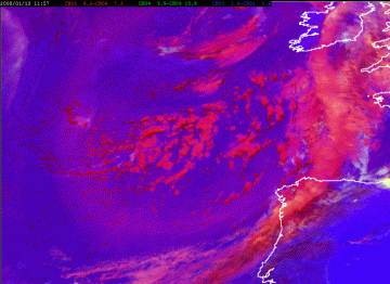
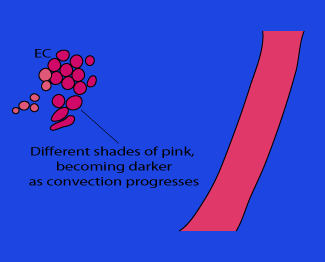
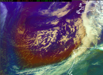
In the Convective Storms RGB shown below ECs appear in different shades of pink. The most striking feature of clouds over the Atlantic is again their cellular shape and three-dimensionality.
|
13 January 2008/12.00 UTC -Meteosat 9 Convective Storms RGB image (WV6.2 -WV7.3, NIR3.9 -IR10.8 and NIR1.6 -VIS0.6) (zoom)
|
EC as it appears in Convective Storms RGB
|
|
|
|
13 January 2008/12.00 UTC -Meteosat 9 Airmass RGB image (WV6.2-WV7.3, IR9.7-IR10.8 and WV6.2i) (zoom)
|
EC as it appears in Airmass RGB
|
|
|
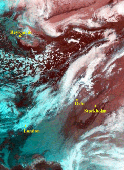
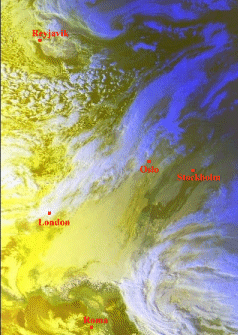
Appearance in AVHRR imagery
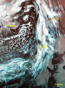
- In the observed areas to the east and southeast of Iceland, AVHRR channel imagery show more detailed structures than Meteosat imagery.
- Comma clouds to the NNE and N. of Iceland (see below) have developed from the Enhanced Cumulus (EC). Note: these areas are too far to the north to be seen by Meteosat.
- RGB-combination of channels (below left, second row) provides a quick overview of high and middle level cloudiness.
- Channel manipulation (third row, right) highlights cloud patterns and physical features.
|
17 February 2000/04.35 UTC - NOAA RGB image (channel 3, 4 and 5)
|
17 February 2000/04.35 UTC - NOAA CH5 image; EC in Atlantic: SE and E. of Iceland (approx. 63N/15W)
|
|
|
|
17 February 2000/04.35 UTC - NOAA RGB image (channel 3, 4 and 5)
|
17 February 2000/04.35 UTC - NOAA RGB image (channel 1, 2 and 4); EC in Atlantic: SE and E. of Iceland (approx.
64N/10W)
|
|
|
|
17 February 2000/04.35 UTC - NOAA CH2 image
|
17 February 2000/04.35 UTC - NOAA CH1 minus CH3B- image; EC in Atlantic: SE and E. of Iceland (approx. 64N/10W)
|
|
|

