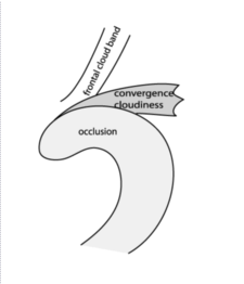
Convergence Cloudiness - Meteorological Physical Background
by ZAMG
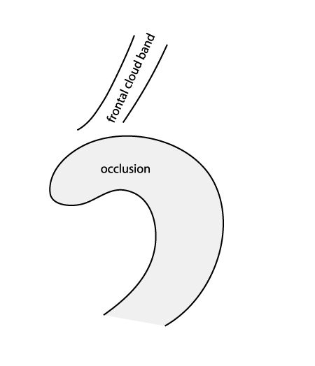
- North of an Occlusion another frontal system is passing by and a zone of confluence is developing
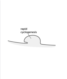
- Associated with Rapid Cyclogenesis (or Cold Conveyor Belt Occlusion): double structure at cloud spiral becoming detached
First Type
|
12 December 2003/00.00 UTC - Meteosat IR image
|
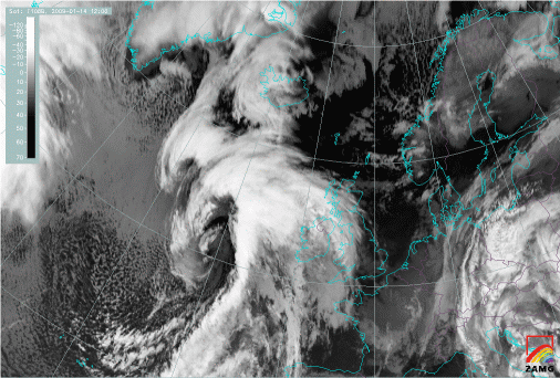
15 January 2009/00.00 UTC - Meteosat 9 IR 10.8 image
|
|
|
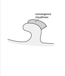
The Convergence Cloud develops in area of confluence of a stream from the north and a stream from the south where the confluence can seen best near the surface. The southerly flow is caused by the rotation of the Occlusion round the surface depression whereas the northerly results from the other system passing by. As a result of these two wind regimes interaction convergence is seen near the surface. A secondary convergence maximum is situated at higher levels, varying from case to case, both in level and in intensity. The relationship of cloud top height with convergence was investigated. It was found that Convergence Cloudiness shows as higher cloudiness if there is a thick layer of upper tropospheric convergence OR if the convergence in low levels is very distinct. Both convergence maxima conribute to the development of cloudiness.
Second Type
|
|
|
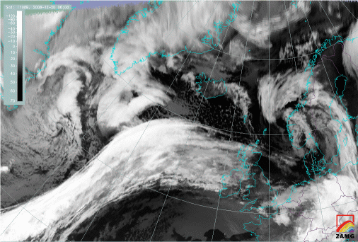
20 December 2008/06.00 UTC - Meteosat 9 IR10.8 image
|
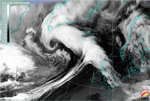
20 December 2008/18.00 UTC - Meteosat 9 IR10.8 image
|
|
|
|
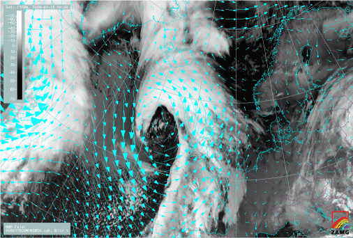
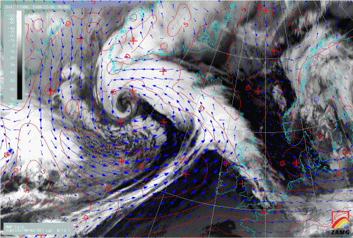
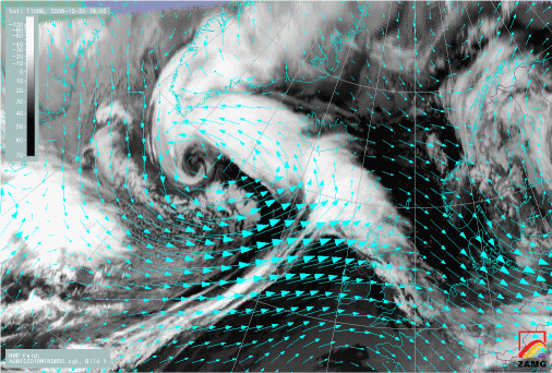
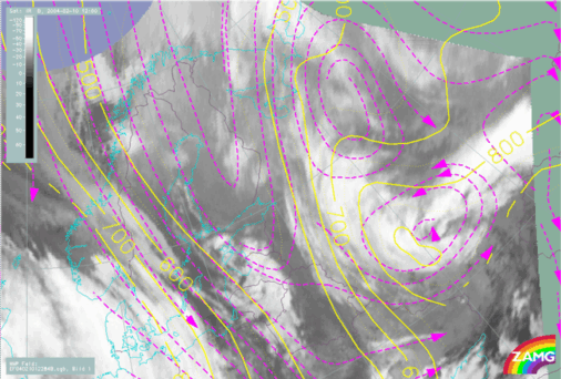
20 December 2008/18.00 UTC - Meteosat 9 IR10.8 image; magenta: wind (blue) and isotachs (red) 1000 hPa
|
20 December 2008/18.00 UTC - Meteosat 9 IR10.8 image; cyan: wind 850 hPa
|
|
|
|
|
|
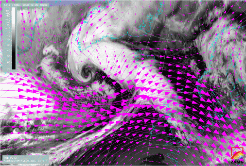
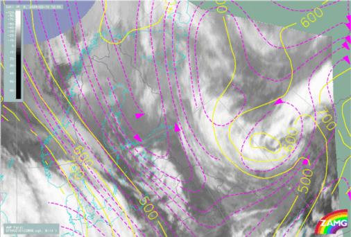
20 December 2008/18.00 UTC - Meteosat 9 IR10.8 image; magenta: wind 500 hPa
|
- The Convergence Cloud has a different velocity which is an indication that it should be treated as a separate CM. In most cases the displacement is less than that of the whole cloud spiral
- In the majority of cases an isolated cyclonic circulation could be found
- This circulation is more pronounced at upper levels
- The convergence cloudiness lies within (slight) upward motion
|
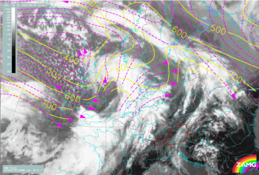
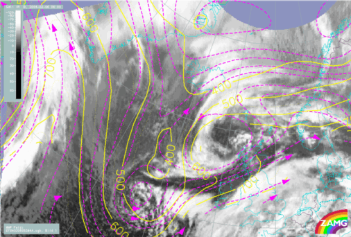
19 March 2004/12.00 UTC - Meteosat IR image; magenta: relative streams 298K, yellow: isobars 298K
|
|
|
|
|

|
|
06 February 2004/12.00 UTC - Meteosat IR image; magenta: relative streams 294K, yellow: isobars 294K
|
06 February 2004/06.00 UTC - Meteosat IR image; magenta: relative streams 298K, yellow: isobars 298K
|
|
10 February 2004/12.00 UTC - Meteosat IR image; magenta: relative streams 284K, yellow: isobars 284K
|
10 February 2004/12.00 UTC - Meteosat IR image; magenta: relative streams 288K, yellow: isobars 288K
|
|
|
Is Convergence Cloudiness a special type of Warm Front?
Indeed, there are many common features between Warm Fronts and this type of Convergence Cloudiness, as seen in numerical parameter fields and satellite imagery. The main difference is the formation: According to the polar front theory a baroclinic zone at the transition between warmer and colder air masses forms a Wave which then leads to cyclogenesis. The Occlusion develops after the Warm Front. In the case of the Convergence Cloudiness the Occlusion cloud spiral is already well developed and then the convergence shield forms.


