Coastal Convergence - Cloud Structure In Satellite Images
by FMI
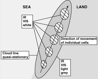
- Coastal Convergence clouds generally appear as of elongated, relatively narrow cloud lines or bands oriented approximately parallel to the coastline.
- Cloud lines can be located either slightly offshore or onshore depending on the wind flow across the coastline.
- Cloud lines are mostly convective in nature, with individual cells often travelling along the coast with the gradient wind, but the whole cloud band appears quasi-stationary for a relatively long period of time.
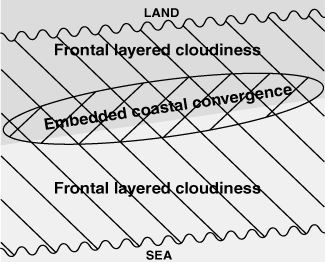
- The enhacement of cloudiness by Coastal Convergence may at times be difficult to detect if embedded in larger-scale frontal cloud systems.
|
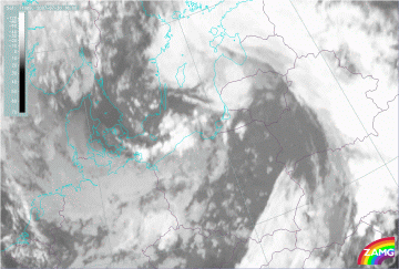
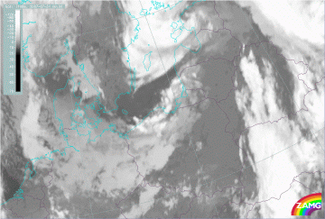
30 July 2007/18.00 UTC - Meteosat 9 IR10.8 image
|
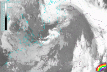
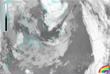
30 July 2007/21.00 UTC - Meteosat 9 IR10.8 image
|
|
|
|
|
|
31 July 2007/00.00 UTC - Meteosat 9 IR10.8 image
|
31 July 2007/03.00 UTC - Meteosat 9 IR10.8 image
|

