Coastal Convergence - Key Parameters
by FMI
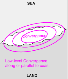
- Low-level divergence/convergence:
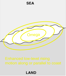
Convergence in the lowest layers in the atmosphere along or parallel to the coast. - Low-level omega:
Rising motion at lower troposphere along or parallel to the coastline. - Angle of geostrophic wind with the coastline:
Onshore wind having a relatively small angle with coastline, the lower pressure being on sea, higher pressure over land. - Accumulated precipitation:
Signs of enhanced accumulated precipitation within the next 6-24 hours along or parallel to the coastline indicative of coastal effects.
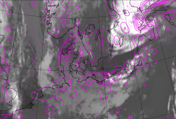
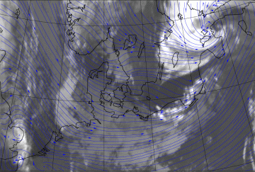
Low-level divergence/convergence
|
31 July 2007/00.00 UTC - Meteosat 9 IR 10.8 image; magenta: divergence 1000 hPa
|
|
|
|
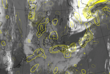
Low-level omega
|
31 July 2007/00.00 UTC - Meteosat 9 IR 10.8 image; yellow: omega 925 hPa
|
|
|
|
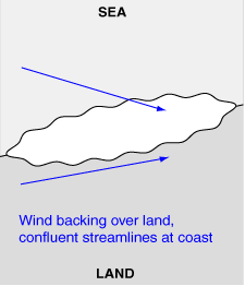
Angle of geostrophic wind with the coastline
|
31 July 2007/00.00 UTC - Meteosat 9 IR 10.8 image; blue arrows: 10-metre-wind streamlines
|
|
|
|
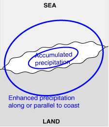
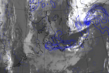
Accumulated precipitation
|
31 July 2007/00.00 UTC - Meteosat 9 IR 10.8 image; blue: accumulated 12 hour total precipitation (30 July 12 UTC - 31 July 00 UTC)
|
|
|
|


