Cloud Streets - Cloud Structure In Satellite Images
by KNMI
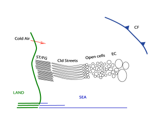
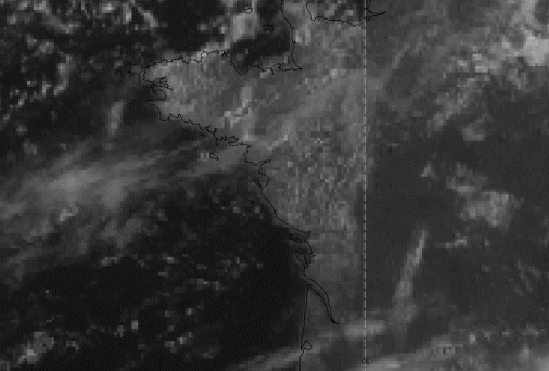
A distinct life-cycle can be seen from Stratus/Sea-Fog to Cloud Streets, especially over sea surfaces during Cold Air Outbreaks from neighbouring continents, most frequently ending up as Open Cells.
|
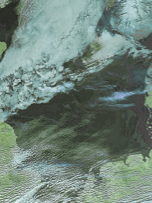
24 February 2004/12.00 UTC - Meteosat Hires VIS image
|
|
|
|
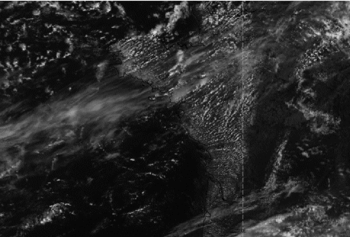
- Cloud Streets can be detected in Meteosat7 VIS imagery, but because of the rather course resolution, the detailed structure isn't easily seen. In Meteosat 7 IR imagery Cloud Streets can’t be easily seen because the convection is limited to the lower levels of the troposphere. In Meteosat WV imagery Cloud Streets cannot be seen at all, again because of the latter reason. In Meteosat 8 HiresVIS imagery they can clearly be seen as parallel white cloudbands, because of the better resolution of this new imagery
|
23 August 2004/11.00 UTC - Meteosat VIS
|
23 August 2004/11.00 UTC - Meteosat Hires VIS
|
|

|
|
|
|
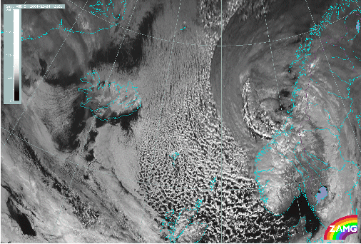
23 August 2004/11.00 UTC - NOAA Ch1 image
|
|
Appearance in AVHRR images:
- In the CH1,2-VIS and RGB the detailed structure of the Cloud Streets over The Netherlands and England can be observed well.
19 February 2004/12.29 UTC - NOAA RGB image