Split Front - Cloud Structure In Satellite Images
by ZAMG and FMI
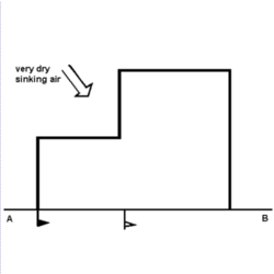
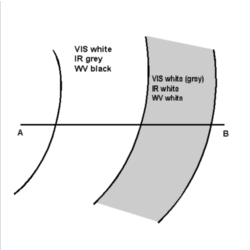
- In the thick cloud band at the leading part of the Split Front VIS signals are white to grey, IR and WV signals are white, representing a thick, multilayered cloud band;
- In the low cloud band at the rear part of the Split Front VIS signals are white, IR signals are dark grey to grey and WV signals are either black (if one is using the Meteosat 8 WV 6.2 µm , which shows higher level water vapour) representing a low cloud band with very dry air above or fairly white/light grey if the Meteosat 8 WV 7.3 µm representing the lower atmosphere is used;
- In the ideal case the boundary between both cloud bands is marked by a sharp gradient of IR and WV pixel values. In reality only a gradual change of IR and WV grey shades exists;
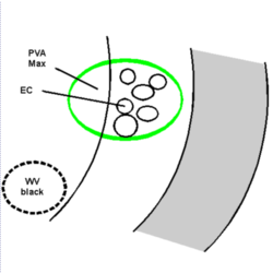
- Some features of a life cycle can be observed:
- often EC shaped cellular cloudiness develops within and above the low cloud band on the cyclonic side of the jet axis;
- in the WV imagery a black area sometimes develops on the anticyclonic part of the jet axis over the low cloud band of the front, indicating sinking dry air connected with relative streams (see Meteorological physical background);
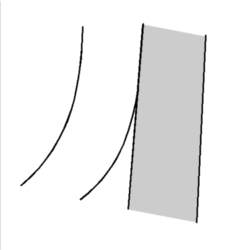
- in a multilayered leading cloud band the higher cloud fibres are shifted downstream and the high and low cloud bands become decoupled.
|
|
|
|
|
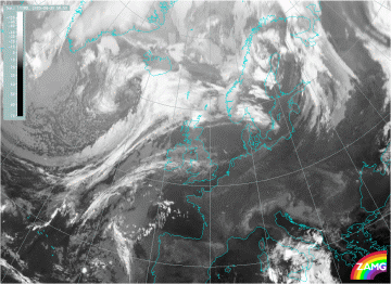
30 August 2005/06.00 UTC - Meteosat 8 IR 10.8 image
|
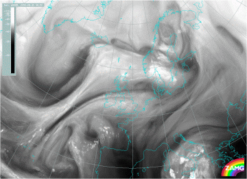
30 August 2005/06.00 UTC - Meteosat 8 WV 6.2 image
|
|
|
|
|
|
30 August 2005/06.00 UTC - Meteosat 8 VIS 0.8 image
|
The long rear cloud band, with warm tops, can be seen from 32W/46N to 20W/57N. The jet axis is indicated in the WV image by the two dark lines behind the front. In this case the jet axis is almost perpendicular to the front. The convective cloudiness in the rear cloud band on the cyclonic side of the jet or within the jet is not very striking (but it is there!), but there is dry sinking air above the rear cloud band on the anticyclonic side of the jet.
Surface and upper level fronts are in accordance with the schematic, as shown in the vertical cross section described in more detail later on.

