Cold Front In Cold Advection - Meteorological Physical Background
by ZAMG and FMI
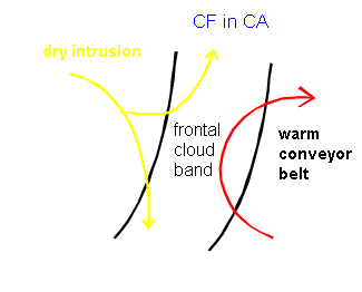
In the summer the CF in CA´s may be accompanied by MCS development on the leading edge of the cloud band (see Convective Cloud Features in Typical Synoptic Environments: At the Leading Edge of Frontal Cloud Bands ). This is due to the unstable stratification caused by the warm conveyor belt below and cold dry intrusion above. This development occurs regularly in the area of northern Adriatic Sea, where the topography is further contributing to the instability.
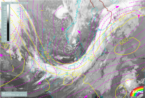
On the 3rd of September 2007 at 00 UTC there is a Cold Front in Cold Advection reaching from Southern Sweden to the English Channel. The relative streams at 316 K show a dry intrusion coming from the cold, dry northern air and splitting over the frontal cloudiness into two branches: one is turning to follow the cloud band towards the northeast, while the other turns to southwest while sinking.