Cumulonimbus Cluster - Typical Appearance In Vertical Cross Sections
by KNMI and DHMZ
|
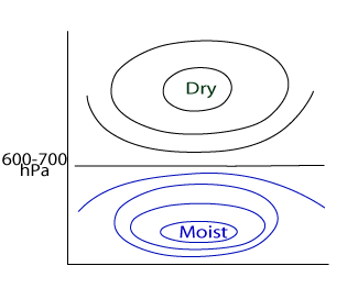
Vertical distribution of humidity in the environment favourable for development of convection
|
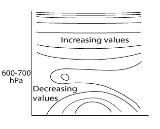
Vertical distribution of (equi)potential temperature in time or space vertical cross sections in the environment favourable for development of
convection
|
|
|
Stability can change with additional ground heating, hence convection happens more often in summer situations. Furthermore, vertical motion can be enhanced in vicinity of the mountain chains. All of this explains why the Southeastern Europe with combination of the Mediterranean water pool and Dinaric Alps is a preferable area for convective developments.
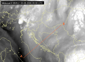
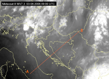
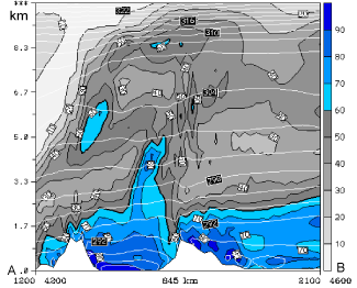
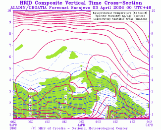
The WV images show the initial stage of convective development in the prefrontal spring situation in the region of Dinaric Alps, a grey to dark grey area in which the first white Cb spots are visible. The ALADIN model forecast vertical cross section shows a very moist layer below approximately 2km and very dry air aloft. In the ALADIN HRID time cross section made for Sarajevo (43.82N, 18.33E) the convectively unstable lower atmosphere is indicated. The equipotential temperature is decreasing with height up to 3km of height, where the closed isolines are found.
|
03 April 2006/09.00 UTC - Meteosat 8 WV 6.2 image; position of vertical cross section indicated
|
03 April 2006/09.00 UTC - Meteosat 8 WV 7.3 image; position of vertical cross section indicated
|
|
|
|
|
|
03 April 2006/09.00 UTC - ALADIN model vertical cross section; blue and grey, shaded: relative humidity (%), white isolines: isentropes (K)
|
03 - 04 April 2006 - ALADIN HRID vertical time cross section; magenta: equipotential temperature (K), green shaded: convectively unstable areas
|
|
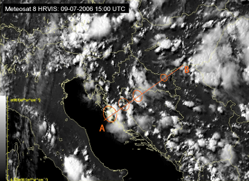
09 July 2006/15.00 UTC - Meteosat 8 HRVIS image; position of vertical cross section and convergence areas indicated
|
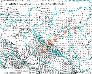
09 July 2006/15.00 UTC - ALADIN model 10m wind (m/s); convergence areas indicated
|
|
|
|
|
|
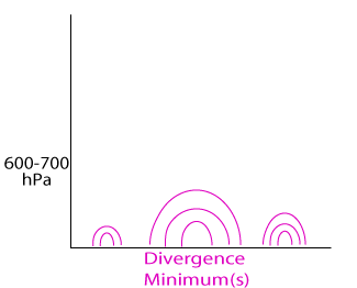
Vertical distribution of divergence in the environment favourable for development of convection, Minimums indicating the areas of high
convergence
|
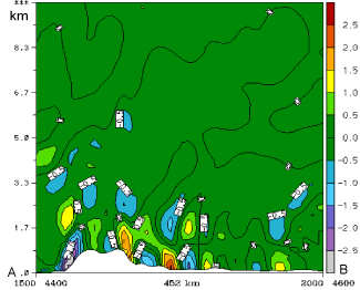
09 July 2006/15.00 UTC - ALADIN model vertical cross section; shaded: divergence (10-5 s-1)
|


