Occlusion: Cold Conveyor Belt Type - Cloud Structure In Satellite Images
by ZAMG and KNMI
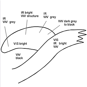
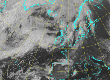
In a fully developed stage the satellite image shows two synoptic scale cloud bands:
- a multilayered frontal cloud band of a Cold Front
- a lower cloud spiral which seems to penetrate from below the higher cloud band
- both cloud bands seem to be uncoupled
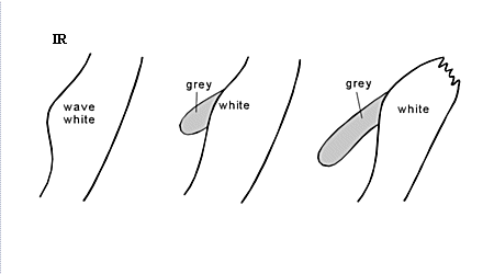
- In the VIS image the cloud spiral is white indicating deep cloudiness with high albedo.
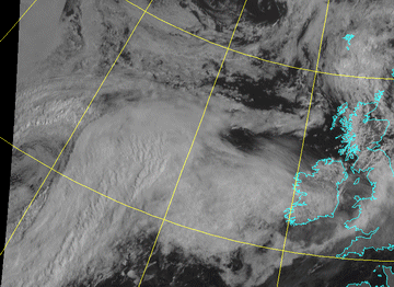
- In the IR image the grey shades of a cold conveyor belt cloud band are spoken rather grey but with some
increased white areas superimposed. The following points can be summarized:
- At the transition between the cloud band of the Cold and Warm Front (oriented south-west to north-east) and the cloudiness of the cold conveyor belt type, a distinct gradient from white to (dark) grey can be observed. After some distance from the transition zone often cloud tops gradually become higher (whiter) followed again by a decrease of cloud tops within the innermost part of the cloud spiral. Such a cloud structure can be explained quite well with the conveyor belt theory (see Meteorological physical background ).
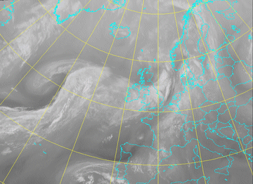
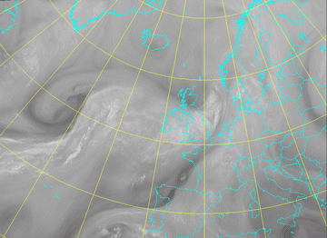
- During the later stages of development, also high cloudiness can develop leading to a similar appearance to the Warm Conveyor Belt type of the Occlusion (see Meteorological physical background ).
- In the WV image the two cloud bands with different cloud types are seen even more distinctly. A black stripe characterizing the dry air on the cyclonic side of the jet axis extends parallel to the higher cloud band and crosses the cold conveyor belt cloudiness immediately at the transition zone. This effect cannot be detected in the case of an Occlusion of the Warm Conveyor Belt type. The driest air represented by very black pixel values is included in the spiral development. This fact can be observed in both types of Occlusion (see Occlusion: Warm Conveyor Belt Type ). During the later stages of development high and bright pixel values can be observed within the whole area of the cloud spiral which means that the crossing black stripe vanishes.
|
21 June 2005/09.00 UTC - Meteosat 8 IR 10.8 image
|
21 June 2005/09.00 UTC - Meteosat 8 IR 3.9 image
|
|
|
|
|
|
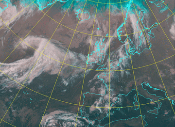
21 June 2005/09.00 UTC - Meteosat 8 Vis 0.6 image
|
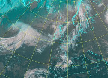
21 June 2005/09.00 UTC - Meteosat 8 HRVIS image
|
|
21 June 2005/09.00 UTC - Meteosat 8 WV 7.3 image
|
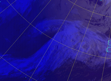
21 June 2005/09.00 UTC - Meteosat 8 WV 6.2 image
|
|
|
The IR-images (10.8 and both 3.9 µm) show quite clear the lower temperature of the Cold Conveyor Belt clouds.
In the visible images (Highres Vis and 0.6 µm) the shadows of the Warm and Cold Front clouds on the Occlusion clouds are quite pronounced.
The WV-images (7.3 and 6.2 µm) show a small dark stripe as separation of the Warm and Cold Front cloudiness and the Occlusion.
|
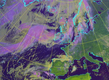
21 June 2005/00.00 UTC - Meteosat 8 RGB image (3.9, 10.8 and 12.0)
|
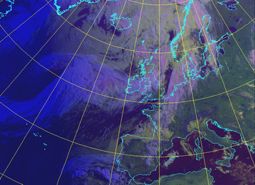
21 June 2005/09.00 UTC - Meteosat 8 RGB image (0.6, 1.6 and 10.8)
|
|
|

|
|
|
21 June 2005/09.00 UTC - Meteosat 8 RGB image (0.6, 0.8 and 10.8)
|
During nighttime the RGB-image, RGB 3.9 - 10.8 - 12.0 µm will enhance the difference between low warm clouds (brownish) and the high cold cloudiness (whitish).
The daytime RGB-image, RGB 0.6 - 1.6 - 10.8 µm, shows especially the different water and ice clouds (yellow and pink).
The daytime RGB-image, RGB 0.6 - 0.8 - 10.8 µm, enhances the contrast between the low (yellow) and the high cold clouds (bluish white).
|
20 June 2005 22.00 UTC - Meteosat 8 RGB image (3.9, 10.8 and 12.0)
|
21 June 2005 06.00 UTC - Meteosat 8 RGB image (0.6, 1.6 and 10.8)
|
|
|
|
21 June 2005 06.00 UTC - Meteosat 8 RGB image (0.6, 0.8 and 10.8)
|
|
|

