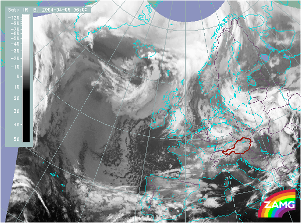
Does this actual case reflect the conceptual model well? Compare the ideal configuration!
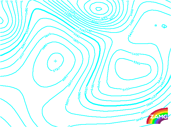
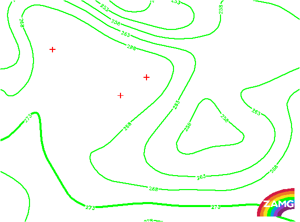
Height contours 500 hPa:
The height field at 500 hPa shows a pronounced ridge from the Atlantic to the Norwegian coast. The cloud of the Detached Warm Front is in the north-south oriented branch. This is the typical configuration which is expected in the case of a Detached Warm Front.
The height field at 500 hPa shows a pronounced ridge from the Atlantic to the Norwegian coast. The cloud of the Detached Warm Front is in the north-south oriented branch. This is the typical configuration which is expected in the case of a Detached Warm Front.
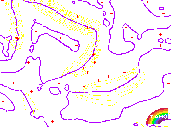
Isotachs 300 hPa:
There is a pronounced jet streak at the eastern border (the leading edge) of the Detached Warm Front cloud. This is the ideal configuration for a Detached Warm Front.
There is a pronounced jet streak at the eastern border (the leading edge) of the Detached Warm Front cloud. This is the ideal configuration for a Detached Warm Front.
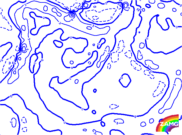
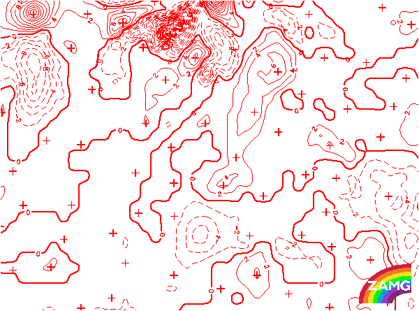
TFP:
The TFP shows a distinct branch on the western border (the rear edge) of the Detached Warm Front cloud. This is the ideal configuration for a Detached Warm Front. However, the TFP is shifted a bit too far to the west; there is low level cloud in this area reaching even more to the West. It is possible that this system has a frontal character and influences the location of the TFP.
The TFP shows a distinct branch on the western border (the rear edge) of the Detached Warm Front cloud. This is the ideal configuration for a Detached Warm Front. However, the TFP is shifted a bit too far to the west; there is low level cloud in this area reaching even more to the West. It is possible that this system has a frontal character and influences the location of the TFP.
Equivalent Thickness:
The equivalent thickness is very similar as the upper level height. There is a huge ridge area from the Atlantic to the Norwegian Sea and a north-south oriented zone of high gradients from N to S (NE to SW). The cloud of the Detached Warm Front is located in this branch and this is very typical for this conceptual model.
The equivalent thickness is very similar as the upper level height. There is a huge ridge area from the Atlantic to the Norwegian Sea and a north-south oriented zone of high gradients from N to S (NE to SW). The cloud of the Detached Warm Front is located in this branch and this is very typical for this conceptual model.
Temperature Advection 700 hPa:
The field of TA shows several maxima from N to S: over the Norwegian Sea which is connected to a classical Warm Front, over Scotland and over SW. England which is connected to the cloud of the Detached Warm Front. This is in agreement with the classical ideas of this Conceptual Model. The only deviation is that the WA maximum is shifted a bit to the west; an effect which is also observed in the TFP.
The field of TA shows several maxima from N to S: over the Norwegian Sea which is connected to a classical Warm Front, over Scotland and over SW. England which is connected to the cloud of the Detached Warm Front. This is in agreement with the classical ideas of this Conceptual Model. The only deviation is that the WA maximum is shifted a bit to the west; an effect which is also observed in the TFP.