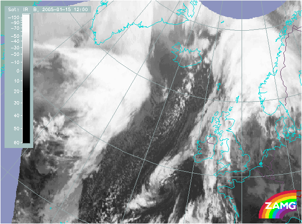
Does this actual case reflect the conceptual model well? Compare the ideal configuration!
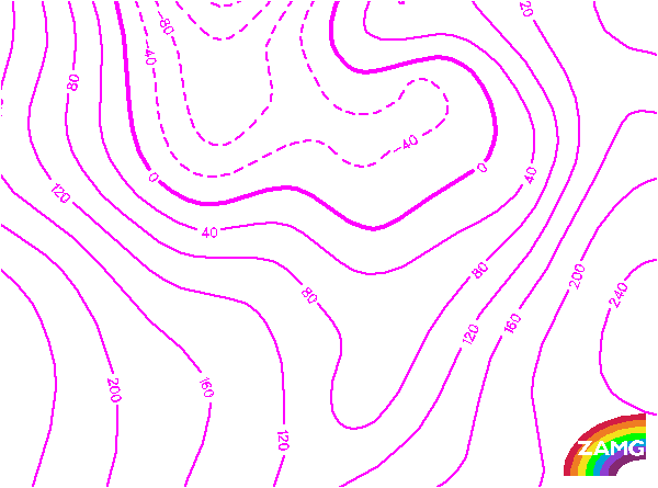
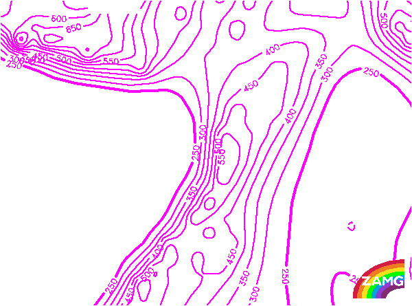
Height Contours 1000 hPa:
The cloud bulge of the Wave east of Iceland lies within an area of a secondary low close to the surface. Although the minimum of height can be found more in the cold air, behind the frontal cloud, it is not related to the cloud bulge and the location is not in agreement with the concept of a Wave.
The cloud bulge of the Wave east of Iceland lies within an area of a secondary low close to the surface. Although the minimum of height can be found more in the cold air, behind the frontal cloud, it is not related to the cloud bulge and the location is not in agreement with the concept of a Wave.
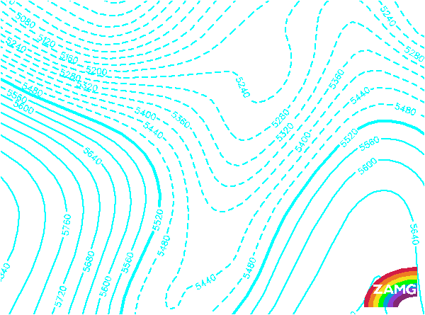
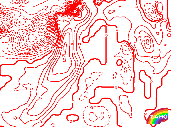
Height contours 500 hPa:
The upper level height shows a very pronounced trough in the cold air behind the frontal cloud band. There is no indication of the Wave. But there is no important deviation from the ideal image of this conceptual model.
The upper level height shows a very pronounced trough in the cold air behind the frontal cloud band. There is no indication of the Wave. But there is no important deviation from the ideal image of this conceptual model.
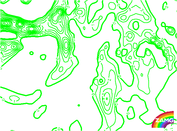
PVA 500 hPa:
There is an extended area of PVA which fits quite well to the upper level height filed. There is a mesoscale PVA maximum nearly within the area of the cloud bulge of the Wave. Although the distribution of isolines is not so striking, the relation between cloud feature and PVA maxima is in agreement with the ideal configuration.
There is an extended area of PVA which fits quite well to the upper level height filed. There is a mesoscale PVA maximum nearly within the area of the cloud bulge of the Wave. Although the distribution of isolines is not so striking, the relation between cloud feature and PVA maxima is in agreement with the ideal configuration.
Height of PV:
The lowest height of PV=2 units corresponding to the height of tropopause is at 550 hPa and behind the frontal system in the the coldest air. Within the frontal cloud band a high gradient of these isolines can be detected and even a small scale trough at the southern part of the cloud bulge of the Wave. This reflects the typical situation at a Wave quite well.
The lowest height of PV=2 units corresponding to the height of tropopause is at 550 hPa and behind the frontal system in the the coldest air. Within the frontal cloud band a high gradient of these isolines can be detected and even a small scale trough at the southern part of the cloud bulge of the Wave. This reflects the typical situation at a Wave quite well.
Temperature Advection 700 hPa:
This parameter reflects well the situation necessary for Wave developement. There is the zeroline of TA crossing the cloud bulge and pronounced centers of WA and CA side by side. This parameters best fulfills the ideal configuration.
This parameter reflects well the situation necessary for Wave developement. There is the zeroline of TA crossing the cloud bulge and pronounced centers of WA and CA side by side. This parameters best fulfills the ideal configuration.