Does this actual case reflect the conceptual model well? Compare the ideal configuration!

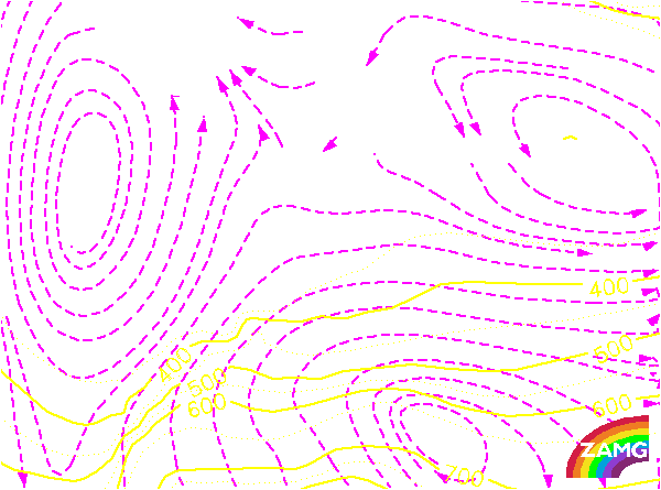
Height Contours 500 hPa:
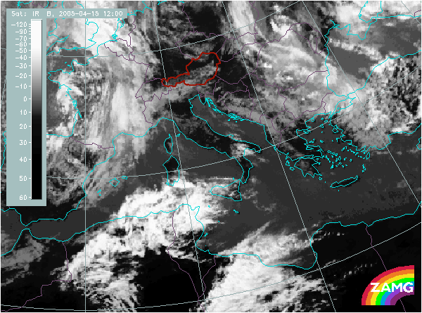
The two cloud fields over Africa which appear as Warm Conveyor Belt cloudiness ahead of the Cold Front cloud over France and E. Spain, appear within a Southwesterly stream forming an upper level ridge. This is typical for this conceptual model.
The two cloud fields over Africa which appear as Warm Conveyor Belt cloudiness ahead of the Cold Front cloud over France and E. Spain, appear within a Southwesterly stream forming an upper level ridge. This is typical for this conceptual model.
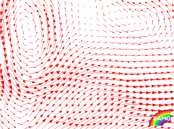
Wind Vectors 500 hPa:
The orientation of the wind vectors is very similar to the upper level height field and the vectors are parallel to the Warm Conveyor Belt cloud features. This conforms well to the conceptual model.
The orientation of the wind vectors is very similar to the upper level height field and the vectors are parallel to the Warm Conveyor Belt cloud features. This conforms well to the conceptual model.
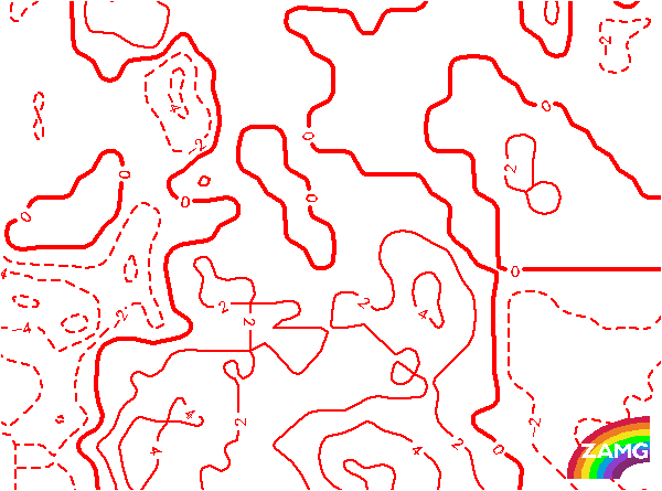
Temperature Advection 700 hPa:
The Warm Conveyor Belt cloud bands are within a field of intensive warm advection. This field shows a typical double structure with two maxima of WA coinciding with the two cloud bands of the Warm Conveyor Belt. Whilst the two maxima are a speciality of this case, they might also account for the double structure in the cloud bands.
The Warm Conveyor Belt cloud bands are within a field of intensive warm advection. This field shows a typical double structure with two maxima of WA coinciding with the two cloud bands of the Warm Conveyor Belt. Whilst the two maxima are a speciality of this case, they might also account for the double structure in the cloud bands.
Relative Streams:
Relative streams at 318 K; system velocity: direction: 269; speed:10m/s.
The relative streams show a rising warm conveyor belt in the area of the two cloud bands. They rise from about 800 - 700 hPa up to about 500 - 400 hPa. This is in good agreement with the ideal situation. There is an upper relative stream in the whole area of the Cold Front cloud band.