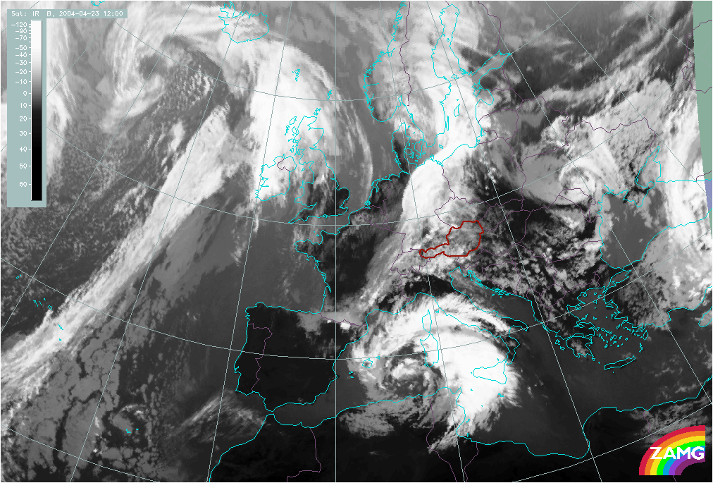
Where can you identify an Upper Level Low in the following image? Click on the area of an Upper Level Low.
Back to Cloud Structure in Satellite Images