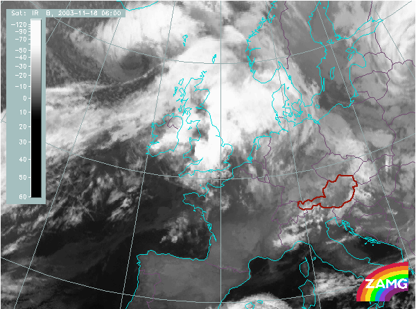
Does this actual case reflect the conceptual model well? Compare the ideal configuration!
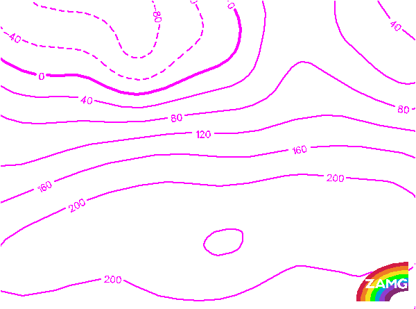
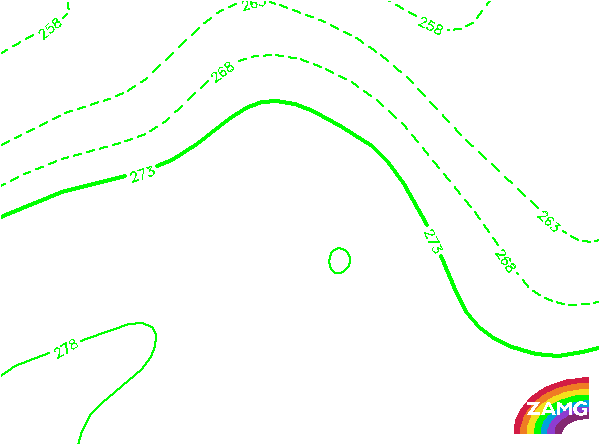
Height Contours 1000 hPa:
In this case, a rather small scale trough indicates the position of the Cold Front and there are mostly W-E orientated isolines in the area of the thickness ridge. Only in the southermost part, to the south of, and over Ireland, a small ridge can be detected. So this parameter is not such a good indicator for this case.
In this case, a rather small scale trough indicates the position of the Cold Front and there are mostly W-E orientated isolines in the area of the thickness ridge. Only in the southermost part, to the south of, and over Ireland, a small ridge can be detected. So this parameter is not such a good indicator for this case.
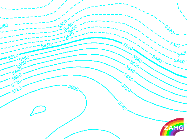
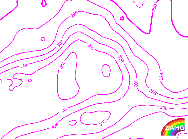
Height contours 500 hPa:
This upper level height field clearly indicates the SW stream over the frontal cloud band and a well developed ridge in the warm sector and the Thickness Ridge Cloud. This is very typical for an ideal case.
This upper level height field clearly indicates the SW stream over the frontal cloud band and a well developed ridge in the warm sector and the Thickness Ridge Cloud. This is very typical for an ideal case.
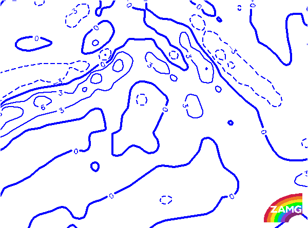
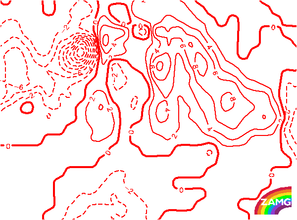
TFP:
The TFP clearly follows the Cold Front and Warm Front cloud bands. In the area of the Warm Front a double structure of the TFP can be seen which is a speciality of this case. No TFP exists in the area of the Thickness Ridge Cloudiness over Ireland and England, which is tyical for this conceptual model.
The TFP clearly follows the Cold Front and Warm Front cloud bands. In the area of the Warm Front a double structure of the TFP can be seen which is a speciality of this case. No TFP exists in the area of the Thickness Ridge Cloudiness over Ireland and England, which is tyical for this conceptual model.
Equivalent Thickness:
The distribution of this parameter shows zones of high gradient typical for fronts and a huge extended thickness ridge. The Thickness Ridge Cloudiness is situated in the center of this ridge which conforms with the ideal conceptual model.
The distribution of this parameter shows zones of high gradient typical for fronts and a huge extended thickness ridge. The Thickness Ridge Cloudiness is situated in the center of this ridge which conforms with the ideal conceptual model.
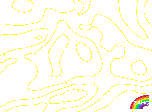
Temperature Advection 700 hPa:
There is an extended area with WA in the cloud band of the Warm Front as well as in the Thickness Ridge Cloudiness. This is very much in agreement with the typical distribution of this parameter in this conceptual model.
There is an extended area with WA in the cloud band of the Warm Front as well as in the Thickness Ridge Cloudiness. This is very much in agreement with the typical distribution of this parameter in this conceptual model.
Showalter Index:
Although this is a November case, the Showalter index shows unstable values exactly in the area of the Thickness Ridge Cloudiness. Values below 3 units are typical for showers and (according to the season) even for thunderstorms, and conform well with this conceptual model.
Although this is a November case, the Showalter index shows unstable values exactly in the area of the Thickness Ridge Cloudiness. Values below 3 units are typical for showers and (according to the season) even for thunderstorms, and conform well with this conceptual model.
ΘE:
This field shows an intensive ridge in the area of the Thickness Ridge Cloudiness representing the warm air there. This is as expected for this conceptual model.
This field shows an intensive ridge in the area of the Thickness Ridge Cloudiness representing the warm air there. This is as expected for this conceptual model.