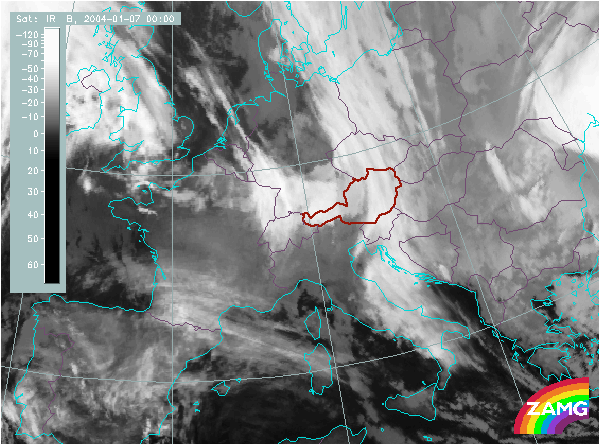
Does this actual case reflect the conceptual model well? Compare the ideal configuration!
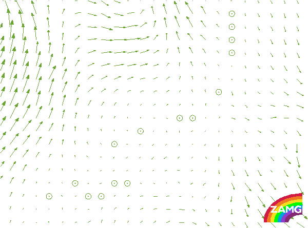

Wind Vectors 1000 hPa:
Winds at the surface are very slow, in advance of the frontal cloud band even calm. This is typical for Front Decoupling and fits well to the theory of the conceptual model.
Winds at the surface are very slow, in advance of the frontal cloud band even calm. This is typical for Front Decoupling and fits well to the theory of the conceptual model.
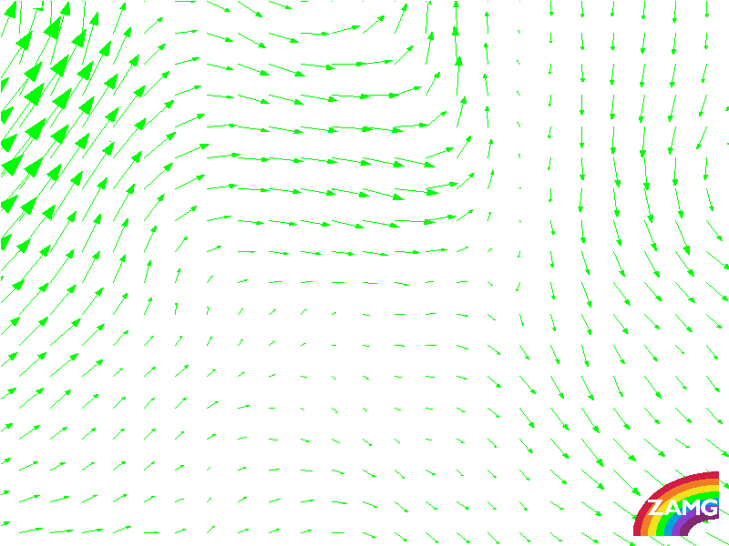
Wind Vectors 850 hPa:
Winds at 850 hPa show a very similar pattern like that of the surface winds: very slow wind speeds. The difference to the wind field of 700 hPa is much more signifant, this is usual for Front Decoupling.
Winds at 850 hPa show a very similar pattern like that of the surface winds: very slow wind speeds. The difference to the wind field of 700 hPa is much more signifant, this is usual for Front Decoupling.
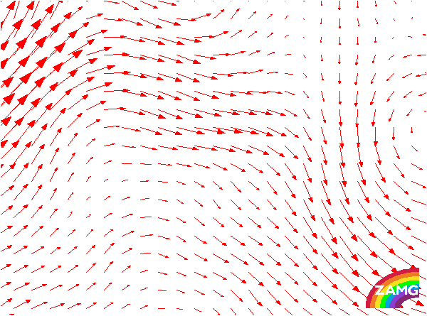
Wind Vectors 700 hPa:
The most important feature of wind at that level are the northerly components. Wind speed has increased and a shear in direction (in relation to wind at 850 hPa) can be seen. In case of a Front Delay the wind would have southerly components.
The most important feature of wind at that level are the northerly components. Wind speed has increased and a shear in direction (in relation to wind at 850 hPa) can be seen. In case of a Front Delay the wind would have southerly components.
TFP:
The maximum of TFP corresponds with the frontal cloud band. More to the south TFP is weaker than in the northern part. TFP does not reveal the Front Decoupling.
The maximum of TFP corresponds with the frontal cloud band. More to the south TFP is weaker than in the northern part. TFP does not reveal the Front Decoupling.
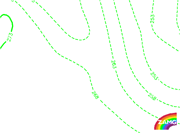
Equivalent Thickness:
The isolines of equivalent thickness is somewhat untypical: the gradient is found in advance of the frontal cloudband whereas usually it is situated above the frontal cloud band.
The isolines of equivalent thickness is somewhat untypical: the gradient is found in advance of the frontal cloudband whereas usually it is situated above the frontal cloud band.
Showalter Index:
The values in this example are high, indicating a very stable troposphere. A stable stratifcation is necessary for the development of Front Decoupling, in this example it is even more than average.
The values in this example are high, indicating a very stable troposphere. A stable stratifcation is necessary for the development of Front Decoupling, in this example it is even more than average.