Hail Catastrophe 04 July 2003 - Development of a Mesoscale Convective System
by DHMZ
|
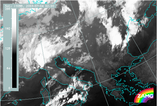
04 July 2003/02.15 - Meteosat 8 (MSG) IR image (10.8 µm)
|
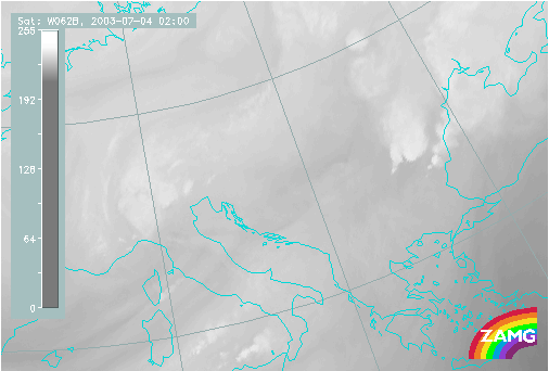
04 July 2003/02.00 - Meteosat 8 WV images (6.2 µm)
|
|
|
|

|
|
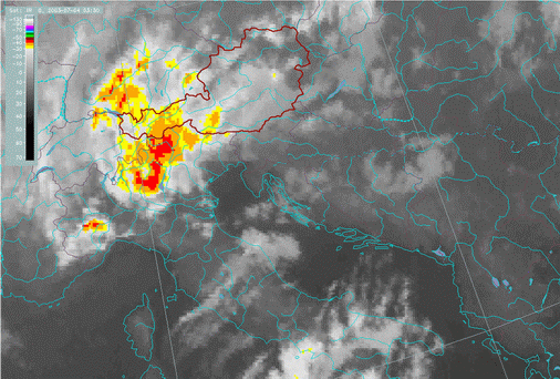
04 July 2003/03.30 - Meteosat IR enhanced image
|
04 July 2003/ 04.00 - Meteosat 8 RGB composite HRVIS-HRVIS-10.8
|
The development of the system started with a small cell in the Adriatic, moving towards the Croatian coast. The
triggering of the strongest convection seems to have taken place between 05.00 and 05.30 UTC, to the right of the initial
cell. At 05:00 there was a line of small cells over the island of Dugi Otok, spreading towards the mainland. At 05.15 the cell over the island is starting to grow while at 05.30 it is already a well defined convective system with overshooting tops and an elongated shadow showing its huge vertical size. Over the next 30 minutes the cell developed rapidly and SYNOP stations in its vicinity already reported thunder and hail. In the 06.00 UTC image the overshooting tops as well as the cirrus anvil are clearly seen. In channel 3.9 µm imagery ice clouds are darker then dense water clouds, and the cirrus anvil above the cell is easily seen. In the image at 07.45 UTC, a plume over the anvil can also be detected. There is also a tail-like line of low clouds that can be seen in all images after 07.15. This marks the outflow boundary from the convective system.
At the same time, convective development took place in the region of the Eastern Alps and western Croatia. That area was in the region of strong PVA, in the left exit region of a jet streak (see Initial Weather Situation).


