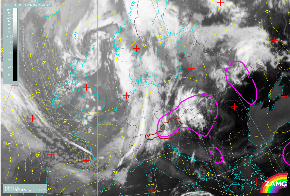
Hail Catastrophe 13 May 2003 - Initial weather situation: 13 May 06.00 UTC
by ZAMG
|
13 May 2003/06.00 UTC - Meteosat IR image
|
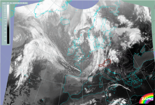
13 May 2003/06.00 UTC - Meteosat IR image; SatRep overlay: names of conceptual models
|
|
|
|
|
|
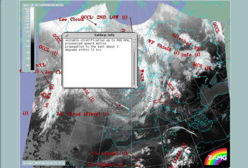
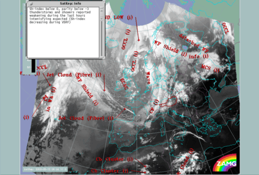
13 May 2003/06.00 UTC - Meteosat IR image; SatRep overlay: names of conceptual models; The window in the upper
left corner shows the additional information the meteorologists has written for the Cold Front situated above
western Europe.
|
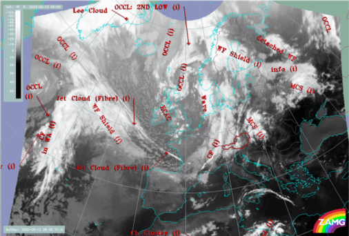
13 May 2003/06.00 UTC - Meteosat IR image; SatRep overlay: names of conceptual models; The window in the upper
left corner shows the additional information the meteorologists has written for the MCS situated over Poland -
Slovakia.
|
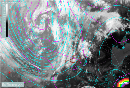
13 May 2003/06.00 UTC - Meteosat IR image; red: height contours 1000 hPa, green: height contours 500 hPa
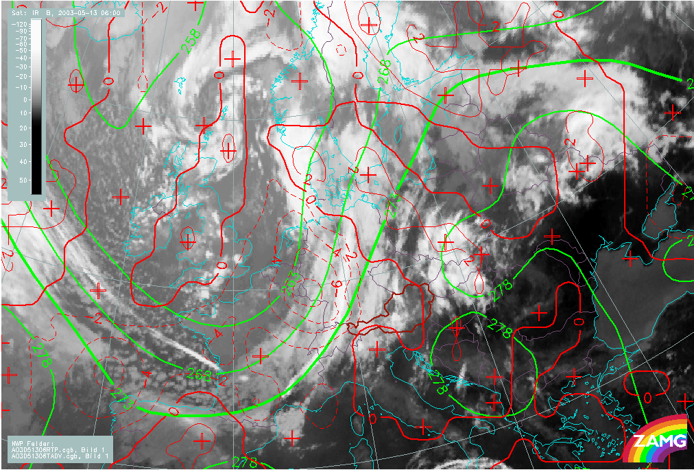
13 May 2003/06.00 UTC - Meteosat IR image; red: temperature advection 700 hPa, green: equivalent thickness,
blue: TFP
13 May 2003/06.00 UTC - Meteosat IR image; yellow: iotachs 300 hPa, black: zero line of shear vorticity 300 hPa
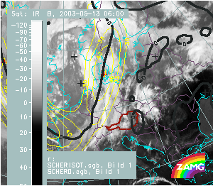
13 May 2003/06.00 UTC - Meteosat IR image; yellow: iotachs 300 hPa, black: zero line of shear vorticity 300 hPa