11 JUNE 1998 - MESOSCALE CONVECTIVE SYSTEM
by FMI
|
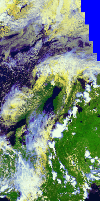
11 June 1998/15.17 UTC - NOAA RGB image (channels 1, 2 and 4)
|
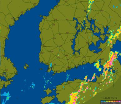
11 June 1998/15.17 UTC - FMI Radar image; CAPPI
|
|
|
More details of the cells can be seen in Radar CAPPI composite.
|
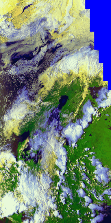
11 June 1998/18.50 UTC - NOAA RGB image (channels 1, 2 and 4)
|
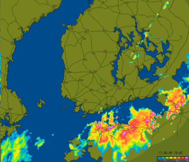
11 June 1998/18.50 UTC - FMI Radar image; CAPPI
|
|
|
|
|
|
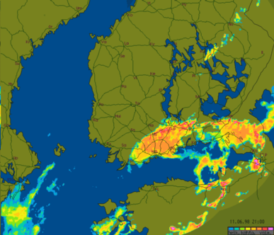
11 June 1998/21.00 UTC - FMI Radar image; CAPPI
|
The active embedded Cb-cores can still be identified in the Radar image at 18.50 UTC.
RADAR at 21.00 UTC shows the later phase of the developement (no simultaneous NOAA available)
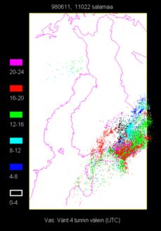
11 June 1998 - Lightning reports
|
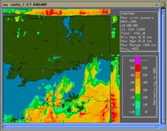
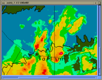
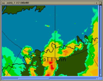
11 June 1998/15.00 UTC - FMI Radar image; MAX
|
11 June 1998/15.00 UTC - FMI Radar image; MAX
|
|
|
Zooming down to a cell near Tallinn shows an intense core of over 60 dBZ (purple) (right image). Such high intensities are almost always related to wet hail inside the cumulonimbus, even though the hail may melt before it reaches ground.
|
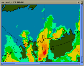
11 June 1998/14.15 UTC - FMI Radar image; MAX
|
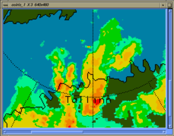
11 June 1998/14.30 UTC - FMI Radar image; MAX
|
|
|
|
|
|
11 June 1998/14.45 UTC - FMI Radar image; MAX
|