15 - 16 MARCH 1998 - 03.00 - 06.00 UTC - COMMA DIAGNOSIS - USE OF VERTICAL CROSS SECTIONS
by ZAMG
16 March 1998/06.00 UTC - Meteosat IR image; position of vertical cross section indicated
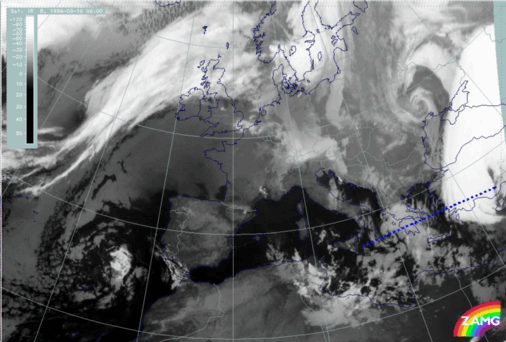
by ZAMG
|
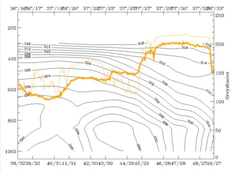
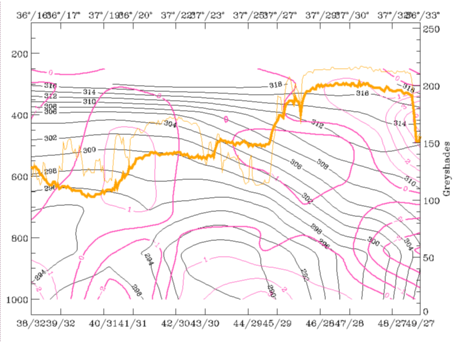
16 March 1998/06.00 UTC - Vertical cross section; black: isentropes (ThetaE), magenta thin: divergence, magenta thick: convergence, orange thin: IR pixel
values, orange thick: WV pixel values
|
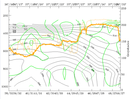
16 March 1998/06.00 UTC - Vertical cross section; black: isentropes (ThetaE), green thick: vorticity advection - PVA, green thin: vorticity
advection - NVA, orange thin: IR pixel values, orange thick: WV pixel values
|
|
|
|
|
|
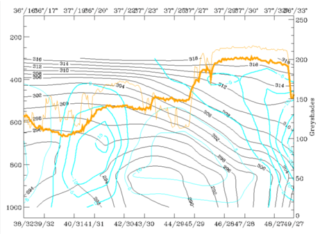
16 March 1998/06.00 UTC - Vertical cross section; black: isentropes (ThetaE), cyan thick: vertical motion (omega) - upward motion, cyan thin:
vertical motion (omega) - downward motion, orange thin: IR pixel values, orange thick: WV pixel values
|
Summarizing, one can say that the development of the Comma is rather untypical. It happened in the cold air behind a Cold Front but below the cloud shield of an approaching frontal zone from the south. Only after this frontal system propagated eastward did the Comma cloudiness become visible. But even then a sinking dry relative stream restricted the growth of the Comma clouds. Nevertheless the physical environment for a Comma was fulfilled quite well and hence the cloud feature was rather long-lived and intensifying later on.

