15 - 16 MARCH 1998 - 03.00 - 06.00 UTC - OVERVIEW OF SATELLITE IMAGERY
by ZAMG
|
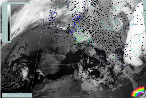
16 March 1998/03.00 UTC - Meteosat IR image; weather events (green: rain and showers, blue: drizzle, cyan: snow, red: thunderstorm with
precipitation, purple: freezing rain, orange: hail, black: no actual precipitation or thunderstorm with precipitation)
|
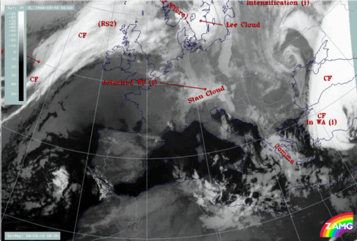
16 March 1998/03.00 UTC - Meteosat IR image; SatRep overlay: names of conceptual models
|
|
|
|
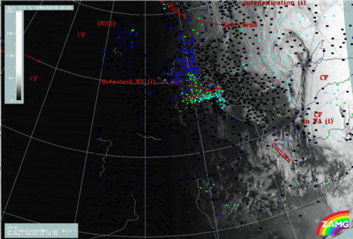
16 March 1998/06.00 UTC - Meteosat IR image; SatRep overlay: names of conceptual models
|
16 March 1998/06.00 UTC - Meteosat VIS image; weather events (green: rain and showers, blue: drizzle, cyan: snow, red: thunderstorm with
precipitation, purple: freezing rain, orange: hail, black: no actual precipitation or thunderstorm with precipitation), SatRep overlay:
names of conceptual models
|

|
|
|
|
|
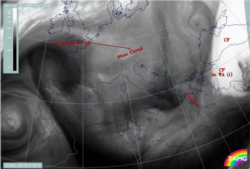
16 March 1998/06.00 UTC - Meteosat WV image
|
There seems to be (and was already before) some discrepancy in the interpretation of the WV features made so far. On the one hand the grey wet zones accompanying the Cold Front band and its remnants are mentioned and interpreted as a humidity supply from above, on the other hand a lack of vertical growth of cloud tops is explained by sinking dry air. The solution of this contradiction seems to lie in the word sinking. Although the grey WV features reflect the configuration of the frontal band and the Comma, the existing sinking motion in these layers leads to a drying of the troposphere; this additional information is gained from an application of the conveyor belt concept. Another source dealing with this matter is the vertical cross sections which reveal for six hours before, as well as at this time, (compare 03.00 - 06.00 UTC - Comma Diagnosis - Key parameters on isobaric surfaces) that the WV signal is rather low compared to the IR signal and to other synoptic systems.


